From Bréhec to Minard

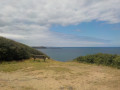
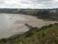
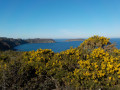
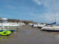
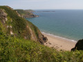
From the coastal road overlooking Bréhec harbour to Pointe de Minard, this route offers breathtaking views of Saint-Brieuc Bay throughout. Once you reach Pointe de Minard, you’ll see Paimpol Bay and the Île de Bréhat. The return journey is along the road with virtually no change in elevation.

Details

23517378
Creation:
Last update:
Last review:
  • Walking
    Activity: Walking
  • ↔
    Distance: 5.15 mi
  • ◔
    Average duration: 2h 35 
  • ▲
    Difficulty: Moderate

  • ⚐
    Back to start: Yes
  • ↗
    Ascent: + 243 ft
  • ↘
    Descent: - 240 ft

  • ▲
    Highest point: 262 ft
  • ▼
    Lowest point: 39 ft
  • ⚐ Country: France
  • ⚐ City: Plouézec (22470)
  • ⚑
    Start/End: N 48.7288° / W 2.945364°
  • ❏
    IGN map(s): Ref. 0814OT, 0815SB
  • Hour-by-hour weather

Photos

Description of the walk

Park in the small car park on the coastal road above Bréhec. GPS: N 48.7288° / W 2.945364°

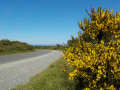
(S/E) Start the walk by taking the tarmac coastal road on the left, following theGR® 34 signposts.
Follow this road, which offers unobstructed views of Anse de Bréhec and then out to the open sea.

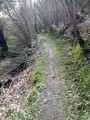
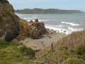
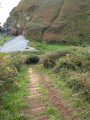
(1) After 1.5 km, leave the road to reach the small (pebble) beach at Porz Pin. Take great care when starting this descent, as this steep little path presents a real risk of slipping.

(2) Take the coastal path, which zigzags uphill to a coastal road.

(3) Turn right until you reach the first road junction.

(4) Keep to the right towards Pointe de Minard. Follow this road for about 1.8 km.

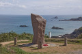
(5) At Pointe de Minard, enjoy the view over Paimpol Bay, including Bréhat Island, and the western part of Saint-Brieuc Bay. Then begin your return journey by taking theGR®34towards Beauport.
At the first junction, turn left onto the farm track between the fields. First turn left then right along this track until you reach the tarmac road and the houses.

(6) Turn left towards Kerdaniou and continue south.

(7) At the end of Rue Vantan Veur, turn left into Rue des Galets Bleus. Then take Rue de Traou Tanguy, a long straight stretch that will lead you directly to the Corniche car park (S/E).

Waypoints

  1. S/E : mi 0 - alt. 240 ft - Bréhec Corniche car park
  2. 1 : mi 0.96 - alt. 223 ft - Start of the path towards Pors Pin
  3. 2 : mi 1.18 - alt. 39 ft - Porz Pin beach
  4. 3 : mi 1.42 - alt. 220 ft - Junction with the tarmac road
  5. 4 : mi 2.14 - alt. 213 ft - Road junction
  6. 5 : mi 2.58 - alt. 180 ft - Pointe de Minard
  7. 6 : mi 3.39 - alt. 213 ft - Minard hamlet
  8. 7 : mi 4.35 - alt. 259 ft - Kertanguy
  9. S/E : mi 5.15 - alt. 240 ft - Bréhec Corniche car park

Notes

The first section of the Corniche to Pointe de Minard is signposted as it forms part of theGR® 34.
The only difficult part of the route is the descent and subsequent climb up Pors Pin.

Always be cautious and plan ahead when you're outdoors. Visorando and the author of this route cannot be held responsible for any accidents occurring on this route.

The GR® and PR® markings are the intellectual property of the Fédération Française de Randonnée Pédestre.

Reviews and comments

4.3 / 5
Based on 3 reviews

Reliability of the description
4 / 5
Ease of following the route
4.7 / 5
Route interest
4.3 / 5
User 22840724

Overall rating : 4 / 5

Date of your route : Jul 13, 2026
Reliability of the description : ★★★★☆ Good
Ease of following the route : ★★★★☆ Good
Route interest : ★★★★☆ Good
Very busy route : No

The view is indeed magnificent. It’s a shame, though, that a large part of the walk takes you along the side of a tarmac road with cars and bikes passing by. There aren’t many of them, mind you, but, in my view, it’s not very pleasant, especially as the road isn’t shaded at all. The description is accurate: the descent and climb to the pebble beach at Porz Pin are indeed steep, but at least it’s a footpath through the greenery. Thanks for the route, anyway.

Machine-translated

User 4454589

Overall rating : 4.7 / 5

Date of your route : Jul 28, 2025
Reliability of the description : ★★★★☆ Good
Ease of following the route : ★★★★★ Very good
Route interest : ★★★★★ Very good
Very busy route : No

A pleasant route with lots of hills. Some paths are narrow and steep. Make sure you have suitable equipment

Machine-translated

famille Boitus
famille Boitus

Overall rating : 4.3 / 5

Date of your route : Aug 28, 2023
Reliability of the description : ★★★★☆ Good
Ease of following the route : ★★★★★ Very good
Route interest : ★★★★☆ Good
Very busy route : Yes

A walk with beautiful scenery along the coast and a little less so further inland; the tricky bit is the descent, as mentioned in the details...

Machine-translated

Other walks in the area

For more walks, use our search engine .

The GPS track and description are the property of this route's author. Please do not copy them without permission.