From Paimpol to Frynaudour

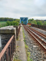
A walk between the sea and the forest offering a wide variety of geographical and historical points of interest: a route along the Trieux beach, a stop at Traounez Manor (a key location in the Seznec affair) and, to finish, the blue Frynaudour viaduct.

A circular walk, returning by TER.

Details

2348012
Creation:
Last update:
Last review:
  • Walking
    Activity: Walking
  • ↔
    Distance: 8.70 mi
  • ◔
    Average duration: 4h 35 
  • ▲
    Difficulty: Moderate

  • ⚐
    Back to start: No
  • ↗
    Ascent: + 630 ft
  • ↘
    Descent: - 551 ft

  • ▲
    Highest point: 266 ft
  • ▼
    Lowest point: 10 ft
  • ⚐ Country: France
  • ⚐ City: Paimpol (22500)
  • ⚑
    Start: N 48.776617° / W 3.047675°
  • ⚑
    End: N 48.727795° / W 3.128369°
  • ❏
    IGN map(s): Ref. 0814OT, 0815SB
  • Hour-by-hour weather

Photos

Description of the walk

Starting point: Paimpol station. Parking is available in the station car park (though it can be difficult on Tuesday mornings due to the weekly market).

(S/E) With your back to the station, turn left onto Avenue du Général de Gaulle. At the roundabout, carry straight on onto Avenue de Guerland (path on the right-hand side).

(1) After about 1.2 km, you’ll come to a tall, circular concrete wall: enter this first concrete basin. You are now standing on the site of a German battery from the Second World War. Cross the first basin and enter a second, identical basin.

(2) Join a tarmac road (Hent Feunten Wern) and follow it to the right towards a housing estate. Turn left onto the Chemin de Kerjiquel towards the village of Plounez (church tower in sight). At the T-junction, turn left.

(3) At the entrance to the village, turn left past the church and head towards the road known as Chemin de Landouezec. Continue straight on (west) and ignore the side tracks.

(4) Go under the D 786 bridge and follow the Chemin de Poul Ranet.

(5) Head towards the level crossing, cross the railway line and follow the Chemin de Kerbiguet for 400 m. At the junction (marker 17), turn right onto a path leading to Pont Erwan beach, passing under the railway line.

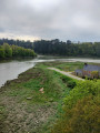
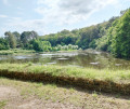
(6) Enter the foreshore area, turn left and walk along the beach on your right-hand side. Please note that at spring tides, some sections may be impassable.

(7) At Lancerf station, cross the railway line at the level crossing. Immediately turn right onto Route de la Gare, which climbs up to the Marcel Cachin roundabout.

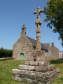
(8) Then turn left twice to reach the Lancerf Chapel.

(9) Return to the roundabout.

(8) Then turn left and follow the road to the entrance to the woods.

(10) Enter the Lancerf Penhoat woodland (there is a sign at the entrance to the woodland indicating walking times).

(11) At the junction, turn right and head downhill. Walk alongside the railway line, which lies below on the right.

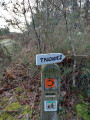
(12) Pass under the railway line, leaving the Manoir de Traou Nez on your right. At the Fork in the road, take the left-hand path towards Coat Ermit. At the end, turn left and pass under the railway line again.

(13) Turn immediately right and continue along a path on the hillside overlooking the railway line on your right.

(14) At the crossroads, head down to the right towards Coat Ermit. Enjoy the view of La Roche Jagu Castle. Retrace your steps.

(14) Take the hillside path on the right again. Pass close to a small, isolated house (Kerdruc). Continue to the next junction. Then turn right onto a path leading downhill. Pass a few houses, come out onto a road and follow it to the right. Walk straight down. Just before Leff, turn right directly onto the platform at Frynaudour station

(E) Return to Paimpol by TER (wave to the driver to ask if you can board).

Waypoints

  1. S : mi 0 - alt. 23 ft - Gare de Paimpol
  2. 1 : mi 0.81 - alt. 56 ft - Location of a battery
  3. 2 : mi 0.93 - alt. 62 ft - Hent Feunten Wern
  4. 3 : mi 1.37 - alt. 125 ft - Entrance to the village of Plounez
  5. 4 : mi 2.04 - alt. 102 ft - Bridge under the D786
  6. 5 : mi 2.4 - alt. 75 ft - level crossing
  7. 6 : mi 2.84 - alt. 23 ft - Access to the beach
  8. 7 : mi 4.06 - alt. 26 ft - Lancerf station
  9. 8 : mi 4.45 - alt. 138 ft - Marcel Cachin Crossroads
  10. 9 : mi 4.5 - alt. 131 ft - Lancef Chapel
  11. 10 : mi 4.69 - alt. 194 ft - Entrance to the Penhoat Lancerf woods
  12. 11 : mi 5 - alt. 262 ft - Crossing
  13. 12 : mi 5.93 - alt. 72 ft - Traounez Manor
  14. 13 : mi 6.47 - alt. 66 ft - Tunnel
  15. 14 : mi 7.21 - alt. 194 ft - Getting to Coat Ermit
  16. E : mi 8.7 - alt. 72 ft - Frynaudour stop and viaduct

Notes

If you leave Paimpol station at around 1.00 pm, you’ll be able to catch the 6.09 pm TER (except on Fridays) to return to Paimpol at 6.27 pm. Don’t forget to flag down the TER driver (the next one doesn’t run until after 8.00 pm).

Worth a visit

A very rewarding walk:
- The sites of the former German batteries
- The walk along the beach between Pont Erwan and Lancerf
- Lancerf Chapel
- Traounez Manor (the Seznec affair)
- The tunnel under the railway line
- Coat Ermit with a view of La Roche Jagu
- The blue viaduct at Frynaudour.

Reviews and comments

4.5 / 5
Based on 2 reviews

Reliability of the description
4 / 5
Ease of following the route
4.5 / 5
Route interest
5 / 5
Lucine55
Lucine55

Overall rating : 4.3 / 5

Date of your route : Sep 03, 2024
Reliability of the description : ★★★★☆ Good
Ease of following the route : ★★★★☆ Good
Route interest : ★★★★★ Very good
Very busy route : No

A very pleasant walk, followed by a train journey back along one of France’s most scenic railway lines.

Machine-translated

kerheol
kerheol

Hello,

You can indeed carry on as far as Pontrieux by taking the viaduct.
That’s what I did last year, in which case it’s 19 km.
The problem is that using the viaduct is prohibited, so naturally I cannot under any circumstances encourage you to break the rules.
There is no pedestrian access on the viaduct (except for maintenance staff)
I’d also checked the timetable to make sure there were no trains running.
Kind regards
Kerheol

Machine-translated

Sébastien Guéry
Sébastien Guéry

Hello, I’d like to go on this walk and carry on to Pontrieux – is it possible to cross the viaduct on foot? Thank you!!

Machine-translated

mamaude
mamaude

My brother lives not far from Paimpol, and it had been three years since I’d last visited from Lorraine. It was lovely to be back in the area, but I wasn’t familiar with the exit from Paimpol as indicated. Thank you

Machine-translated

kerheol
kerheol

Hello,
thank you for your very positive review of this unique walk.
This is the first walk I’ve posted on the Visorando website (since then I’ve posted 34 more);
it’s also my favourite – if you’re not put off by the 14 km, you’ll get to see a whole host of sights.
Kind regards
Kerheol

Machine-translated

mamaude
mamaude

Overall rating : 4.7 / 5

Date of your route : Sep 17, 2022
Reliability of the description : ★★★★☆ Good
Ease of following the route : ★★★★★ Very good
Route interest : ★★★★★ Very good
Very busy route : No

A brilliant route, especially along the Trieux. But best done at high tide or when the tide is rising. The best bit: hitching a lift on the train for the return journey. Don’t panic if the train is running late: it connects with the TGV from Paris at Guingamp. If the TGV is late, you’ll have to wait… but it signals its arrival with a whistle about a minute before it arrives. So keep your ears open!

Machine-translated

Other walks in the area

For more walks, use our search engine .

The GPS track and description are the property of this route's author. Please do not copy them without permission.