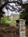
Hollow ways and villages in Plouha

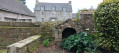
Plouha is home to the highest cliffs in Brittany. You can explore them on theGR®®34. Very close to the village centre, starting from the town centre, the first half of this short route follows beautiful sunken paths typical of the Goëlo region and then passes through a few villages with lovely stone houses. Along the route, there are several granite wayside crosses.

Details

16651711
Creation:
Last update:
Last review:
  • Walking
    Activity: Walking
  • ↔
    Distance: 3.95 mi
  • ◔
    Average duration: 1h 55 
  • ▲
    Difficulty: Easy

  • ⚐
    Back to start: Yes
  • ↗
    Ascent: + 138 ft
  • ↘
    Descent: - 164 ft

  • ▲
    Highest point: 292 ft
  • ▼
    Lowest point: 184 ft
  • ⚐ Country: France
  • ⚐ City: Plouha (22580)
  • ⚑
    Start/End: N 48.675099° / W 2.930626°
  • ❏
    IGN map(s): Ref. 0815SB, 0916OT
  • Hour-by-hour weather

Photos

Description of the walk

Car park behind the ‘L’Hermine’ village hall.

(S/E) Go down the steps in the right-hand corner of the car park (with your back to the village hall), cross the playground and turn left to walk alongside the tennis courts on Rue Amiral Ronarc’h. At the junction, take Rue Anatole Le Braz, which is almost directly opposite, then, at a wooden house, turn right onto Rue Ropartz, which continues as a track that joins the Plouha bypass. Cross carefully and follow the road to the left as far as the Point Vert shop.

(1) Enter the Grand Étang industrial estate, then head left towards “Abeille Paysage” and “Les Ambulances” and go round the building belonging to the “Vieux Gréments, Vieux Outils” association, where there is a small chain that you can step over.

(2) Opposite, take the first sunken lane on the route, which leads to the hamlet of Kerrohan.

(3) At the first houses, just after a large grassy area, turn sharply left onto another sunken track. Cross a stream, walk along a grassy area beside a watercourse, and at the end of the embankment, turn sharply right into athird sunken track. Pass a small road on your left and continue along afourth sunken track, which climbs up a grassy path to the left and becomes a farm track.

(4) Continue to the right along this track, which turns into a small road and passes under the high-voltage power line. At the hamlet of Bon Repos, veer to the right and carry on straight ahead. Pass Méridoul and reach a junction on the D84.

(5) Carry on straight ahead towards “Lizandré, le Goasmeur”. After the Méridoul gardens (perennial growers), take a small road on the right and arrive at Stivell Farm, at a right-hand bend.

(6) Carry on straight ahead along a sunken track, which may be damp. Join a road at Vieux Lizandré and carry on, first turning right then left to rejoin the road you had left. Turn left, keep left onto the D84 and pass under the high-voltage power line again. At Kergroas, by two stone crosses, turn right towards Kerrohan to return to the junction where the circular route begins.

(3) Carry on straight ahead.

(2) Turn left and carry on until you reach the Point Vert shop.

(1) Take the small road on the left, which initially runs alongside the Plouha bypass before veering away from it.

(7) Turn right at the Stop sign and, at the sign for Plouha, take the path on the left, cross Rue de Pen Ker and carry on to the sports hall. Turn right to join the Plouha bypass, cross at the pedestrian crossing and follow the road to the left for about thirty metres.
Turn right towards the tennis club. Walk alongside it along a small path which leads to the playground and the steps leading back to the car park (S/E).

Waypoints

  1. S/E : mi 0 - alt. 292 ft - Car park behind the ‘L’Hermine’ village hall
  2. 1 : mi 0.6 - alt. 197 ft - Junction of the circular loop
  3. 2 : mi 0.72 - alt. 200 ft - Behind the ‘Vieux Métiers, Vieux Outils’ exhibition space
  4. 3 : mi 0.88 - alt. 220 ft - Kerrohan, junction of the circular loop
  5. 4 : mi 1.38 - alt. 276 ft - Junction, on the right
  6. 5 : mi 1.88 - alt. 272 ft - D84
  7. 6 : mi 2.2 - alt. 253 ft - Stivell
  8. 7 : mi 3.43 - alt. 223 ft - D84
  9. S/E : mi 3.95 - alt. 292 ft - Car park behind the ‘L’Hermine’ village hall

Notes

  • Plouha: a small town with a good range of shops near the starting point. On Wednesdays, there is a lovely market, though this can lead to congestion in the car park, particularly in summer.
  • You must take care when crossing the Plouha bypass, particularly on the outward journey, as there is no pedestrian crossing.
  • The ‘Vieux Métiers, Vieux Outils’ building is closed off by a low chain, which does not prevent pedestrians from passing through.
  • Lizandré Castle is private property and entry is prohibited.

Groups of houses, localities or hamlets are referred to as ‘villages’.

Worth a visit

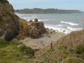
Plouha: in the municipality of Plouha, theGR®®34runs along an east-facing coastline offering beautiful sunrises. It passes through Gwin Zegal and its stilted harbour, the Plouha headland and its cliffs, Le Palus and its pebble beach, Bonaparte beach and its Shelburn path, and Brehec, with its sandy beach and small heritage harbour.

Always be cautious and plan ahead when you're outdoors. Visorando and the author of this route cannot be held responsible for any accidents occurring on this route.

The GR® and PR® markings are the intellectual property of the Fédération Française de Randonnée Pédestre.

Reviews and comments

4.6 / 5
Based on 6 reviews

Reliability of the description
4.7 / 5
Ease of following the route
5 / 5
Route interest
4 / 5
gillot54
gillot54

Overall rating : 4.7 / 5

Date of your route : Sep 12, 2025
Reliability of the description : ★★★★★ Very good
Ease of following the route : ★★★★★ Very good
Route interest : ★★★★☆ Good
Very busy route : No

short, easy hike with some beautiful hamlets

Machine-translated

Mathilde 22
Mathilde 22

Overall rating : 5 / 5

Date of your route : Oct 22, 2023
Reliability of the description : ★★★★★ Very good
Ease of following the route : ★★★★★ Very good
Route interest : ★★★★★ Very good
Very busy route : No

A very beautiful short hike. In three stages: sunken paths, farm tracks and then the GR34. Steep and sloping. Muddy because it rained the day before. You need to be in good physical shape and wear sturdy shoes!

Machine-translated

jlin
jlin

Overall rating : 4.3 / 5

Date of your route : Feb 24, 2022
Reliability of the description : ★★★★☆ Good
Ease of following the route : ★★★★★ Very good
Route interest : ★★★★☆ Good
Very busy route : No

pretty paths and beautiful hamlets

Machine-translated

grandiere
grandiere

Overall rating : 4.3 / 5

Date of your route : Apr 29, 2022
Reliability of the description : ★★★★★ Very good
Ease of following the route : ★★★★★ Very good
Route interest : ★★★☆☆ Average
Very busy route : No

A short walk with little of interest except for a few discoveries in Plouha and its surroundings.

Machine-translated

jlin
jlin

Overall rating : 4.3 / 5

Date of your route : Mar 07, 2022
Reliability of the description : ★★★★☆ Good
Ease of following the route : ★★★★★ Very good
Route interest : ★★★★☆ Good
Very busy route : No

a few beautiful hamlets and lovely sunken lanes

Machine-translated

Lambret
Lambret

Overall rating : 4.7 / 5

Date of your route : Feb 20, 2022
Reliability of the description : ★★★★★ Very good
Ease of following the route : ★★★★★ Very good
Route interest : ★★★★☆ Good
Very busy route : No

Excellent and accurate description. The southern part is the most interesting. You have to wade a little at point 3 along the stream.

Machine-translated

Other walks in the area

For more walks, use our search engine .

The GPS track and description are the property of this route's author. Please do not copy them without permission.