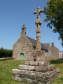
Sea and countryside in Plounez

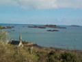
After leaving the town of Paimpol, you’ll head down through the fields to the mouth of the Trieux, opposite the port of Lézardrieux. A walk along the edge of what is effectively a lake at high tide awaits you at the Ledano. Finally, a long climb through the Plounez countryside will take you back to Paimpol. This route combines the agricultural and coastal landscapes typical of this corner of the Goëlo.

Details

n°21994488
Creation:
Last update:
Last review:
  • Walking
    Activity: Walking
  • ↔
    Distance: 6.21 mi
  • ◔
    Average duration: 3h 10 
  • ▲
    Difficulty: Moderate

  • ⚐
    Back to start: Yes
  • ↗
    Ascent: + 354 ft
  • ↘
    Descent: - 361 ft

  • ▲
    Highest point: 207 ft
  • ▼
    Lowest point: 16 ft
  • ⚐ Country: France
  • ⚐ City: Paimpol (22500)
  • ⚑
    Start/End: N 48.782628° / W 3.058859°
  • ❏
    IGN map(s): Ref. 0814OT, 0815SB
  • Hour-by-hour weather

Photos

Description of the walk

Start from the Islandia swimming pool car park. GPS: N 48.782628° / W 3.058859°

(S/E) Leave the car park, turn left and walk past Lanvignec Chapel. Turn left onto
Hent Kervik Street. You’ll pass Garden Traou on your right.

(1) Turn right at the next junction onto Gardenn Keraudren. Walk past the wash house and continue along the path to Keraudren, following the red and white markings for theGR®34alternative route. Walk between the houses in the hamlet, ignoring the road on the left. At the junction (marker 35), turn left. Ignore a turn-off on the left and continue to a T-junction.

(2) Turn left and walk past a greenhouse and some farm buildings. At the end, turn right onto Rue Hent Traou Skaven. Ignore a turn-off to the left, then one to the right, and continue to a crossroads in the hamlet of Kerderrien.

(3) Cross the Route de Coz Castel and take the Traverse de Mezou Gouez opposite. Pass between two large greenhouses and continue straight on. At the end of the road, first turn left then right to follow a track. After about 250 metres, turn left onto a grassy path through the woodland. Walk downhill to the banks of the Trieux.

(4) Turn left towards Lézardrieux. Head uphill to reach the Traou Vantan washhouse. Go round the wash house on the left. Further on, cross a road carefully and continue straight ahead along Rue de Porjou. At the T-junction, turn right into Rue de Kerivon. Ignore a road on the right, pass under the D786 and reach the car park at Ledano beach.

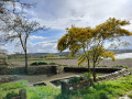
(5) Then follow the coastal path to the left. Further on, you’ll come out onto a stony track; follow it to the right for about fifty metres.

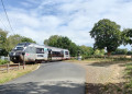
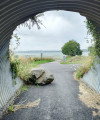
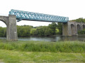
(6) Leave the coastal path and the signposting, and turn left onto an uphill road. Pass under the railway bridge. At the next junction, turn left onto Chemin de Kerbiguet. Join the railway line and walk alongside it on your left.

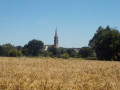
(7) Cross the railway line at the level crossing and follow Rue de Poul Ranet to the right. Ignore the slip roads to the D786 on the left and turn right. Walk alongside the railway line again (on your right) and pass under the D786. Continue straight on along the uphill road known as Chemin de Landouezec until you reach the village of Plounez.

(8) Go round the church on the right. Cross the Chemin de Goasmeur on the right-hand side, then turn right onto the Chemin de Kergicquel. At the Fork in the road, turn left onto the Chemin de Kergoat. Cross a stream, head uphill and reach the Route de Kergrist.

(9) Cross this busy road with care and take the path opposite called Gardenn Jean Antoine. You’ll soon come out onto the Chemin de Penn Crech; follow it as it continues. At the end, turn right onto the Allée des Hêtres and pass a sports ground on your left. At the next junction, carry straight on along the Allée des Hêtres, passing the school car park on your right. You’ll come out onto the Allée Kerraoul; follow it to the left and continue onto Avenue Gabriel Le Bras. Stay on the
pavement on the left.

(10) Turn left onto the street called Garden Toul Ar Werzhid. Take a path under the trees running parallel to the road and head straight for the swimming pool car park (S/E).

Waypoints

  1. S/E : mi 0 - alt. 112 ft - Islandia swimming pool car park
  2. 1 : mi 0.22 - alt. 144 ft - Gardenn Keraudren
  3. 2 : mi 0.59 - alt. 128 ft - T-junction
  4. 3 : mi 1.13 - alt. 187 ft - Kerderrien
  5. 4 : mi 2.07 - alt. 20 ft - Along the - Trieux (fleuve)
  6. 5 : mi 2.86 - alt. 20 ft - Ledano Beach
  7. 6 : mi 3.45 - alt. 23 ft - Dervan Bridge
  8. 7 : mi 3.87 - alt. 72 ft - Level crossing
  9. 8 : mi 4.85 - alt. 125 ft - Église Saint-Pierre (Plounez)
  10. 9 : mi 5.43 - alt. 194 ft - Road crossing
  11. 10 : mi 6.1 - alt. 105 ft - Toul ar Werzhid
  12. S/E : mi 6.21 - alt. 115 ft - Islandia swimming pool car park

Notes

This walk can be done in any season. However, it is best to go at high tide, as this enhances the beauty of the landscape, particularly around the Ledano.

This walk involves crossing very busy roads: take extra care.

Worth a visit

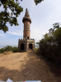
- Right from the start, the Lanvignec chapel, surrounded by its cemetery, offers a particularly picturesque setting against
the heights of Paimpol.
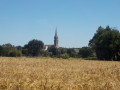
- With its vast greenhouses and fields of wheat and cauliflowers, this part of the Goëlo is typical of the
agricultural character of the area.
- From Ledano beach, you can admire the Lézardrieux bridge, which spans the River Trieux and links the Goelo to the Trégor.
- The village of Kergrist, described in Pierre Loti’s novel *Mon frère Yves*.
- The Church of Saint Pierre in Plounez.

Always be cautious and plan ahead when you're outdoors. Visorando and the author of this route cannot be held responsible for any accidents occurring on this route.

The GR® and PR® markings are the intellectual property of the Fédération Française de Randonnée Pédestre.

Reviews and comments

4.5 / 5
Based on 2 reviews

Reliability of the description
5 / 5
Ease of following the route
5 / 5
Route interest
3.5 / 5
User 31360004

Overall rating : 4.3 / 5

Date of your route : Sep 28, 2026
Reliability of the description : ★★★★★ Very good
Ease of following the route : ★★★★★ Very good
Route interest : ★★★☆☆ Average
Very busy route : No

Far too much driving

Machine-translated

alfa14
alfa14

Overall rating : 4.7 / 5

Date of your route : Oct 07, 2024
Reliability of the description : ★★★★★ Very good
Ease of following the route : ★★★★★ Very good
Route interest : ★★★★☆ Good
Very busy route : No

Easy to walk along, except when heading down towards the Trieux, where the ground is quite wet.

Machine-translated

Other walks in the area

For more walks, use our search engine .

The GPS track and description are the property of this route's author. Please do not copy them without permission.