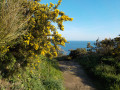
From Plourhan to the sea

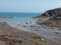
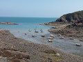
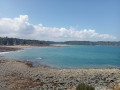
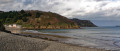
Apart from a few unavoidable sections on tarmac roads, most of the walk follows farm tracks, sometimes through woodland. The reward for this approach route is the walk along Palus Beach, followed by theGR®34 trail.
A somewhat steep route offering views of the cliffs at Plouha and the Pointe de Bec de Vir.

Details

23334822
Creation:
Last update:
Last review:
  • Walking
    Activity: Walking
  • ↔
    Distance: 7.02 mi
  • ◔
    Average duration: 3h 35 
  • ▲
    Difficulty: Moderate

  • ⚐
    Back to start: Yes
  • ↗
    Ascent: + 371 ft
  • ↘
    Descent: - 371 ft

  • ▲
    Highest point: 302 ft
  • ▼
    Lowest point: 10 ft
  • ⚐ Country: France
  • ⚐ City: Plourhan (22410)
  • ⚑
    Start/End: N 48.645398° / W 2.898131°
  • ❏
    IGN map(s): Ref. 0815SB, 0916OT
  • Hour-by-hour weather

Photos

Description of the walk

Park in the small car park at the drinking water pumping station. GPS: N 48.645398° / W 2.898131°

(S/E) Start the walk by taking the wide path lined with apple trees on the right.

(1) At the first junction, turn left, then at the end of this path, turn right. Turn left onto the grassy path between two fields, which then turns right onto a wide track; continue straight on to the hamlet of Keroisel.
Turn right onto the tarmac road towards the RD 786.

(2) Cross this busy road with care (no pedestrian crossing) and continue straight on towards Kerégal.

(3) Turn right onto a small road. Walk through the hamlet and continue along a stony track until you reach the start of a path leading downhill. After 20 metres, turn right onto a steep, descending path leading to the car park at Plage du Palus.

(4) Turn right onto the pebble embankment (at low tide, it’s better to walk on the sand). At the far end of the beach, take the path leading uphill. After 120 metres, turn left
theGR®34steps and follow them to Port Goret.

(5) Turn right onto Rue de Port Goret. Before reaching the roundabout, follow the sandy path downhill. Cross Rue de Saint Marc.

(6) At Kercadoret, take the path along the stream, which leads gently uphill for one kilometre to the village of Tréveneuc.

(7) Walk round the church on the left to admire Pommerio Castle at the end of a long driveway. Retrace your steps and pass between two commercial buildings. Cross Rue de Kerezen and take Rue de Tournebride until you reach the D786.

(8) Cross the D786 with care (no pedestrian crossing) to take Rue de Kerlan and continue straight on to the edge of the woods.

(9) At the wayside cross, continue straight ahead along the farm track.

::10: At the bottom of a slight hollow, turn right onto the grassy track between two fields and, at the first junction, carry on straight ahead to the junction you passed on the way out.

(1) Turn left to reach the pumping station car park (S/E).

Waypoints

  1. S/E : mi 0 - alt. 302 ft - Pumping station
  2. 1 : mi 0.27 - alt. 269 ft - Crossroads at the circular loop
  3. 2 : mi 1.72 - alt. 223 ft - Crossing the D786
  4. 3 : mi 2.23 - alt. 213 ft - Kerégal
  5. 4 : mi 2.82 - alt. 23 ft - Palus Beach
  6. 5 : mi 4.01 - alt. 92 ft - Port Goret
  7. 6 : mi 4.45 - alt. 79 ft - Kercadoret
  8. 7 : mi 5.04 - alt. 230 ft - The village of Tréveneuc
  9. 8 : mi 5.44 - alt. 249 ft - Crossing the D786
  10. 9 : mi 5.99 - alt. 266 ft - Calvaire
  11. 10 : mi 6.37 - alt. 246 ft - Junction
  12. S/E : mi 7.02 - alt. 302 ft - Pumping station

Notes

The path across the pebble dune along Palus Beach may be impassable on a few days of the year during periods of very high tides.

Worth a visit

Palus Beach.
TheGR®34.
Pommerio Castle.
On the way there, as you emerge from the woods at a place called Kergromo, you will pass a hop field on your left.

Always be cautious and plan ahead when you're outdoors. Visorando and the author of this route cannot be held responsible for any accidents occurring on this route.

The GR® and PR® markings are the intellectual property of the Fédération Française de Randonnée Pédestre.

Reviews and comments

4 / 5
Based on 4 reviews

Reliability of the description
4.3 / 5
Ease of following the route
3.8 / 5
Route interest
4 / 5
User 24572317

Overall rating : 4.3 / 5

Date of your route : Jul 25, 2025
Reliability of the description : ★★★★☆ Good
Ease of following the route : ★★★★☆ Good
Route interest : ★★★★★ Very good
Very busy route : No

Follow the directions carefully, especially in the woods, as there are many paths. Use maps if necessary to reach Keroisel.
Once you see the castle from the church, follow the directions carefully for the return journey. There is a lane that runs alongside the road to Kerlan, but this is not the recommended route as it is longer. Follow the directions and you will cut through the village, which is what you want to do.

Machine-translated

Gilou22
Gilou22

Overall rating : 3.3 / 5

Date of your route : Apr 21, 2024
Reliability of the description : ★★★★☆ Good
Ease of following the route : ★★★☆☆ Average
Route interest : ★★★☆☆ Average
Very busy route : No

A fairly easy walk, with lovely sea views, but the signposting is virtually non-existent.

Machine-translated

Gilou22
Gilou22

Overall rating : 4 / 5

Date of your route : Apr 21, 2024
Reliability of the description : ★★★★☆ Good
Ease of following the route : ★★★★☆ Good
Route interest : ★★★★☆ Good
Very busy route : No

A very easy route, apart from the climb up the Palus, but the scenery is superb 😉

Machine-translated

rando2259
rando2259

Overall rating : 4.3 / 5

Date of your route : Mar 24, 2023
Reliability of the description : ★★★★★ Very good
Ease of following the route : ★★★★☆ Good
Route interest : ★★★★☆ Good
Very busy route : No

I went on the hike on the morning of Thursday 23 March; the weather was lovely, though it hadn’t actually been forecast as such. So we didn’t see a soul. But it’s an interesting route, both in terms of the variety of terrain it covers and its length. There were no particular difficulties

For your information:

  • on Palus Beach, you can’t cross the pebble bank at high tide when the tidal coefficients are high. That was the case on Thursday morning. This should be noted in the route description. Fortunately, we’d set off from the Palus Beach car park, so we went the other way round.

Starting from Palus also meant we avoided the return journey to the pumping station at Plourhan.

  • At Tréveneuc, you can avoid the road by taking – in the direction described – the side lane that runs through the grounds of POMMERIO Castle, skirting the road on the right. You come out through the gate a little further on to the left and cross the road. Almost directly opposite, a small grassy path runs alongside a housing estate on one side and a slope on the other. You rejoin the route between point 7 and point 8.

All in all, we really enjoyed this walk.

Machine-translated

Other walks in the area

For more walks, use our search engine .

The GPS track and description are the property of this route's author. Please do not copy them without permission.