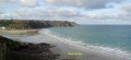
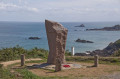
Saint-Jean Chapel in Plouha

Leave the village of Plouha and head for Saint-Jean Chapel along the country lanes. These are tarmac-surfaced, except for a short stretch which is a farm track but is easily passable.

Details

24046734
Creation:
Last update:
Last review:
  • Walking
    Activity: Walking
  • ↔
    Distance: 3.14 mi
  • ◔
    Average duration: 1h 30 
  • ▲
    Difficulty: Easy

  • ⚐
    Back to start: Yes
  • ↗
    Ascent: + 108 ft
  • ↘
    Descent: - 115 ft

  • ▲
    Highest point: 322 ft
  • ▼
    Lowest point: 194 ft
  • ⚐ Country: France
  • ⚐ City: Plouha (22580)
  • ⚑
    Start/End: N 48.675846° / W 2.930032°
  • ❏
    IGN map(s): Ref. 0815SB, 0916OT
  • Hour-by-hour weather

Description of the walk

Park near the Plouha Tourist Office: there are plenty of parking spaces nearby, particularly around the church.

(S/E) Head towards the church and walk round it on the right-hand side. At the junction, take Rue du Bois du Chat, which is opposite, and continue until you reach a four-way junction.

(1) Take Rue de la Croix Blanche, which is opposite. The Calvary known as the ‘White Cross’ is further on, set against a house on the left-hand side.

(2) At the Fork in the road just beyond the Calvary, take the left-hand path. Further on, the path turns right and leads onto a road at a place called Kertanguy. Follow the road to the right for about 300 metres.

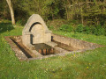
(3) Then turn left to quickly reach the Chapel of Saint John (information board on site). Retrace your steps.

(3) Continue along the road to the left. Pass a road on your left and turn left immediately at the foot of a wayside cross. At the next junction, turn right and continue to the next junction (wash house).

(4) Turn left and pass the hamlet of Scanv. Carry on straight ahead along Rue Théodore Botrel and ignore Rue Jules Ferry on the right.

(5) Take the next right, Rue du Loc. Keep going straight on and ignore the side streets. You’ll come out onto Rue Georges Clemenceau; follow it to the right for about a hundred metres.

(6) Turn left into Rue Kerilis. Cross Rue Jean-Louis Hamon and continue along Rue du Chamoine Dagorn. Turn right into Rue Jeanne d’Arc to reach the Tourist Office (S/E).

Waypoints

  1. S/E : mi 0 - alt. 302 ft - Tourist Office - Église Saint-Pierre (Plouha)
  2. 1 : mi 0.47 - alt. 285 ft - Crossroads
  3. 2 : mi 0.79 - alt. 312 ft - Junction after the wayside cross
  4. 3 : mi 1.4 - alt. 259 ft - Access to the - Chapelle Saint-Jean (Plouha)
  5. 4 : mi 2.09 - alt. 236 ft - Junction – Washhouse
  6. 5 : mi 2.6 - alt. 223 ft - Rue Théodore Botrel x Rue Loc
  7. 6 : mi 2.97 - alt. 289 ft - Rue Georges Clemenceau x Rue Kerilis
  8. S/E : mi 3.14 - alt. 302 ft - Tourist Office - Église Saint-Pierre (Plouha)

Worth a visit

Reviews and comments

4.5 / 5
Based on 2 reviews

Reliability of the description
5 / 5
Ease of following the route
4.5 / 5
Route interest
4 / 5
User 15491361

Overall rating : 4 / 5

Date of your route : Aug 25, 2025
Reliability of the description : ★★★★★ Very good
Ease of following the route : ★★★★☆ Good
Route interest : ★★★☆☆ Average
Very busy route : No

The ride is nice, but there are too many paved roads.
There's quite a lot of traffic.

Machine-translated

rando2259
rando2259

Overall rating : 5 / 5

Date of your route : Oct 16, 2023
Reliability of the description : ★★★★★ Very good
Ease of following the route : ★★★★★ Very good
Route interest : ★★★★★ Very good
Very busy route : No

It was a quiet route when I took it (outside the tourist season).
It makes for a short walk starting from the town centre, even in wet weather.

Machine-translated

Other walks in the area

For more walks, use our search engine .

The GPS track and description are the property of this route's author. Please do not copy them without permission.