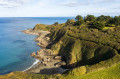
Through moors, woods and cliffs in the Goelo region

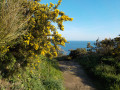
A lovely walk through the countryside and along the coast.
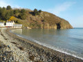
Stop off at the lovely Palus Beach for a refreshing swim and a delicious, energising crêpe!

Details

458716
Creation:
Last update:
Last review:
  • Walking
    Activity: Walking
  • ↔
    Distance: 8.20 mi
  • ◔
    Average duration: 4h 10 
  • ▲
    Difficulty: Moderate

  • ⚐
    Back to start: Yes
  • ↗
    Ascent: + 413 ft
  • ↘
    Descent: - 417 ft

  • ▲
    Highest point: 335 ft
  • ▼
    Lowest point: 0 ft
  • ⚐ Country: France
  • ⚐ City: Plourhan (22410)
  • ⚑
    Start/End: N 48.63881° / W 2.897956°
  • ❏
    IGN map(s): Ref. 0815SB, 0916OT
  • Hour-by-hour weather

Photos

Description of the walk

Start from the Manoir de la Ville Hellio in Plourhan (lodge on the manor side). Park on the small road leading off the D9 heading north.

(S/E) Follow the small road northwards – it soon becomes a sunken track – for about 300 metres.

(1) Then take the first path on the right, following a living hedge. Cross the D21 and continue north-east.

(2) At the fork, ignore the path on the left (the return route) and carry on straight ahead, ignoring the side paths. Turn left along the path to reach a crossroads.

(3) Continue north, then north-north-east. Carry on along a small road (cross). Ignore the road on the right and pass close to the water tower. You’ll reach the D786.

(4) Cross the road and carry on to Tréveneuc church. Continue along the small road that runs between the sports ground and the school towards the hill until you reach a small road; follow this to the right for a few dozen metres.

(5) Before the holiday centre, take a path on the left and, after about 200 metres, join the coastal path. Then turn left and follow the coast to Palus Beach (GR®34signposted). Depending on the tide, walk along the beach or along the rocks towards the village of Palus, at the other end of the beach.

(6) Return to the southern end of the car park and take the small path that climbs quite steeply at the corner of the villa “Les Sapins”.

(7) At the top of the path, turn left and follow the path to Kérégal Chapel.

(8) Take the small road on the left until you reach the D786.

(9) Cross it and follow the small road opposite for about 500 metres.

(10) When you reach the hamlet of Keroisel (on the right), take the path on the left at the corner of a small farmhouse and follow it for about 1 km, ignoring two turnings on the left and then one on the right.

(11) As you emerge from a small copse, turn left onto the grassy track for 400m. Turn right at the first junction at the entrance to the copse. Follow the track for about 500m.

(12) Turn onto the first path on the left into the woods. After a few hundred metres through the undergrowth, turn onto the first path on the right. Then take the first path on the left and follow it until you reach a fork you took on the way there.

(2) Head up to the right and then cross the D21 road.

(1) Continue to the left until you reach Ville Hellio (S/E).

Waypoints

  1. S/E : mi 0 - alt. 312 ft - Ville Hellio Manor House
  2. 1 : mi 0.23 - alt. 331 ft - Turn right, following the hedge
  3. 2 : mi 0.71 - alt. 269 ft - Junction on the circular loop
  4. 3 : mi 1.01 - alt. 246 ft - Crossroads
  5. 4 : mi 1.94 - alt. 249 ft - Crossing the D786
  6. 5 : mi 2.85 - alt. 171 ft - Path on the left towards the sea
  7. 6 : mi 4.58 - alt. 23 ft - Palus Beach and crêperies
  8. 7 : mi 4.79 - alt. 187 ft - Turn left towards Kerégal
  9. 8 : mi 5.16 - alt. 213 ft - Kerégal Chapel
  10. 9 : mi 5.68 - alt. 220 ft - Crossing the D786
  11. 10 : mi 6 - alt. 266 ft - On the left, at the corner of a small farmhouse
  12. 11 : mi 6.62 - alt. 279 ft - Turn left as you leave the woods
  13. 12 : mi 6.98 - alt. 282 ft - Crossroads
  14. S/E : mi 8.2 - alt. 312 ft - Ville Hellio Manor House

Notes

Palus Beach: in season, swimming is possible and there is a crêperie.

Worth a visit

Always be cautious and plan ahead when you're outdoors. Visorando and the author of this route cannot be held responsible for any accidents occurring on this route.

The GR® and PR® markings are the intellectual property of the Fédération Française de Randonnée Pédestre.

Reviews and comments

3.9 / 5
Based on 4 reviews

Reliability of the description
4 / 5
Ease of following the route
4 / 5
Route interest
3.8 / 5
jmdoutey
jmdoutey

Overall rating : 4.7 / 5

Date of your route : Apr 05, 2023
Reliability of the description : ★★★★★ Very good
Ease of following the route : ★★★★★ Very good
Route interest : ★★★★☆ Good
Very busy route : Yes

The most interesting section is undoubtedly the one following the GR34; there’s a bit too much tarmac, but then again, at that time of year, some sections of the path can be really very muddy… For those who aren’t keen on steep climbs, it’s ideal.

Machine-translated

krystin29
krystin29

Overall rating : 2.7 / 5

Date of your route : Jan 07, 2022
Reliability of the description : ★★★☆☆ Average
Ease of following the route : ★★★☆☆ Average
Route interest : ★★☆☆☆ Disappointing
Very busy route : No

On the plus side, the walk to the coast, the section of the GR34…
Otherwise, the printed guide is fairly accurate, but the signposting is poor; the sunken paths are often flooded in winter...
Too much tarmac.

Machine-translated

Randojoyeux
Randojoyeux

Overall rating : 4 / 5

Date of your route : Feb 06, 2021
Reliability of the description : ★★★★☆ Good
Ease of following the route : ★★★☆☆ Average
Route interest : ★★★★★ Very good
Very busy route : Yes

Once you’ve found the starting point, it’s well signposted. However, when we got to La Croix, it wasn’t clear and we took the wrong path. I wouldn’t recommend this route in damp or rainy weather; it’s best done in summer as it gets very muddy! We’ll also opt for a different route, even though the detour to the beach is definitely worth it.

Machine-translated

mariedaniel
mariedaniel

Overall rating : 4.3 / 5

Date of your route : Sep 06, 2018
Reliability of the description : ★★★★☆ Good
Ease of following the route : ★★★★★ Very good
Route interest : ★★★★☆ Good

A pleasant route, particularly the section along the GR 34. One slight downside is that it involves a bit too much walking on tarmac.

Machine-translated

Other walks in the area

For more walks, use our search engine .

The GPS track and description are the property of this route's author. Please do not copy them without permission.