Saint-Samson to Lanloup circular

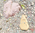
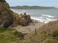
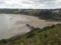
Discover Bréhec Bay from the top of the cliffs, descend to the Red Rocks beach, walk over red, yellow and green stones dating back 600 million years, then climb back up to the plateau to return to your car in Saint-Samson.

Details

60499598
Creation:
Last update:
Last review:
  • Walking
    Activity: Walking
  • ↔
    Distance: 4.04 mi
  • ◔
    Average duration: 2h 10 
  • ▲
    Difficulty: Easy

  • ⚐
    Back to start: Yes
  • ↗
    Ascent: + 381 ft
  • ↘
    Descent: - 374 ft

  • ▲
    Highest point: 338 ft
  • ▼
    Lowest point: 26 ft
  • ⚐ Country: France
  • ⚐ City: Plouha (22580)
  • ⚑
    Start/End: N 48.703706° / W 2.934712°
  • ❏
    IGN map(s): Ref. 0814OT, 0815SB, 0916OT
  • Hour-by-hour weather

Photos

Description of the walk

Saint Samson’s Chapel. Park in the small car park opposite the chapel (GPS: N 48.703817° / W 2.934841°).

(S/E) Start the walk on the tarmac road leading uphill to the left of the chapel, ignoring the dirt track on the right, until you reach a Fork in the road.

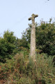
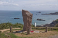
(1) At the stone cross, turn left onto a wide farm track and follow it for 800 m.

(2) You’ll reach a second wayside cross at a place called Kerflec’h; continue straight on and, at the end of this road, turn right onto a road with a pedestrian crossing. Walk past the entrance to a large farm on your right.

(3) Turn left at the large farm sheds and follow the road downhill towards Lanloup; pass through the hamlet of Kerhuel, ignoring the roads to the left and right, until you reach the hamlet of Kermagadel.

(4) Turn right between two houses; you can take a detour to admire the beautifully restored Golven fountain and wash house, 250 metres away.
Walk along a wide grassy path between fields towards the top of the hill, where you’ll find an old cross and, most notably, a large aerial.
At the foot of the mast, turn left onto the small tarmac road. Before reaching the gate of Kerjolis Manor, turn right and follow the road.

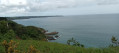
(5) At the junction, cross the coastal road and take the Chemin de Padel opposite. Follow this very wide farm track, ignoring theGR®34on the left. As you go, the Anse de Bréhec comes into view in all its majesty. Begin a fairly steep descent towards the shore.

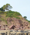
(6) At the lowest point, at a place called Les Rochers Rouges, you can head down to the sea. Continue along theGR®34to the right and, shortly afterwards, leave it to take a path leading uphill opposite, through the vegetation. This 1 km-long path takes you back up onto the plateau and to a farm on your left. Cross the tarmac road and carry on straight ahead towards the cross perched on a rock, which you passed on the way out.

(1) Carry on straight ahead to return to the Chapel of Saint-Samson (S/E).

Waypoints

  1. S/E : mi 0 - alt. 256 ft - Chapelle Saint-Samson (Plouha)
  2. 1 : mi 0.32 - alt. 292 ft - Calvary perched on a rock
  3. 2 : mi 0.84 - alt. 312 ft - Kerflec’h crossroads
  4. 3 : mi 1.3 - alt. 285 ft - Kerdreux junction
  5. 4 : mi 1.63 - alt. 253 ft - The hamlet of Kermagadel - Église Saint-Loup (Lanloup)
  6. 5 : mi 2.29 - alt. 249 ft - Kerjolis crossroads - Point de vue sur Anse de Bréhec
  7. 6 : mi 2.91 - alt. 26 ft - The Red Rocks
  8. S/E : mi 4.04 - alt. 256 ft - Chapelle Saint-Samson (Plouha)

Notes

The climb from (6) is long but not particularly difficult. It is likely to be very muddy in winter and early spring.

Worth a visit

- Saint-Samson Chapel with its fountain.
- Ruins of Alphonse’s house (Shelburn Escape Network).
- Saint-Golven Fountain.
- Red Rocks (a recognised geological site featuring red, yellow and green rocks dating back 600 million years).

Always be cautious and plan ahead when you're outdoors. Visorando and the author of this route cannot be held responsible for any accidents occurring on this route.

The GR® and PR® markings are the intellectual property of the Fédération Française de Randonnée Pédestre.

Reviews and comments

4.5 / 5
Based on 2 reviews

Reliability of the description
4.5 / 5
Ease of following the route
4.5 / 5
Route interest
4.5 / 5
User 21384583

Overall rating : 5 / 5

Date of your route : Jul 13, 2026
Reliability of the description : ★★★★★ Very good
Ease of following the route : ★★★★★ Very good
Route interest : ★★★★★ Very good
Very busy route : Yes

A lovely walk

Machine-translated

Soizik
Soizik

Overall rating : 4 / 5

Date of your route : May 26, 2025
Reliability of the description : ★★★★☆ Good
Ease of following the route : ★★★★☆ Good
Route interest : ★★★★☆ Good
Very busy route : No

A lovely circular walk with a beautiful view of Bréhec beach. A lovely chapel, an old wayside cross… Highly recommended

Machine-translated

Other walks in the area

For more walks, use our search engine .

The GPS track and description are the property of this route's author. Please do not copy them without permission.