


Refine your search for walks in Ouges
Ouges walks
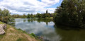
 Walk along the banks of the Ouche from Longvic
 Visorando Member
 7.19 mi
 +39 ft
 -36 ft
 3h 20
 Moderate
 Departure from Longvic (Côte-d'Or)
Étang Royal, a little corner of paradise.
Walkers, joggers and other nature lovers appreciate this site for its calm, beauty and balance.
An easy walk to enjoy the green charm of the ponds and banks of the Ouche.
Circular along the banks of the Ouche starting from Neuilly-lès-Dijon
 6.81 mi
+33 ft
-43 ft
3h 10
 Easy
Departure from Neuilly-lès-Dijon (Côte-d'Or)
The Ouche has been redeveloped, making it a great place for a walk in spring or autumn. You can collect walnuts in season. A very pleasant bucolic setting where you can watch the birds. Picnics are possible by the pond.Note:La Gaule de Neuilly is organising its Enduro Carpes from 23 to 25 May (2025) at theNeuilly-Crimoloispond.
The Burgundy Canal at Bretenière
4.67 mi
+26 ft
-26 ft
2h 10
Easy
Departure from Bretenière (Côte-d'Or)
A bridge linking the north and the south: the 242-km-long Burgundy Canal connects Migennes on the Yonne to Saint-Jean-de-Losne on the Saône. The idea of crossing the Burgundian hills by water dates back to 1490, but work was not commissioned until 1774 by Louis XVI. It was not until 1833 that the canal was fully opened to navigation. It has 189 locks.
From Domois to Cîteaux Abbey
 12.14 mi
+33 ft
-131 ft
5h 35
Moderate
Departure from Perrigny-lès-Dijon (Côte-d'Or)
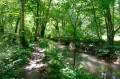
This very pleasant walk will take you to Cîteaux Abbey, following the Cent Fonts river, which will serve as your guide. There are a few picnic areas along this lovely walk.
From one Saulon to another
 5.85 mi
+151 ft
-148 ft
2h 50
Easy
Departure from Saulon-la-Rue (Côte-d'Or)
Winter hike with limited risk of mud and hunting, but to be avoided in case of flooding due to the Sans Fond river.
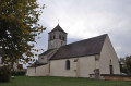
This hike will allow you to see the castle of Saulon-la-Rue, the church of Saulon-la-Chapelle with its two turrets, and to walk along part of the river "La Sans Fond" with the mill of Saulon-la-Chapelle.
Due to private property issues, a change to the route is currently being considered.
The banks of the Oscara from Fauverney
 6.87 mi
+26 ft
-26 ft
3h 10
Moderate
Departure from Fauverney (Côte-d'Or)
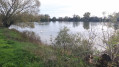
This walk takes place partly along the Ouche river (Oscara in Latin). It has its source in Lusigny-sur-Ouche. This commune is the guardian of the sources of the Ouche. The village is particularly charming with its stone houses.
Chenôve vineyard
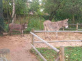 2.85 mi
+194 ft
-194 ft
1h 30
Easy
Departure from Chenôve (Côte-d'Or)
A short walk well suited to families with children, through the vineyards, then through woodland, and ending in a park with a children’s play area and animals.
The Bois de la Combe du Pré
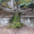 5.83 mi
+696 ft
-682 ft
3h 15
Easy
Departure from Marsannay-la-Côte (Côte-d'Or)
A pleasant forest walk offering lovely views in places.
Through the Bois des Francs via the Combe Pénevelle
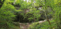 5.74 mi
+958 ft
-942 ft
3h 30
Moderate
Departure from Marsannay-la-Côte (Côte-d'Or)
Fancy exploring the forest, the Bois des Francs and its paths, seeing Marsannay-la-Côte Castle and its church, and strolling along the vineyards? Then let’s go.
The vineyards of Marsannay-la-Côte are part of the Climats of the Burgundy vineyards, listed as a UNESCO World Heritage Site. Thanks to the combined effect of the geology, the exposure and human labour, these vineyards produce a wine distinct from those of the neighbouring Climats.
Circular route through the plains on the outskirts of Dijon
11.73 mi
+79 ft
-79 ft
5h 30
Moderate
Departure from Quetigny (Côte-d'Or)
A circular route with no technical difficulty starting from Quétigny, taking you to the outskirts of the residential areas of Saint-Apollinaire, Varois and Chaignot, Couternon, and Chevigny-Saint-Sauveur. A very pleasant route in fine weather when the path runs alongside the Vieille Tille and then the Norges between Couternon and Chevigny.
La Combe Pevenelle, or a day without a compass or common sense
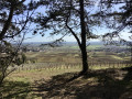 4.57 mi
+1,063 ft
-1,037 ft
3h 00
Moderate
Departure from Marsannay-la-Côte (Côte-d'Or)
Searching for the Batier path from Marsannay-la-Côte, on a day when my sense of direction had deserted me. A lovely little walk, often through woodland, so pleasant in hot weather.
In search of the Owl of Dijon
5.11 mi
+52 ft
-59 ft
2h 25
Easy
Departure from Dijon (Côte-d'Or)
Some towns have a ‘symbolic’ animal: the lion in Belfort, an imposing statue; the frog in Salamanca, much harder to find… In Dijon, it’s an owl, which I suggest you try to find on this city centre walk. Here’s a clue: the bird is carved onto an ancient monument. The legend goes: place your left hand on the owl and your right hand on your heart, make a wish, and it will come true. But first, you’ve got to find the animal…
In the heart of the Dijon vineyards
 Association / Club / Walk leader
 11.94 mi
+1,263 ft
-1,263 ft
6h 35
 Difficult
Departure from Chenôve (Côte-d'Or)
This day-long hike allows you to discover the vineyards that will eventually make up the Dijon appellation. You will regularly enjoy beautiful views of the plain or Dijon, but also more mysterious passages in the undergrowth and at the bottom of the valley. It is a varied route rich in heritage, on terrain that can be very different at times.
Around Saint-Apollinaire
5.46 mi
+151 ft
-151 ft
2h 40
Easy
Departure from Saint-Apollinaire (Côte-d'Or) (Côte-d'Or)
I suggest you take a tour of Saint-Apollinaire along the dirt tracks, passing by the Fort de la Redoute, the town’s various housing estates and the Bois Guillaume business park.
In search of greenery in Dijon
 4.53 mi
+262 ft
-240 ft
2h 20
Easy
Departure from Dijon (Côte-d'Or)
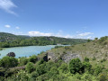
I suggest a short walk that will take you through some of Dijon's parks, passing by a beautiful viewpoint overlooking Lac Kir.
Marais Trail in Magny-sur-Tille
3.07 mi
+13 ft
-13 ft
1h 25
Easy
Departure from Magny-sur-Tille (Côte-d'Or)
An easy, well-signposted family walk around the ponds of Magny-sur-Tille
Hauts Combes de Vaulon, Semetrot and Pévenelle from Couchey
4.28 mi
+312 ft
-305 ft
2h 15
Easy
Departure from Couchey (Côte-d'Or)
This walk, starting from the car park by the Couchey orientation table, takes you around the tops of the Vaulon, Semetrot and Pévenelle valleys. There are several viewpoints for walkers to enjoy, amidst forests, cliffs and limestone meadows dotted with flowers in spring.
Above the valleys at Couchey
4.54 mi
+256 ft
-226 ft
2h 20
Easy
Departure from Couchey (Côte-d'Or)
Starting from the Couchey orientation table, a route above the Vaulon, Pévenelle and Semetrot valleys. Particularly recommended in summer when it is hot. This route is in the middle of the forest with views over the entire Dijon plain and Mont Blanc, weather permitting.
Dijon, from the Valois to Art Nouveau
 4.92 mi
+30 ft
-20 ft
2h 15
Easy
Departure from Dijon (Côte-d'Or)
Dijon is a remarkable city, shaped by its history. Since its Gallo-Roman origins (3rd century), three major periods have shaped this city: the Middle Ages, with its churches; then the Valois, Grand Dukes of Burgundy; and the Renaissance, reflected in the splendour of the parliamentarians’ mansions; and Art Nouveau, with its inventive decorations. The aim of this discovery walk is to take you through these different periods.
The heights of Combe de Fixey or Combe Laveau
 5.03 mi
+666 ft
-673 ft
2h 55
Easy
Departure from Fixin (Côte-d'Or)
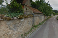
Pass through the Cent Marches de Fixin (100 steps), then head for the top of the Combe de Fixey on the south side, then on the north side to descend through the vineyards.
The Hundred Steps of Fixin and the Chamerey Spring
 10.84 mi
+1,486 ft
-1,509 ft
6h 15
Moderate
Departure from Fixin (Côte-d'Or)
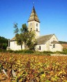
Depart from Fixin towards Chamerey then Ecotois, return via Chamerey then Fixey. A mainly forest route.
Gevrey to Fixin ridge trail
 7.39 mi
+902 ft
-906 ft
4h 10
Moderate
Departure from Fixin (Côte-d'Or)
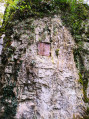
There are a number of interesting places to visit, including the 100 Fixin steps ('Cent Marches des Fixin') and the top of the Combe Lavaux ridges.
Discover the vineyards of Dijon
7.91 mi
+1,017 ft
-1,004 ft
4h 30
Moderate
Departure from Chenôve (Côte-d'Or)
This route is designed to allow you to discover the vineyards of Dijon, which are located above the Combe à la Serpent or near the Fort de la Motte Giron.
In recent years, there has been a real desire to develop a Dijon appellation, and several vineyards have been planted or replanted. This is also an opportunity to enjoy an original route and pass from one valley to another via less frequented paths.
This is a short but fairly challenging hike, dotted with heritage sites such as Le Rucher, cadoles (stone huts), Fort de la Motte Giron, the beautiful Combe Persil and its Jardin des Poètes (Poets' Garden), and on the way back, Combe Saint-Joseph and La Bergerie, which is also your starting and finishing point.
Fixin - Chamerey
 8.74 mi
+1,089 ft
-1,070 ft
5h 00
Moderate
Departure from Fixin (Côte-d'Or)
Some pleasant stopping points, including the Cents Marches de Fixin, the Chamerey Rent with views of Chamboeuf, and the Col de la Toppe.
The Parc Noisot Combe de Fixin – Napoleon’s Russian campaign
2.20 mi
+433 ft
-420 ft
1h 25
Moderate
Departure from Fixin (Côte-d'Or)
This a short pleasant walk, mostly in the shady forest with just a modest amount of climbing. There is a fascinating historic connection in that one of Napoleon’s grenadier guards, Noisot, created in his own name the Parc Noisot and the associated walks, waymarked with symbols of Napoleons’ Russian, Egyptian and Italian military campaigns.
This guide is for the longer but most fulfilling route – the Russian route. About halfway along is a staircase of 100 steps marking the number of days Napoleon took to regain power after release from first captivity.
The walk is also of geological interest, being part of the Combe de Fixin. The meaning of Combe is a narrow gorge, ravine or small valley often containing a mixture of limestone, cliff faces, and forestry, leading to a plateau, but with no significant water course, with similarity to the Combes in England such as Ilfracombe. The excellent Tourist Office in the nearby and famous Gevry Chambertin can tell you more.
The Batier Trail starting from Fixin
5.22 mi
+823 ft
-823 ft
3h 05
Moderate
Departure from Fixin (Côte-d'Or)
A short walk along the Félix Batier path, which can be summed up as follows: a mix of flat sections, ascents and descents, steep climbs and steep descents.
The descent into the Brochon valley and the ascent on the opposite side should be tackled with caution. A route not to be undertaken with children.
2 x 100 steps
 3.60 mi
+682 ft
-669 ft
2h 15
Easy
Departure from Brochon (Côte-d'Or)
This trail will take you to the 100 steps of Brochon and its valley and springs, and then the 100 steps of Fixin and its valley.
Longecourt Castle and Burgundy Canal
 5.83 mi
+30 ft
-30 ft
2h 40
Easy
Departure from Longecourt-en-Plaine (Côte-d'Or)
A circular route through the Domaniale d'Izeure forest and along the Burgundy Canal with three locks, which may be in operation when you visit. In Longecourt, you can see the castle, the wash house and the church.
Between Thorey-en-Plaine and Longecourt-en-Plaine
4.30 mi
+30 ft
-30 ft
2h 00
Easy
Departure from Longecourt-en-Plaine (Côte-d'Or)
A short family walk between woods and the Burgundy Canal.
Batier circular route
 10.27 mi
+948 ft
-961 ft
5h 35
Moderate
Departure from Dijon (Côte-d'Or)
A short section of the Parcours Batier, allowing you to return to the starting point. This route, created in 1965 by Félix Batier, president of the CAF, is a challenging cycle route running from Dijon to Nuits-Saint-Georges; it is 52 km long and has an elevation gain of 1,998 m, said to be equivalent to that of Mont Blanc.
Around the Combe à la Serpent, off the beaten track
5.43 mi
+682 ft
-656 ft
3h 05
Easy
Departure from Dijon (Côte-d'Or)
A short route offering unique views of the Combe à la Serpent, following little-used paths. Minimal elevation gain. Don’t always follow the markings (red and yellow); the route sometimes follows them and sometimes veers off.
Gevrey Chambertin to Chenove (Dijon) - Route des Grands Crus
 6.45 mi
+577 ft
-646 ft
3h 30
Moderate
Departure from Gevrey-Chambertin (Côte-d'Or)
This is stage 8, the final walk in the Route des Grands Crus (RDGC) series, starting in the world famous Grand Cru Burgundy wine town of Gevrey-Chambertin, ending on the outskirts of Dijon.
It begins at Gevrey church, taking you past the Chateau up through woods to the delightful Parc Noisot and past Clos Napoleon vineyard and restaurant to the charming villages of Fixey, Couchey and Marsannay before passing the last major vineyard of the Cote d'Or to the outskirts of Dijon at Genove. It is dog friendly and a reasonably easy walk after a climb at the start. The Yellow Red (YR) lines to indicate the RDGC make for good navigation.
On the path to Vergy and the Grosne spring from Gouville
 4.09 mi
+390 ft
-413 ft
2h 15
Easy
Departure from Corcelles-les-Monts (Côte-d'Or)
A circular route around Gouville Castle takes you along the Vergy path, where you can admire the Combe des Grands Vaux, before returning via a good footpath to the Crosne spring, which flows from a small cliff.
The Tacot Trail and Combe Lavaux circular route from Gevrey
6.46 mi
+620 ft
-614 ft
3h 30
Moderate
Departure from Gevrey-Chambertin (Côte-d'Or)
A walk starting from Gevrey, above the vast vineyards through the woods overlooking the Côte. You’ll discover an old tramway track – quite unusual in these parts – and paths through the woods in the valleys of the plateau, before returning via the upper reaches of the Combe Lavaux, a nature reserve.
Circular path on the Batier trail from Gevrey-Chambertin
5.72 mi
+1,010 ft
-1,004 ft
3h 30
Moderate
Departure from Gevrey-Chambertin (Côte-d'Or)
A short walk, mostly on flat ground. Two fairly steep climbs, straight up the slope. A 150-metre stretch to be tackled with care along the unnamed valley, alongside the cliffs.
The woodland is never dense and the paths are pleasant.
Combe Grisard, Combe de Creuse and Tacot trail
 5.73 mi
+741 ft
-712 ft
3h 15
Moderate
Departure from Gevrey-Chambertin (Côte-d'Or)
This hike follows parts of the route of the old Tacot de Gevrey to Beaune, which passed through Curley. It also takes you through mysterious valleys: the Combe Grisard and the Combe de Creuse. There are also beautiful views of the cliffs of the Combe Lavau.
Combe à la Serpent
2.10 mi
+417 ft
-400 ft
1h 20
Easy
Departure from Dijon (Côte-d'Or)
A walk off the beaten track in the Combe à la Serpent, with a few climbs and some lovely views.
On the heights of Dijon via the Chenôve plateau
 6.88 mi
+866 ft
-869 ft
3h 55
Moderate
Departure from Corcelles-les-Monts (Côte-d'Or)
This circuit will take you on a route that will allow you to discover pretty valleys and charming woodland paths near Dijon.
Route de la Combe à la Serpent
 4.46 mi
+446 ft
-449 ft
2h 25
Easy
Departure from Corcelles-les-Monts (Côte-d'Or)
A short, easy route in Combe à la Serpent, taking in its main attractions: the Aviators' Memorial, the dry stone apiary, two springs and numerous cadoles. The little path along the Bressey hillside is particularly spectacular!
Circular walk along the Sans Fond starting from Corcelles-lès-Cîteaux
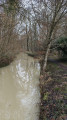 5.84 mi
+115 ft
-125 ft
2h 45
Easy
Departure from Corcelles-lès-Cîteaux (Côte-d'Or)
A short circular loop around the River Sans Fond, which winds through fields and the Izeure State Forest. The Sansfondis 16.3 km long, rising at Perrigny-les-Dijon at an altitude of 230 m and flowing into the Vouge at the Abbey of Cîteaux within the municipality of Saint-Nicolas-lès-Cîteaux at an altitude of 193 m.
A variation on the Corcelles-lès-Cîteaux circular route running alongside the Sansfond
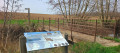 5.83 mi
+72 ft
-72 ft
2h 45
Easy
Departure from Corcelles-lès-Cîteaux (Côte-d'Or)
A circular walk around the River Sansfond, this walk takes place in the Izeure National Forest and across fields; it is not technically demanding and the terrain is fairly flat. This alternative route follows the Sansfond for longer towards Noiron-sous-Gevrey, now that a footbridge allows you to cross the river safely to reach Corcelles-lès-Cîteaux. Alovely walk, ideal for everyone.
Around Varois-et-Chaignot
5.40 mi
+82 ft
-82 ft
2h 35
Easy
Departure from Varois-et-Chaignot (Côte-d'Or)
An easy walk with no significant elevation gain in the Dijon plain
Fontaine-lès-Dijon Circular
 5.18 mi
+456 ft
-436 ft
2h 45
Easy
Departure from Fontaine-lès-Dijon (Côte-d'Or)
A short walk on the outskirts of Dijon. Lovely views of the villages along the route.
Around Couternon
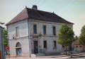 5.84 mi
+39 ft
-39 ft
2h 45
Easy
Departure from Couternon (Côte-d'Or)
A leisurely walk around Courternon. This route will take you round the village and allow you to discover it in a different light.
The route is in open countryside with little shade. Make sure you bring suitable gear if the sun is strong.
The national forest and the banks of the Cent Fonts in Izeure
 11.58 mi
+46 ft
-46 ft
5h 20
Moderate
Departure from Izeure (Côte-d'Or)
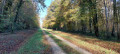
As a resident of Izeure, I had to suggest a hike starting from my town, and now I have. This beautiful walk can be done with the family, is not difficult and has many picnic spots along the Cent Fonts (and not without bottom).
Moderator's warning on 07/04/2021: Caution! Private property issue in (12). See reviews.
Fountain in Hauteville
5.81 mi
+472 ft
-446 ft
3h 05
Easy
Departure from Fontaine-lès-Dijon (Côte-d'Or)
From the Basilica of Saint Bernard to the Hauteville-lès-Dijon viewpoint.
From the Hauts du Suzon to the crocodiles of the Ouche
 10.45 mi
+413 ft
-554 ft
5h 10
Moderate
Departure from Dijon (Côte-d'Or)
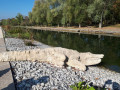
The Suzon and the Ouche, two rivers of great importance to Dijon. This route runs from one to the other through a patchwork of gardens, avenues and small paths. Historical and artistic points of interest and viewpoints.
Access by tram; access by car is also possible.
Lac Chanoine Kir loop - French alpine club (CAF) route and variants
 7.18 mi
+840 ft
-853 ft
4h 00
Moderate
Departure from Talant (Côte-d'Or)
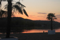
Lac Chanoine Kir loop through the heights of Talant, Plombières-lès-Dijon and Fontaine d'Ouche.A route between town and nature, with beautiful views over the lake.
The heights of Talant-Plombières and the Bonvaux tour
 5.33 mi
+587 ft
-577 ft
3h 00
Easy
Departure from Talant (Côte-d'Or)
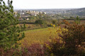
A beautiful walk, two-thirds of it shaded, in the countryside at the gateway to Dijon, between Talant and Plombières, between valleys and vineyards, with beautiful views over Talant, the Ouche valley and Mont Afrique in the distance. The incline is reasonable and broken down into three short climbs, making this a very easy and relatively fast walk.
The lords of Vergy from Morey-Saint-Denis
13.97 mi
+2,162 ft
-2,162 ft
8h 20
Difficult
Departure from Morey-Saint-Denis (Côte-d'Or)
A circular walk through the vineyards of the Côte de Nuits, extending into the hinterland, offering the chance to visit an equestrian centre and see some unusual animals, as well as to explore the history of the rocky outcrop at Vergy.
Between Morey-Saint-Denis and Chambolle-Musigny
 3.47 mi
+377 ft
-377 ft
1h 55
Easy
Departure from Morey-Saint-Denis (Côte-d'Or)
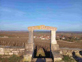
A lovely little walk alternating between valleys, plateaus, views and vineyards.
The Plombières circular route via Velars-sur-Ouche
 12.29 mi
+2,395 ft
-2,405 ft
7h 45
Difficult
Departure from Plombières-lès-Dijon (Côte-d'Or)
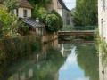
This route, just on the outskirts of Dijon, offers a varied walk alternating between wooded areas, meadows and fields, sometimes at the bottom of a valley or, conversely, across vast plateaus. It provides sweeping views towards Notre-Dame d’Étang or further afield towards Pont-de-Pany, as well as towards Plombières, Talant, Dijon and the nearby Lake Kir.
However, this is a route with a significant elevation gain (over 660 m), featuring slopes that are at times quite steep, which can be tricky in wet weather or when there is snow. This walk is good training for longer hikes, so it’s best to approach it with a sporting spirit – though that doesn’t mean you shouldn’t take the time to appreciate its charms.
Between Velars-sur-Ouche and Plombières-les-Dijon, this route largely follows the Sentier Bernard and, in part, the Sentier Sage – two trails signposted by the CAF in Dijon.
The GPX track may prove very useful.
Between Tille and Gourmerault
9.92 mi
+33 ft
-33 ft
4h 35
Moderate
Departure from Arc-sur-Tille (Côte-d'Or)
This circular walk, between the two rivers that flow through our villages, takes you along these waterways and allows you to explore the church and the old mill at Arc-sur-Tille, Bressey-sur-Tille Castle, and the ponds at Remilly-sur-Tille.Did you know that the bell tower of the church at Arc-sur-Tille owes its flat roof to the Chape telegraph (1841)?
Around the lake and green spaces of Arc-sur-Tille
6.30 mi
+16 ft
-16 ft
2h 55
Easy
Departure from Arc-sur-Tille (Côte-d'Or)
This hike will take you through the town's green spaces, around the lake and along the Tille river.
The mill at Arc-sur-Tille
1.69 mi
+10 ft
-10 ft
0h 45
Easy
Departure from Arc-sur-Tille (Côte-d'Or)
A superb walk along the River Tille, during which you’ll discover the watermill and the church at Arc-sur-Tille.
From one mill to another in Arc-sur-Tille
6.65 mi
+66 ft
-79 ft
3h 05
Moderate
Departure from Arc-sur-Tille (Côte-d'Or)
Country walk between Arc-sur-Tille and Remilly-sur-Tille, taking in their mills.
Plains and woods around Orgeux
 5.16 mi
+46 ft
-46 ft
2h 25
Easy
Departure from Orgeux (Côte-d'Or)
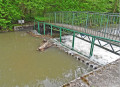
Does the village of Orgeux owe its name to ancient barley fields (Hordeu)? The Church of the Assumption dates back to the 13th century and features beautiful stained-glass windows in the choir. In the cemetery, there is a 17th-century calvary with a stone plaque. Adjacent to a small stone bridge, the wash house is built straddling a stream. A needle weir on the Norges slows the flow of the water just a stone’s throw away. A Roman road once crossed the area and, in 1967, a hoard of Gallo-Roman coins was unearthed in a sand pit.
The Norges Valley between Orgeux and Saint-Julien
9.12 mi
+56 ft
-56 ft
4h 15
Moderate
Departure from Orgeux (Côte-d'Or)
A walk starting from Orgeux, with no technical difficulty, which follows the pleasant Norges valley and leads to Saint-Julien. The return route takes you through woods and fields, away from the road.
Circular route via the Ogny farm, starting from Orgeux
11.51 mi
+217 ft
-207 ft
5h 30
Moderate
Departure from Orgeux (Côte-d'Or)
A circular route with no technical difficulties, starting from Orgeux, which takes us to the Ogny farm, then passes close to Brétigny, Ruffey-Lès-Echirey and Varois-et-Chaignot before returning to the starting point.
From Vougeot to Cîteaux via the Chemin des Moines
 9.37 mi
+36 ft
-141 ft
4h 20
Moderate
Departure from Vougeot (Côte-d'Or)
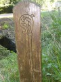
This walk follows the path that the monks of Cîteaux used in the Middle Ages to go and work in their vineyards in Vougeot. It passes through the pretty village of Gilly-lès-Cîteaux, with its beautifully restored castle, which was once a dependency of Cîteaux Abbey. The walk ends in front of Cîteaux Abbey.