Country:
 City:
City:


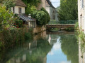
You can park in a small car park on the left at the start of the Combe de la Cité la Flamme, just after the tunnel under the railway line. You can also travel by bus using the Divia network (there’s a stop at the entrance to the valley) or by bike, given its proximity to Dijon.
(S/E) From the car park, head west and walk slightly uphill to reach a stony path branching off to the right. Climb steeply until you come out onto a small road.
(1) Cross it before rejoining it a little further up, then follow it. After a house on the right, the road becomes a wide track and the gradient gradually levels out, leading you towards the Pérouse farm, which you’ll soon come to.
(2) Go round it on the left and, after the cherry orchard, you’ll be treated to a stunning view across the whole of the Ouche Valley. Continue along the same path, which soon descends to the left towards the Combe de Fontenotte. At the bottom of the valley is a small, long meadow. Keep to the right, following the yellow markings, until you reach the Source de Fontenotte, which rarely runs dry.
(3) Carry on past the spring and continue along the same path, which soon turns to the right before sloping down towards a vast meadow, access to which is blocked to vehicles by a gate that you must go round. Immediately after this, at the edge of the woods, take the path on the left leading to another spring known as the Cigey Spring (though its name is only mentioned on old maps).
(4) Carry on, taking the path on the left and heading towards the bottom of the Combe de Cigey. Take the path on the right to climb up the wooded valley. After passing a cleared area on the right, you’ll reach a crossroads of paths at the bottom of the valley.
(5) Take the path furthest to the left and climb straight up the hillside. After an initial fairly steep section, cross a path marked in yellow and continue straight on to emerge onto a plateau and come upon a vast field. On the left, in a copse, you will see the ruins of the old Contard farm. You will rejoin theGR®7markings.
(6) Continue straight on along the path at the edge of the woodland, which descends towards the bottom of the valley. Then take the first path you come to on the left (signposted ‘Source de la Tuilerie’).
(7) Follow this path, the entrance to which is marked by a pretty wooden bench. Further on, information boards provide details about the trees. Continue to the Source de la Tuilerie, where you can take shelter if necessary.
(8) Join the forest track at the bottom of the valley and turn left, following the field, then continue to the right (west) up the path, which becomes quite steep but leads to the road (D10) at elevation 354.
(9) Cross the road and continue along the path running alongside the field. Head up towards the Rente du Fays, then go round to the left and join the road to Velars.
(10) Follow the road towards Velars for about 500 m, with fields and open countryside to your left and woodland to your right. Continue a little further until you reach two wide tracks at a four-way junction at elevation 394.
(11) Turn right onto the track that enters the forest on the right, following theGR®7signposts. Soon after, at the first fork, turn left to cross the Bois de la Brosse. On leaving the forest, pass under a double power line before beginning the descent towards Velars-sur-Ouche. At the final left-hand bend just before the railway line, join the road leading to the village centre at a junction.
(12) Head down to the right towards Velars, passing under the railway bridge, until you reach the first houses. Take the first street on the left and follow it to the junction with the Route de la Verrerie, opposite a bar-restaurant.
(13) Carry on straight ahead along this road, passing the church before crossing the bridge over the Ouche. You will then walk past the small shopping area and the petrol station on your left, before crossing the Canal de Bourgogne at the lock.
(14) Just after the bridge, take the road on the right and cross it at the bus stop. A little further on, on the right, you can just make out the small tunnel that allows pedestrians to pass under the motorway. The path leads out onto Rue Pierre Desvignes. Take this road to the left until you reach Allée de la Cude, which you cross by veering slightly to the left, then turn right onto Route de Notre-Dame d’Étang. Follow this for about a hundred metres, turn left at the first junction and follow Chemin des Pins. Turn left onto a small street leading from the housing estate. Turn left onto it, then immediately right down a dead-end lane until you reach a small clearing at the start of a field.
(15) Take the path that starts between a fenced-off area where wood is stored on the left and a field on the right. At the end of this, continue straight on and, after the first incline, take a small path on the left.
(16) Follow this path as it enters the forest, then turn immediately right into the bottom of the Combe Bertrand, which you follow uphill for 800 metres until you reach the Signpost (White Cross) for the Sentier Sage, and continue straight on
(17) Stay on the path at the bottom of the valley and take the path on the left, which soon climbs quite steeply before coming out onto the road (D108).
(18) Cross the road (__watch out for cars that may approach quickly from Corcelles_) to join a small path situated almost directly opposite, which, 200 metres further on, meets a wide, carriageable track. Follow it to the right, slightly uphill. 300 m further on, on the left, head diagonally into the forest, passing above the Combe Maréchal. Continue until you reach a forest track.
(19) Follow it to the left, straight ahead, towards the Roche du Crucifix. As the track begins to descend, turn right around a wide bend to soon head back in the opposite direction. Then begin the descent, which is quite steep and tricky in wet weather (stony ground). This will take you to the bottom of the Combe du Diable (if you’re lucky enough to make it there). Turn right and head for a crossroads of paths.
(20) Turn left, heading north-west, then, a little further on, climb back up onto the plateau.
On this section of the route, which is also the Sentier Bernard (marked in yellow and red), the very distinctive terrain of our limestone region, with its deep valleys, features some fairly tough and at times very steep ascents and descents. This gives this particular hike a rather challenging nature.
The path is barely marked: cross scree slopes following the edge of a small cliff, then turn sharply to the right (north-east) before crossing a flat area and coming out onto another path running perpendicular to it. Take this path to the left for about 100 metres.
(21) In the Bois du Crucifix (if you’ve survived the Combe du Diable), turn sharply right onto a straight path at the edge of the plateau and pass under a small power line. Continue straight on before beginning a long and difficult descent to reach the bottom of an unnamed valley. Turn left to reach a crossroads still at the bottom of the valley, then turn right to climb up the Combe Grivelle to a junction of paths at elevation 323.
(22) Turn left and take the path that climbs back up towards the plateau, where you’ll find a double power line, then descend towards the Combe de la Cras at a junction. Cross it and immediately set off opposite, tackling another steep climb to reach the Bois Impérial in the Bois Brûlé. The path soon turns right, offering views of the walls of a large limestone quarry. Descend gently along the edge of a valley before climbing back up the valley floor to the quarry access road.
(23) Cross this track and follow a path overlooking the quarry. A little further on, to the right, you can just make out the tops of two masts. Continue along the edge of the field and arrive directly opposite the two masts (on your right) at a fork in the path.
(24) Take a path on the left, heading due north, which also marks the boundary of the quarry’s land. Head down into the forest and then, shortly afterwards, turn right. Continue along this path and, at a fork, turn right (following the yellow and red-marked path) to easily reach the road, which runs from Corcelles-les-Monts down towards Plombières-les-Dijon. Turn left at the bend.
(25) As you come out of the bend, take the path (still signposted) on the right. Descend steeply above the village of Plombières, which lies spread out below you. You’ll come out onto a good path; follow it to the left until you rejoin the road.
Do not take the first road immediately on the right, which joins the dual carriageway, but carry on straight ahead along the side of the road until you reach a large junction. The road curves sharply to the right here.
(26) Continue downhill towards the bridge that passes under the Côte d’Or motorway. To the right of the road is a path protected from traffic by a low concrete wall, allowing you to walk in complete safety. You will then come out onto the Route de Paris and the Port du Canal. Cross this road and follow the promenade by turning right. You will reach a lock; cross it on foot, or, if this isn’t possible, cross the canal via the road bridge a little further on. Return to the Port du Canal to reach Rue de Weotenga (a village in Burkina Faso).
(27) Look out for the footbridge on the right, which takes you across the Ouche through a rather unspoilt and very pleasant stretch of countryside. Keep to the left of the large car park opposite a school to find a pedestrian crossing leading to Rue du Château d’eau. Turn left onto this street, then turn right onto Rue Victor Hugo. Cross the leat via a small bridge, then head straight on towards Rue de Velars.
(28) Turn left onto this street and, after walking past the Lycée Agricole, you’ll come to Rue Bernard Courtois.
(29) Walk up this street to the right, through the tunnel under the railway line, to reach the car park (S/E).



 Visorando Member
 Moderate
 Easy
Easy 
 Association / Club / Walk leader