The Bois de la Combe du Pré

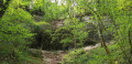
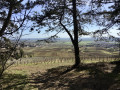
A pleasant forest walk offering lovely views in places.

Details

69006523
Creation:
Last update:
Last review:
  • Walking
    Activity: Walking
  • ↔
    Distance: 5.83 mi
  • ◔
    Average duration: 3h 15 
  • ▲
    Difficulty: Easy

  • ⚐
    Back to start: Yes
  • ↗
    Ascent: + 696 ft
  • ↘
    Descent: - 682 ft

  • ▲
    Highest point: 1,424 ft
  • ▼
    Lowest point: 919 ft

Photos

Description of the walk

Start from the car park opposite the Maison de Marsannay, on Chemin aux Vaches.

(S/E) Opposite the house, head left and, at the next junction, turn right towards the recycling centre. Go round a bend to the right and you’ll reach the path on the left about fifty metres further on.

(1) Take this path, then at the three-way junction, keep left and ignore the path with the gate. Walk alongside the vineyard until you reach its corner.

(2) Enter the woodland and continue straight on (north-west) until you reach a fork in the path (alt. 325 m). Look out for a path on the right (return route).

(3) Carry on straight ahead for 230 m until you reach a fork in the trough of a valley.

(4) Turn left and follow the stony path on the left which runs along the bottom of the valley. After a steep climb of about 340 m, you’ll reach a crossroads at the top, including a signposted path.

(5) Head left along this path (Sentier Bombis) and keep left at the next fork. On your right, you’ll come to the start of a path that begins with a hairpin bend.

(6) Follow this path to a car park.

(7) Take the path to the right, then turn left a few metres further on to reach a crossroads.

(8) Head down to the right into the wide gully and reach a cross-path.

(9) Turn right and join the signposted path (Sentier Bombis).

(10) Head down to the left to the Source de la Crosne.

(11) Continue down a steeper slope to reach the bottom of the valley.

(12) Turn left and head uphill towards the Plateau de Chenove. After a right-hand bend, you’ll reach a fork at the edge of the woods.

(13) Leave the signposted path, take the track on the right, then quickly turn right again and head down into the woods. Then turn left and follow a well-marked trail along the mountainside until you reach a four-way junction.

(14) Head down to the right along the stony path, which is quite steep (take care in wet weather), and rejoin the route you took earlier.

(3) Head left and, following the path in the opposite direction to the way out, return to the car park opposite the Maison de Marsannay (S/E).


Waypoints

  1. S/E : mi 0 - alt. 919 ft - Maison de Marsannay - Église Notre-Dame de l'Assomption (Marsannay-la-Côte)
  2. 1 : mi 0.44 - alt. 961 ft - Junction common to both the outward and return journeys
  3. 2 : mi 0.72 - alt. 984 ft - Junction of the circular loop
  4. 3 : mi 1.41 - alt. 1,066 ft - A/R junction
  5. 4 : mi 1.54 - alt. 1,083 ft - Stony path to the left
  6. 5 : mi 1.76 - alt. 1,319 ft - Crossroads, signposted path (Sentier Bombis)
  7. 6 : mi 2.28 - alt. 1,325 ft - Hairpin bend
  8. 7 : mi 2.69 - alt. 1,401 ft - Car park
  9. 8 : mi 2.91 - alt. 1,424 ft - Wide gully on the right
  10. 9 : mi 3.18 - alt. 1,358 ft - Cross-country path
  11. 10 : mi 3.35 - alt. 1,325 ft - Junction, signposted path (Sentier Bombis)
  12. 11 : mi 3.6 - alt. 1,227 ft - Source de la Crosne
  13. 12 : mi 3.7 - alt. 1,112 ft - Bottom of the valley
  14. 13 : mi 3.89 - alt. 1,273 ft - Edge of the woodland
  15. 14 : mi 4.31 - alt. 1,266 ft - Stony path, steep slope
  16. S/E : mi 5.83 - alt. 919 ft - Maison de Marsannay

Worth a visit

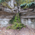
(11) Source de la Crosne.

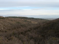
Between (10) and (11), view of the valley.

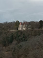
After (13), view of Goville Castle on the right.

Reviews and comments

4.6 / 5
Based on 3 reviews

Reliability of the description
4.5 / 5
Ease of following the route
4.3 / 5
Route interest
5 / 5
randonneur 21
randonneur 21
• Edited:

Hello
Glad you enjoyed this little hike
I usually hike on my own, but I wouldn’t mind joining up with some new hikers

Machine-translated

DROUILLOT
DROUILLOT

Overall rating : 5 / 5

Date of your route : Apr 08, 2026
Reliability of the description : Not used / Not applicable
Ease of following the route : ★★★★★ Very good
Route interest : ★★★★★ Very good
Very busy route : No

Thank you, "randonneur 21", for this lovely route.
Alternating between shaded and open areas, you’ll discover some lovely views as you walk along beautiful paths and trails. The source of the Crosne is a very pleasant spot to stop for lunch. I agree with “Puce21”.

Machine-translated

randonneur 21
randonneur 21
• Edited:

Some passages do need to be tackled with caution
but with a pair of walking sticks and good shoes
everything goes smoothly.
Caution is always advised
Thank you for your comments, they will help future hikers.

Machine-translated

Puce 21
Puce 21

Overall rating : 4.7 / 5

Date of your route : Oct 19, 2025
Reliability of the description : ★★★★★ Very good
Ease of following the route : ★★★★☆ Good
Route interest : ★★★★★ Very good
Very busy route : No

Very pleasant hike. Note that there are a few slightly tricky climbs and descents. Avoid in rainy or wet weather. Not necessarily an easy hike, as noted!

Machine-translated

randonneur 21
randonneur 21

Thanks for the comment
I can see you enjoyed this little walk
Doing it the other way round doesn’t make much difference
Enjoy your future walks
Kind regards

Machine-translated

Soliine
Soliine

Overall rating : 4.3 / 5

Date of your route : Mar 23, 2025
Reliability of the description : ★★★★☆ Good
Ease of following the route : ★★★★☆ Good
Route interest : ★★★★★ Very good
Very busy route : No

Actually, I did the route in the opposite direction, starting from Corcelles, so I encountered a few difficulties – simply because of the choice I made.
The spring is well worth a visit
Thank you

Machine-translated

Other walks in the area

For more walks, use our search engine .

The GPS track and description are the property of this route's author. Please do not copy them without permission.