Hauts Combes de Vaulon, Semetrot and Pévenelle from Couchey

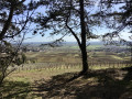
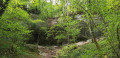
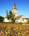
This walk, starting from the car park by the Couchey orientation table, takes you around the tops of the Vaulon, Semetrot and Pévenelle valleys. There are several viewpoints for walkers to enjoy, amidst forests, cliffs and limestone meadows dotted with flowers in spring.

Details

68955787
Creation:
Last update:
Last review:
  • Walking
    Activity: Walking
  • ↔
    Distance: 4.28 mi
  • ◔
    Average duration: 2h 15 
  • ▲
    Difficulty: Easy

  • ⚐
    Back to start: Yes
  • ↗
    Ascent: + 312 ft
  • ↘
    Descent: - 305 ft

  • ▲
    Highest point: 1,526 ft
  • ▼
    Lowest point: 1,332 ft
  • ⚐ Country: France
  • ⚐ City: Couchey (21160)
  • ⚑
    Start/End: N 47.264214° / E 4.966627°
  • ❏
    IGN map(s): Ref. 3023OT, 3123O
  • Hour-by-hour weather

Description of the walk

Park in the car park above the village of Couchey, next to the orientation board.

(S/E) Walk along the top of the Combe de Vaulon (south-facing slope) heading west until you reach the very top of the valley, where the path climbing up from the bottom of the valley joins the plateau.

(1) Take the path leading up to the right (at almost a right angle) and follow it for just under 100 m. Turn right again, at a right angle, and follow the path to the junction with the track leading down from La Rente Neuve towards Couchey.

(2) Turn left onto this track and continue to the second path (signposted on the right), which veers off to the right.

(3) Follow it towards Combe Semetrot (north-west) for about 1 km until you reach the junction with a forest track.

(4) Cross it and head straight ahead, then leave the top of the Combe Semetrot (on your left) behind you, and follow this path for just under 300 m until you reach a path that descends to the left.

(5) Take this path, which descends slightly and overlooks the Combe Semetrot: there are some lovely views along this path. Follow it for about 2 km, and only head uphill at the end of the path, to the right, for about 100 m, until you reach a junction with a cross-path leading down from the plateau, on your left

(6) Turn left at a right angle onto this path, which veers to the right, and continue until you reach the forest track leading up from the Sapin du Garde. Cross this track, then look immediately to your right, where a small, straight path begins.

(7) Follow it for 500 m. Turn left, then immediately right, and continue for another 500 m along the Sentier Bâtier. You’ll reach the rocks overlooking the Combe Pévenelle, at the point where the Sentier Bâtier plunges into the valley: take a moment to admire the view.

(8) At this viewpoint overlooking the Combe Pévenelle, leave the Sentier Bâtier by turning right, and follow the narrow path that runs alongside the valley (south-facing slope), crossing the limestone grasslands, to the top of the Combe Pévenelle, where a path descends into the valley.

(9) Take the path on the left, which overlooks the valley (north-facing slope), and walk across the meadows for the final hundred metres to reach the car park (S/E).


Waypoints

  1. S/E : mi 0 - alt. 1,388 ft - Couchey orientation table car park
  2. 1 : mi 0.33 - alt. 1,470 ft - Summit of Combe Vaulon
  3. 2 : mi 0.53 - alt. 1,490 ft - Junction with the track towards La Rente Neuve
  4. 3 : mi 0.7 - alt. 1,526 ft - Start of the path towards Combe Semetrot
  5. 4 : mi 1.18 - alt. 1,503 ft - Crossing a forest track
  6. 5 : mi 1.37 - alt. 1,473 ft - Path leading down to the left
  7. 6 : mi 2.05 - alt. 1,437 ft - Sharp left-hand bend
  8. 7 : mi 2.52 - alt. 1,332 ft - Right-angle turn
  9. 8 : mi 3.11 - alt. 1,371 ft - Combe Pévenelle viewpoint (south-facing slope)
  10. 9 : mi 3.57 - alt. 1,457 ft - Summit of Combe Pévenelle
  11. S/E : mi 4.28 - alt. 1,388 ft - Couchey orientation table car park

Reviews and comments

5 / 5
Based on 2 reviews

Reliability of the description
5 / 5
Ease of following the route
5 / 5
Route interest
5 / 5
FranciSicep
FranciSicep

Overall rating : 5 / 5

Date of your route : Nov 11, 2025
Reliability of the description : ★★★★★ Very good
Ease of following the route : ★★★★★ Very good
Route interest : ★★★★★ Very good
Very busy route : No

A very beautiful hike, done today in sunny weather, which allows you to discover the unique landscape of the Côte d'Or.
To be repeated in spring.

Machine-translated

Val21
Val21

Overall rating : 5 / 5

Date of your route : May 26, 2025
Reliability of the description : ★★★★★ Very good
Ease of following the route : ★★★★★ Very good
Route interest : ★★★★★ Very good
Very busy route : No

A lovely route – thank you.
I took a wrong turn at one point and ended up in a valley – it was well worth it, it was magnificent. After taking a few photos, I got back on the right track.
I’d recommend it

Machine-translated

Other walks in the area

For more walks, use our search engine .

The GPS track and description are the property of this route's author. Please do not copy them without permission.