Country:
 City:
City:


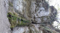
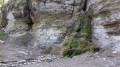
Park in the swimming pool car park next to the sports grounds.
(S/E) With the swimming pool on your left, follow Avenue du Lac and pass the secondary school on your right.
(1) At the junction, turn right onto Rue de la Combe à la Serpent. At the first junction, turn left diagonally onto the small path which leads to a flight of steps. Follow the road uphill to the right, Rue des Layottes, go round the hairpin bend to the left and continue to No. 25 Rue des Hauts de la Combe.
(2) Take the path on the right marked in yellow, then turn right again 100 metres further on. Then stay at the same level by taking the alternative route of the Circuit du Faucon, running parallel to another, wider path. Keep to the right just before joining it and you’ll reach a crossroads.
(3) Continue left into the Combe à la Serpent.
(4) Pass under the power line, then begin a gentle descent to the right before continuing to the left until you reach the road (elevation 341), which you follow to the left. You will then emerge from the forest, pass under the power line again, and turn right to reach the Dijon–Corcelles road (D108g).
(5) Cross this road and follow the path opposite, passing under the power line once more. Continue to the right along the Chemin de la Rente Saint-Joseph, keeping to the right as you approach the Bergerie Chapel.
After the chapel, turn right to go round the back of a model aeroplane field, a possible picnic spot. Then cross a road and follow the signs opposite for “Parcours Batier – source de Crosne”, marked in yellow.
(6) Turn right, following the markings, pass the Crosne spring and reach a crossroads.
(7) Head slightly to the left, then turn immediately right and carry on straight ahead until you reach a car park near the Marsannay–Corcelles road. Join the road, cross it carefully to take the path opposite, and walk for about fifty metres to reach a signpost.
(8) At this point, follow the sign on the left for “Parcours Batier – easy route”. Begin the descent, which is quite steep at the start (slippery in wet weather), and follow it straight on until you reach a car park on the nature trail (picnic area). Continue to the road leading to Marsannay (D108).
(9) Head down to the right along the road until you reach the first houses, then turn left towards Les Finottes. Keep to the right at the Fork in the road that appears shortly afterwards to reach a four-way junction.
(10) Carry on straight ahead. The route then takes you through the vineyards, staying at the same level and heading in the same direction until you reach Chenôve. Pass under the power line once more before arriving at the Chenôve wine presses.
(11) Leave the wine presses on your right and head up the street on the left for 50 metres, then turn right onto Rue Jules Blaizet. After passing the church, keep left at the Fork in the road to follow Rue Charles Poisot as far as the secondary school.
Opposite the school, turn left, keep left, then turn right at the crossroads. Walk alongside the cemetery and continue to the junction with Rue de la Croix des Valendons.
(12) Turn left, continue along Rue Docteur Calmette and you’ll come out onto Rue du Père Charles de Foucauld, which you follow to the right for about 150 metres.
(13) Cross the street carefully to take a parallel street above which leads back to Rue du Père Charles de Foucauld, then to Rue de Corcelles by turning left.
Cross this street and follow Rue des Marcs d’Or on the opposite side until the next junction. Turn slightly to the right.
(14) Continue straight ahead, running alongside the sports ground (Esplanade des Marcs d’Or). Join a path marked in yellow and follow it straight on through woodland until you reach Rue du Tire Pesseau. Turn right for 50 metres before turning left onto a path leading to the roundabout on Boulevard Gaston Bachelard.
(15) Go round this roundabout on the right, then enter the tunnel on the left which passes under Boulevard Chanoine Kir. You will then pass through a shopping area; turn right at the end of this area and continue to the Canal de Bourgogne.
(16) Turn left and follow the canal until you reach the swimming pool car park, which will be on your left (S/E).

 Visorando Member
 Easy
Easy 
 Association / Club / Walk leader