Country:
 City:
City:


To get to Orgeux via the D960, Route de Fontaine Française:
- coming from Varois-et-Chaignot, take thefirst left after passing the junction leading to the centre of Orgeux
- coming from the direction of Arcelot, turn into thefirst street on the right after crossing the motorway and the River La Norges in succession.
Park under the trees along Chemin du Breuil, on the banks of the River La Norges, near the ZAC du Moulin.
(S/E) Take the Chemin du Breuil towards the village centre, then keep left onto Rue du Moulin. At the crossroads, cross the D28d with care – be aware that visibility is restricted due to an S-bend – and follow the road along the right-hand pavement towards the church. Turn right onto Rue Rasée, just before the cemetery, towards Le Petit Noyer. Follow this road to the edge of the village. After passing a wayside cross, continue for a few metres along a dirt track.
(1) Turn right to head into the fields. Take the second path on the left. Follow it downhill to the next crossroads of tracks, after it has veered to the right and crossed a stream.
(2) Turn right onto a white stony track. At the next Fork in the road, keep right to skirt a small copse on the right. Further on, the track veers first to the left and then to the right, before heading off to the right towards a copse. It comes to the edge of a field after crossing a stream.
(3) Turn left for a few metres, then immediately right so as to follow the edge of this field, which borders the woodland and is flanked by a ditch. Further along the edge, after a bend to the right, a beam allows you to cross the dry ditch and enter the woodland via a path. Cross the woodland from one side to the other until you reach a field.
(4) Turn left at the edge of the woodland and field onto the grassy path (a few metres before reaching the field, you can turn left onto a woodland path that runs parallel to the one you are on). Follow the edge of the woodland and field until you reach a sharp bend to the right. At this point, turn left and then immediately right to join the woodland path (the one mentioned in brackets) which, on the right, leads across the fields towards the farm and Ogny Castle, which you can see ahead.
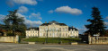
(5) At the wayside cross, you’ll join the tarmac road leading to Ogny Castle. Keep to the right to pass between the buildings and follow the Allée d’Ogny to the D28 at the Bretigny level crossing.
(6) Carefully cross the D28 and then the railway line before turning left onto the road leading to the Rougemont composting plant. Further on, at the Fork in the road, keep to the right towards the composting plant. At the next T-junction, turn left, with your back to the composting plant.
(7) At the first crossroads of tracks that follows, turn right (you’ll see a completely isolated copse). Continue along this field track, which curves in an S-shape – left then right – until you reach the edge of the Bois du Roz. Turn left and carry on straight ahead until you can see a vineyard. Leave the path you’ve been following, which veers off to the right, and continue straight on, passing along the left-hand edge of the vineyard. Shortly afterwards, the grassy path veers to the left. It runs alongside patches of woodland and, further on, crosses a stream.
(8) At the junction just after crossing the stream, halfway up the slope, turn left. Follow this field path continuously until it joins the railway line. Carefully cross the level crossing and then the D28, continuing straight ahead.
(9) Follow signs for the Breuil Business Park in Ruffey-Lès-Echirey, taking Rue En Chatoux. At the first junction, turn right onto a tarmac road which later becomes a gravel track. At the end of this track, it passes between farm buildings and joins Rue de la Motte. Turn left and follow this road until you reach the edge of the built-up area.
(10) At the crossroads of tracks, just after passing a farm building, head left, then turn right after a copse. Walk across the fields until you reach the south-eastern end of the cemetery straight ahead, level with the village hall opposite.
(11) Signpost showing Ruffey. Set off to the left along the tarmac road, with your back to the village. Shortly afterwards, at the first crossroads, turn left to reach one of the two communal wash houses further down the slope.
(12) Washhouse and picnic area. Follow the stream Le Bas Mont to the left, then, before the sewage treatment plant, head up to the right back to the original tarmac path. Keep following it to the left.
(13) Immediately after crossing the Le Bas Mont stream, when you reach the houses of the same name, turn right to follow the stream, keeping to the right along a wide grassy path until you come to a field track.
(14) Turn left twice in succession to follow this track uphill, until it veers right at the end and, further on, joins a white, stony track, the Chemin de la Rente Rouge. Then turn left and, at the next crossroads, turn right towards the south-east, to a place known as l’Étang.
(15) At the next junction, turn left towards Les Bordes onto a grassy track running down the middle of the path, then, further down, take the first track on the right. It runs alongside a ditch (keeping to the right) and, after passing a copse on the left, leads to a farm shed. Turn left after the shed to return to the junction where the circular loop began.
(2). As a reminder, turn right and cross the stream where there is a ‘no entry’ sign. Return to Orgeux via the same route taken on the way out to reach the car park on Chemin du Breuil (S/E).

 Visorando Member
 Easy
Easy