La Combe Pevenelle, or a day without a compass or common sense

Searching for the Batier path from Marsannay-la-Côte, on a day when my sense of direction had deserted me. A lovely little walk, often through woodland, so pleasant in hot weather.

Details

2685558
Creation:
Last update:
Last review:
  • Walking
    Activity: Walking
  • ↔
    Distance: 4.57 mi
  • ◔
    Average duration: 3h 00 
  • ▲
    Difficulty: Moderate

  • ⚐
    Back to start: Yes
  • ↗
    Ascent: + 1,063 ft
  • ↘
    Descent: - 1,037 ft

  • ▲
    Highest point: 1,457 ft
  • ▼
    Lowest point: 945 ft

Photos

Description of the walk

From the D974 heading towards Dijon–Gevrey-Chambertin, turn right at the traffic lights (Café du Rocher). Drive up to the Route des Grands Crus, Rue de Mazy, with the church on your left. After the post office, take the second right (Rue de l’Argilière), which ends in a track. Park wherever you can along the last few houses.

(S/E) Follow the track, which is still passable by vehicle. After about 300 m, turn left onto the track and continue for about 100 m until you reach a junction. Take the second track on the right, which does not go uphill and runs along the edge of the woodland, until you reach a junction.

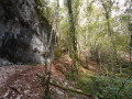
(1) Turn left onto a path that climbs straight up the slope, with a small rocky outcrop towards the end.

(2) A little further on, take a path on the left marked in yellow: this is the Batier path. If you carry on straight ahead, this is the Batier path, heading towards the Combe Semenot.

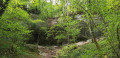
Follow the path on the left until you are directly below Combe Pévénelle. When you reach the cliffs, turn left for 10 to 20 metres and look for the yellow markings (which are faint) indicating the descent into the valley. Follow the path down between the rocks, then continue to the bottom of the valley.

(3) Turn left into the valley until you reach an uphill path on the right which leads back to a road suitable for vehicles.

(4) Turn right to head back up the road, passing the car park and the orientation table, until you reach a junction with several paths.

(5) Take thefirst path on the right, which is normally signposted, and which leads back to Combe Pévenelle after about 800 metres.

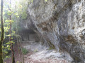
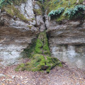
(6) Turn right, make a short descent between the rocks (safe to do so) to reach the valley, passing under a natural shelter. Descend the valley to the junction with the path taken on the way there.

(3) Turn left uphill and retrace your steps in the opposite direction back to the car (S/E).

Waypoints

  1. S/E : mi 0 - alt. 945 ft - Car park on Rue de l’Argilière
  2. 1 : mi 0.53 - alt. 1,106 ft - Path on the left, entering the forest
  3. 2 : mi 0.85 - alt. 1,391 ft - Arrival at the Batier path
  4. 3 : mi 1.22 - alt. 1,148 ft - Junction of the circular Combe loop
  5. 4 : mi 1.87 - alt. 1,194 ft - Road junction, on the right
  6. 5 : mi 2.36 - alt. 1,457 ft - Junction, first path on the right
  7. 6 : mi 2.91 - alt. 1,434 ft - Top of the valley, on the right
  8. S/E : mi 4.57 - alt. 945 ft - Car park on Rue de l’Argilière

Notes

Hiking boots recommended.

Reviews and comments

4.6 / 5
Based on 3 reviews

Reliability of the description
4.7 / 5
Ease of following the route
4.3 / 5
Route interest
4.7 / 5
pauletteC21
pauletteC21

Hello
We only managed part of this walk because it took us nearly an hour to find where the start point was
As we’re not used to reading this sort of information, we hadn’t understood it. I must say we’re getting on a bit and it takes our brains a while to get to grips with things 😏😒 That said, we did a short walk above Chaignay and were delighted with this lovely little walk
Done by three people: aged 88, 78 and 77

Machine-translated

bernardcadiou
bernardcadiou

Overall rating : 5 / 5

Date of your route : Jan 17, 2023
Reliability of the description : ★★★★★ Very good
Ease of following the route : ★★★★★ Very good
Route interest : ★★★★★ Very good
Very busy route : No

Take care on the descent from La Combe via Le Batier in wet weather. It’s a bit tricky for walkers who aren’t used to it.
A lovely walk.

Machine-translated

Bofed
Bofed

Overall rating : 4 / 5

Date of your route : May 02, 2021
Reliability of the description : ★★★★☆ Good
Ease of following the route : ★★★★☆ Good
Route interest : ★★★★☆ Good
Very busy route : Yes

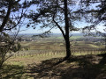
A lovely walk in the forest, with varied scenery. We took a short detour to see the Vaulon valley from above.

Machine-translated

jo Macé
jo Macé

Overall rating : 4.7 / 5

Date of your route : Mar 28, 2021
Reliability of the description : ★★★★★ Very good
Ease of following the route : ★★★★☆ Good
Route interest : ★★★★★ Very good
Very busy route : Yes

We avoided the steep descent into the valley by turning right well before reaching it, between points 2 and 3 (path marked with a yellow X). We stayed at the top of the cliff to reach the start of the valley at point 6. There are plenty of options for getting to Marsannay from there.

Machine-translated

Other walks in the area

For more walks, use our search engine .

The GPS track and description are the property of this route's author. Please do not copy them without permission.