A variation on the Corcelles-lès-Cîteaux circular route running alongside the Sansfond

A circular walk around the River Sansfond, this walk takes place in the Izeure National Forest and across fields; it is not technically demanding and the terrain is fairly flat.
This alternative route follows the Sansfond for longer towards Noiron-sous-Gevrey, now that a footbridge allows you to cross the river safely to reach Corcelles-lès-Cîteaux. Alovely walk, ideal for everyone.

Details

92830679
Creation:
Last update:
Last review:
  • Walking
    Activity: Walking
  • ↔
    Distance: 5.83 mi
  • ◔
    Average duration: 2h 45 
  • ▲
    Difficulty: Easy

  • ⚐
    Back to start: Yes
  • ↗
    Ascent: + 72 ft
  • ↘
    Descent: - 72 ft

  • ▲
    Highest point: 745 ft
  • ▼
    Lowest point: 666 ft

Photos

Description of the walk

Getting to Corcelles-lès-Cîteaux: from Dijon, take the D996; once in the village, follow the Route de Seurre through the centre. Park in the car park on the right, Allée des Cerisiers. This car park is signposted and also serves as a car-sharing park.

(S/E) Leave the car park and head towards Route de Seurre, cross the road at the pedestrian crossing and turn left onto Rue de l’Église.

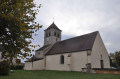
(1) Turn right onto it and head towards the town hall. Turn right between the town hall and the church. Then follow the path to Rue des Chênes. Turn left and continue along Petite Rue au Chêne. Join Route de Longecourt-en-Plaine.

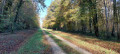
(2) Take it to the right with care, entering the Bois des Hées de l'Aige Caillet. You will soon come to the T-junction of a forest track.

(3) Turn right and, following a long straight stretch through the hamlet of Les Perreaux, head towards the Maison Forestières des Perreaux.

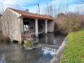
(4) Turn left onto Route de l'Abbé. Reach the star-shaped junction and the stone bridge over the Sansfond or CentFonts.

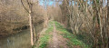
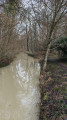
(5) Cross this bridge then take the path on the left running alongside the river. Caution: this section can be muddy and slippery in wet or rainy weather. Walk along the riverbank until you reach the D25.

(6) Cross the road, continue along the left bank of the river, leave the woods and reach two footbridges.

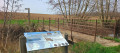
(7) Caution: do not take the unsecured footbridge consisting of a single plank; continue to the metal footbridge with a guardrail just after the information board about amphibians. After crossing, turn right onto the grassy path to reach the edge of the Bois de Matelois. Turn left to follow the edge and, following a straight path, you will come to a crossroads.

(8) Turn left then right, take the wide track between the fields to reach the entrance to the village of Corcelles-lès-Cîteaux.

(9) Take Rue du Clos du Château, which is opposite and slightly to the right, then turn left onto Route de Seurre. You will then come back to the junction you passed on the way out.

(1) Head straight on to return to the car park on Allée des Cerisiers (S/E).

Waypoints

  1. S/E : mi 0 - alt. 738 ft - Car park: Allée des Cerisiers
  2. 1 : mi 0.13 - alt. 722 ft - Crossroads of the circular loop
  3. 2 : mi 0.47 - alt. 745 ft - Route de Longecourt
  4. 3 : mi 0.75 - alt. 732 ft - Forest track
  5. 4 : mi 2 - alt. 682 ft - Maison Forestières des Perreaux
  6. 5 : mi 2.24 - alt. 669 ft - Bridge over the - Sansfond (rivière) - Affluent de la Vouge
  7. 6 : mi 3.35 - alt. 673 ft - D25
  8. 7 : mi 4.45 - alt. 669 ft - Secure footbridge
  9. 8 : mi 4.8 - alt. 686 ft - Crossroads
  10. 9 : mi 5.38 - alt. 738 ft - Route de Longecourt
  11. S/E : mi 5.83 - alt. 738 ft - Car park: Allée des Cerisiers

Notes

Corcelles-lès-Cîteaux:
The archaeological register of the Côte d'Or archives mentions this commune from the year 871 onwards.
The commune also boasts several items listed in the inventory of Historic Monuments:
- the church’s two bells dating from 1620,
- two polychrome statues of Saint Sebastian from the 17th and 18th centuries,
- a 17th-century painting.
A communal woodland park is equipped with a few play facilities for younger children and picnic tables for older visitors.
The River Sansfond is a small lowland river in the Burgundy region:its history is marked by hydraulic works carried out since the Middle Ages, notably by the monks of Cîteaux Abbey. The aim of these works was to regulate the flow of the river and improve irrigation of the surrounding farmland

Worth a visit

Between (5) and (6): note the information boards along the route referring to the Sansfond, but written as ‘la Cent Fonts’.
(S/E) Just south on the D996:
Cîteaux Abbey is also famous for its cheese: Cîteaux. This pressed cow’s milk cheese, with its fruity, grassy flavour, can be bought directly from the abbey shop, where the Cistercian monks carry on the region’s cheese-making tradition by selling this uniquely flavoured cheese at very reasonable prices.

Other walks in the area

For more walks, use our search engine .

The GPS track and description are the property of this route's author. Please do not copy them without permission.