Country:
 City:


From the D968, enter Bretenière via Rue de la Distillerie (the first access point to the village when coming from Dijon and the Longvic industrial estate). At the end of the street, turn left and park a few metres further on in the car park by the playground (City Stade).
(S/E) Return towards Rue de la Distillerie and take Impasse de la Garande on the left. At the end of the cul-de-sac, take the small lane between the houses to the end, then turn left for about 150 metres to reach a junction.
(1) Turn right onto the path leading to the market gardener’s buildings, then right again before the buildings to reach Rue de la Garenne.
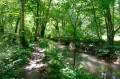
(2) Turn left along the street and stay between the houses and the fields. After skirting a wood, at the end of the path, you’ll reach a T-junction.
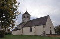
(3) Turn right onto Rue de l’Église and walk past Saint-Phal Church. Continue until you reach the ‘Stop’ sign before the D31c.
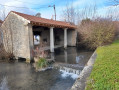
(4) Follow it to the right until you reach the junction, then turn left onto Rue du Canal and continue to the Bretenière Lock.
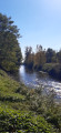
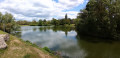
(5) Before the bridge, turn right and take the towpath along the bank of the Canal de Bourgogne. Carry on straight ahead, past the Époisses Lock, then under the motorway and on to Lock 62 at Petit Ouges.
(6) Leave the riverbank by turning right, following the yellow ‘Bretenière’ sign. Continue along Rue des Mirages, then follow a tarmac road for over a kilometre. It passes close to the southern end of the airport runways, then turns sharply left and reaches a junction (IGN elevation 215).
(7) Turn right towards the motorway, cross it via a bridge, then head back to the car park (S/E).
 Visorando Member
 Moderate