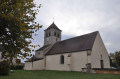
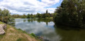
From Domois to Cîteaux Abbey

This very pleasant walk will take you to Cîteaux Abbey, following the Cent Fonts river, which will serve as your guide. There are a few picnic areas along this lovely walk.

Details

227277
Creation:
Last update:
Last review:
  • Walking
    Activity: Walking
  • ↔
    Distance: 12.14 mi
  • ◔
    Average duration: 5h 35 
  • ▲
    Difficulty: Moderate

  • ⚐
    Back to start: No
  • ↗
    Ascent: + 33 ft
  • ↘
    Descent: - 131 ft

  • ▲
    Highest point: 787 ft
  • ▼
    Lowest point: 659 ft
  • ⚐ Country: France
  • ⚐ City: Perrigny-lès-Dijon (21160)
  • ⚑
    Start: N 47.258483° / E 5.034297°
  • ⚑
    End: N 47.128916° / E 5.092899°
  • ❏
    IGN map(s): Ref. 3023OT, 3123O
  • Hour-by-hour weather

Photos

Description of the walk

(S/E) Head south along the tarmac path that runs alongside the A311 motorway until you reach a small building on the right.

(1) Then turn left onto the path leading to the Cent Fonts spring (spelt ‘Sans Fond’ on the IGN map).

(2) Continue straight on along theGRP® “In the footsteps of the monks of Cîteaux”, passing a snail farm before going under the A31 motorway.

(3) At the junction, carry on straight ahead. When you reach a tarmac road, turn right towards the Moulin des Étangs. Before the entrance to the private property, turn left along a poplar plantation and follow it for about 300 metres.

(4) Enter this grove to reach the Cent Fonts, cross the footbridge and turn left towards Saulon-la-Rue.

(5) Follow Rue des Pâtis and continue up it until you reach the D31. Then turn left and you’ll come out onto the D996 (Route de Seurre). Follow the D996 to the left.

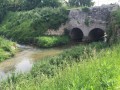
(6) Walk past Saulon Castle and then over the Cent Fonts bridge. When you reach the car park, enter the woods and walk round them, following the path along the inner edge until you reach the side of the castle.

(7). Follow the path on the left that runs alongside the Cent Fonts (do not enter the private property) until you reach the entrance to Saulon-la-Chapelle. Then take the D108K and then the D31 towards the centre for about 250 metres.

(8) Turn right towards the pond and walk round it on the right-hand side. Then head towards a small housing estate. Take Rue du Petit Essart. At the end, cross the D109F to reach a picnic area along the Cent Fonts. Then follow the river to the Pont des Arvaux.

(9) Continue to follow the Cent Fonts, which runs behind the houses in Noiron-sous-Gevrey. You’ll come to a small tarmac road and cross over to the opposite bank.

(10) Cross the D109D and pass behind a go-kart track. Continue along the left bank and, about 1 km further on, enter the Izeure State Forest.

(11) Cross the D25 at a place known as ‘Forêt du Millénaire’ (a good spot for a picnic) and continue along the left bank. At the bridge on the Route Forestière de l’Abbé, head straight on, keeping to the left bank of the Cent Fonts, until you reach the Château de la Forgeotte.

(12) Go round the small pond by the château on the left to rejoin the river. Cross the Route Forestière aux Foins towards the marshes, situated about 500 metres away.

(13) Continue southwards to reach the abbey, taking care when crossing the road (S/E)
Waypoints

  1. S : mi 0 - alt. 787 ft - Domois car-sharing car park
  2. 1 : mi 0.67 - alt. 764 ft - Building
  3. 2 : mi 0.97 - alt. 755 ft - Cent Fonts Spring
  4. 3 : mi 1.62 - alt. 738 ft - Straight ahead
  5. 4 : mi 2.19 - alt. 725 ft - Turn right towards Fontaine Rouge
  6. 5 : mi 2.98 - alt. 709 ft - Rue des Pâtis
  7. 6 : mi 3.51 - alt. 702 ft - Saulon Castle
  8. 7 : mi 4.34 - alt. 699 ft - Behind the castle
  9. 8 : mi 5.38 - alt. 686 ft - Turn right towards the pond
  10. 9 : mi 6.65 - alt. 663 ft - Arvaux Bridge
  11. 10 : mi 7.29 - alt. 679 ft - Crossing the D109d
  12. 11 : mi 8.96 - alt. 673 ft - Millennium Forest
  13. 12 : mi 10.45 - alt. 673 ft - La Forgeotte Castle and Lake
  14. 13 : mi 11.45 - alt. 669 ft - Marsh
  15. E : mi 12.14 - alt. 663 ft - Abbaye de Cîteaux

Notes

Park in the Domois car-sharing car park, situated just below the roundabout leading towards the A311 motorway.
Unless you’re keen on hitchhiking, park a second car at the abbey for the return journey.
Bring drinks, energy-boosting snacks and good walking shoes.

Worth a visit

The name Cent Fonts (spelt ‘Sans Fond’ on the IGN map) comes from the abbreviation of ‘cent fontaines’ (a hundred fountains), the main outlet of the southern Dijon aquifer.
The Cent Fonts canal is a 13th-century structure built by the monks, which diverts the river’s original course from the washhouse at Saulon-la-Chapelle to the abbey over a distance of 11 km, with a constant gradient of 1 metre per kilometre; the works took nine years, from 1212 to 1221. It provided a water supply for the abbey, as the Vouge has an irregular flow that was insufficient for the monks’ needs (both for people and livestock), whereas the flow of the Cent Fonts, though low, has the advantage of being very regular.
Interesting fact: the Pont des Arvaux (9), where the Cent Fonts flows over another river, the Varaude.

Reviews and comments

5 / 5
Based on 2 reviews

Reliability of the description
5 / 5
Ease of following the route
5 / 5
Route interest
5 / 5
jcehenne
jcehenne

Overall rating : 5 / 5

Date of your route : May 30, 2020
Reliability of the description : ★★★★★ Very good
Ease of following the route : ★★★★★ Very good
Route interest : ★★★★★ Very good
Very busy route : No

A lovely signposted walk.
The path is quiet in places; two or three fallen trees are blocking the way just before ‘La Quincenière’.

Machine-translated

herrator
herrator

Overall rating : 5 / 5

Date of your route : Mar 25, 2019
Reliability of the description : ★★★★★ Very good
Ease of following the route : ★★★★★ Very good
Route interest : ★★★★★ Very good

A lovely route

on foot for my daughter, and by bike with my grandson in the child seat for me

Machine-translated

Other walks in the area

For more walks, use our search engine .

The GPS track and description are the property of this route's author. Please do not copy them without permission.