Around Couternon

A leisurely walk around Courternon. This route will take you round the village and allow you to discover it in a different light.
The route is in open countryside with little shade. Make sure you bring suitable gear if the sun is strong.

Details

2668523
Creation:
Last update:
Last review:
  • Walking
    Activity: Walking
  • ↔
    Distance: 5.84 mi
  • ◔
    Average duration: 2h 45 
  • ▲
    Difficulty: Easy

  • ⚐
    Back to start: Yes
  • ↗
    Ascent: + 39 ft
  • ↘
    Descent: - 39 ft

  • ▲
    Highest point: 748 ft
  • ▼
    Lowest point: 699 ft
  • ⚐ Country: France
  • ⚐ City: Couternon (21560)
  • ⚑
    Start/End: N 47.334728° / E 5.159823°
  • ❏
    IGN map(s): Ref. 3122SB, 3123O
  • Hour-by-hour weather

Photos

Description of the walk

Park in the small car park near the football pitch on the edge of the Chemin des Criquaulins

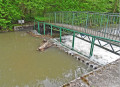
(S/E) Take the access path to the football pitch, then the first footpath on the left. Follow it to the metal footbridge spanning the Norges.

(1). Cross the footbridge.

(2) At the roundabout, turn right and use the pedestrian crossing to cross Rue de Bourgogne.
Then continue to the right along the footpath running alongside this street until you reach the edge of the village.

(3) Turn left at the corner of the housing estate and you’ll come out onto Chemin du Paquier.

(4) Turn right. At the next junction, turn left and continue along the D700. On the straight stretch, take the first path on the left, then, at the next fork, turn right until you reach the D107d.

(5) Cross the D107d with care to take the path opposite. Continue along this path, which turns left at a 90° angle and becomes Rue de la Croix Pommier.

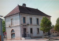
(6) When you reach Rue de Dijon, follow it to the right as far as the town hall, then turn left into Rue de la Fabrique.
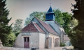
Cross Rue de Bourgogne, and before turning right, walk to the church and back.
Continue along Rue de Bourgogne until you reach the junction with Rue du Moulin on the left.

(7) Take Rue du Moulin and, after crossing the bridge over the Norges, take the path on the right to the equestrian centre. Opposite the equestrian centre, turn left onto the path that runs alongside the Vieille Tille.

(8) Turn left to cross the bridge over the stream, turn left again and walk alongside the ponds to reach the road to Bressey-sur-Tille.

(9) Cross this road and take the dirt track opposite, on the edge of the woods, until you reach the Chemin des Criquaulins.
Turn slightly left to reach the nearby car park (S/E).


Waypoints

  1. S/E : mi 0 - alt. 709 ft - Football ground car park
  2. 1 : mi 0.44 - alt. 712 ft - Norges (rivière)
  3. 2 : mi 0.49 - alt. 712 ft - Roundabout
  4. 3 : mi 0.77 - alt. 715 ft - Path to the left
  5. 4 : mi 1 - alt. 715 ft - Chemin du Paquier, on the right
  6. 5 : mi 2.48 - alt. 722 ft - Crossing the D107d
  7. 6 : mi 3.14 - alt. 712 ft - Rue de Dijon, on the right
  8. 7 : mi 3.68 - alt. 712 ft - Rue du Moulin.
  9. 8 : mi 4.73 - alt. 702 ft - Bridge over the Vieille Tille
  10. 9 : mi 5.55 - alt. 709 ft - Route de Bressey-sur-Tille
  11. S/E : mi 5.84 - alt. 709 ft - Football ground car park

Worth a visit

Explore the village of Arc-sur-Tille and its surroundings. Its lake and its ponds.

Reviews and comments

4.4 / 5
Based on 3 reviews

Reliability of the description
4.7 / 5
Ease of following the route
5 / 5
Route interest
3.7 / 5
jo Macé
jo Macé
• Edited:

Overall rating : 4 / 5

Date of your route : Jun 08, 2020
Reliability of the description : ★★★★☆ Good
Ease of following the route : ★★★★★ Very good
Route interest : ★★★☆☆ Average
Very busy route : No

No significant elevation gain, easy. Best done on a cloudy day, as it’s very exposed! The section running alongside the Arc is a bit of a shame – you can hear the traffic… but the start is wooded and lovely once you’ve found the stadium tucked away behind the woods!

Machine-translated

Philippe COULOT
Philippe COULOT
• Edited:

Thank you.
See you soon for another hike.

Machine-translated

prielle
prielle
• Edited:

Overall rating : 4.7 / 5

Date of your route : Mar 02, 2020
Reliability of the description : ★★★★★ Very good
Ease of following the route : ★★★★★ Very good
Route interest : ★★★★☆ Good

An easy walk, suitable for everyone.
To find the football pitch car park, follow the signs carefully as it is located outside the village.

Machine-translated

Chabanis
Chabanis
• Edited:

Overall rating : 4.7 / 5

Date of your route : Jan 22, 2020
Reliability of the description : ★★★★★ Very good
Ease of following the route : ★★★★★ Very good
Route interest : ★★★★☆ Good

A lovely winter walk in the sunshine. Very well explained. However, as we don’t live in Couternon, we couldn’t find the football ground car park where the walk starts, so we began the walk a little further on…

Machine-translated

Other walks in the area

For more walks, use our search engine .

The GPS track and description are the property of this route's author. Please do not copy them without permission.