Country:
 City:
City:


Head to Morey-Saint-Denis and park in the large car park in the village centre, below the Place du Monument, where the Cellier de Dyonisos is located (Dionysus, the god of wine, sowing, the fertility of the vine and joy in ancient Greece).
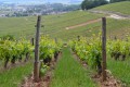
(S/E) Climb the few steps leading up to the Place du Monument. Pass to the right of the War Memorial. Take Rue de la Montagne, the second street on the right, which climbs through houses and vineyards. When you reach the junction just after the water tower, continue straight on (follow the ‘30 km/h zone’ sign). Ignore Rue de La Bidaude on your left. As you leave the housing estate, the road turns into a track suitable for vehicles. Note the underground water tank on your left. Continue up to the next sharp bend to the right.
(1) Continue straight ahead and follow the track for about 130 m before turning left at the next junction of tracks. Take the clearly visible path which descends briefly at first before climbing for a long stretch through scree (yellow markings). At the summit junction with a cross-country path, turn right. This path winds through the forest until it meets a wider track. Turn right. The edge of the woodland is nearby. Head for the La Buère equestrian centre.
(2) Once you’re on a white, vehicle-accessible track that crosses the farm, turn left (towards the car park) and walk up alongside a stable on your right. Ignore the track branching off to the left; continue to the right and walk between large, fenced-off meadows. As well as horses, you may spot a camel, a black bull and a long-horned cow. Enter the forest and follow this track straight on, ignoring any side paths. You’ll reach a crossroads with four tracks.
(3) Turn left. Take plot 4, which is a path that descends into the Combe Ambin and joins the D122h. Cross this road and set off again along the path leading off to the left, heading back up into the woods. Once on level ground, cut across a cross-path to continue straight ahead. At the second junction of tracks, turn right (stone marker no. 3 – plot 29). Follow this path straight on until you are very close to the edge of the woods. At this point, the path branches off to the left, running parallel to a field and, in between, a well-marked and visible track. Take a few steps to the right to join this track. Follow it to a gate blocking the way. Go through the gate and continue for a few metres.
(4) Turn right onto a barely visible track to walk along the right-hand side of a living hedge separating two fields. Cross the open space between the hedge and the edge of the woodland (a overgrown track) for a few tens of metres to reach the edge of the woodland opposite. Walk up it, keeping to the right. Continue in this way until you find yourself directly beneath a high-voltage (HV) power line. Turn right, enter the woodland and follow the path running beneath the line. Walk uphill until you reach the base of a metal pylon. Continue along the path beneath the line until you reach and pass a second pylon. As you approach the third, join a wide, white, vehicle-accessible track.
(5) Turn left and follow this white track for about 200 m before turning off onto the first path leading diagonally to the right. Carry on straight ahead, keeping to the right of a pine woodland. At the point where the slope changes, head straight down the slope to reach a path running perpendicular to it at the bottom of the ravine. Follow this path to the right, keeping to the right-hand side, until you catch sight of the first houses of Reulle-Vergy after passing under another high-voltage power line.
There’s a spot for a picnic at the edge of the forest near a playground.
(6) Make the most of the large playground and picnic tables with a beautiful view. Return to the original path to reach the village centre via Rue de Chambolle. When you reach Place de la Mairie, turn left towards Curtil-Vergy. To do this, take Rue Mont. Continue straight ahead along Ruelle du Châtelet (where you’ll see a stone cross dating from 1870). Follow theGR® 7, signposted on the ground and on posts. Before the arched porch of a property, turn right and then immediately left to walk alongside a wall (keep to the left). Further on, you’ll come out onto the road at the hamlet of La Croix montée de Vergy (altitude 429 m) and continue along theGR® towards Vergy church. Walk past a stone cross dating from 1864, dedicated to the Esmonin family. Head up the ‘No Entry’ sign and reach the church.
(7) Take in the historic hill of Vergy and its four sites. The parish church of Saint-Saturnin in Vergy and the ruins of the old village; the fortress of Vergy, demolished in 1610 by Henry IV; the canon’s quarter of the fortress and the Collegiate Church of Saint-Denis, of which only one tower remains; and the Benedictine Abbey of Saint-Vivant, destroyed in the 19th century.
Follow theGR® markings continuously (remains of wells and foundations, orientation boards, panoramic views of Chamboeuf, Semezanges, l’Étant-Vergy, Messanges… as you make your way along the route). Shortly after the second orientation table, begin the descent towards the ruins of the abbey, which are currently being restored. Go round it on the right after joining a track suitable for vehicles, until you reach a sharp bend to the left. There is a stone bench at the crossroads of the tracks.
(8) Head straight ahead along a path markedGR® and descend through the vineyard. Turn left at the end of the vineyard plot to reach Rue de l’Abbaye Saint-Vivant in Curtil-Vergy. Opposite, take Rue des Sires de Vergy, which descends and passes in front of the Town Hall (on the right). This will take you to the D116; then follow signs for Nuits-Saint-Georges via Rue de Beauvois. On leaving the village, before a right-hand bend, turn left onto a field track (white gravel car park at the junction). Less than 100 m further on, at the first crossroads of tracks, take the one on the right. When you reach the edge of the woods, turn round to take in the view (Butte de Vergy, the abbey and the village).
(9) Turn right (towards Vosne – marker 19 on the Chemin des Moines de Saint-Vivant). Follow the path through the woodland, keeping the field and vineyards on your right as a guide. At the second junction of tracks, just before a pine copse, turn sharply left. Follow this path uphill for less than 100 m before turning right this time (marker 18, Chemin des Moines), with the pine copse on your right to guide you. You’ll pass near the Source du Chêne (on the left), whose stream crosses the path depending on the season. When you reach the next junction (a T-junction), turn left (signpost 17, Chemin des Moines). Walk for about 100 m, climbing as you go, until you reach another junction.
(10) Continue straight ahead, climbing up an S-shaped path (temporarily leaving the Chemin des Moines). Carry on in this way to the top of the climb (returning to the Chemin des Moines) and turn left at the next four-way junction. Shortly afterwards, when you reach the end of a cross-path, keep to the left. Shortly afterwards, at the signpost for “Forêt Domaniale de Mantuan”, continue along this track, which curves to the right, until you reach a clearing in the woods where, on the left, a white, vehicle-accessible track begins, closed off by a barrier (Route Forestière de Mantuan).
(11) Ignore the forest road and carry on straight ahead. This track descends for a long way to the Concoeur Leisure Centre (on the right). Do not follow the road, but take the footpath which begins with wooden sleepers, on the left opposite the water tower. Walk down to the Concoeur cemetery after passing the war memorial (cannons and cannonballs).
(12) Follow the D109 to the left, a road known as Rue des Deux Hameaux, then, on reaching Corboin, Rue du Lavoir. At the cross (with a bus stop), ignore the road branching off to the right and head up Chemin des Menas, a dead-end track. As you leave the housing estate, the cul-de-sac turns into a forest track. Stay on the main track, which remains flat (ignore the path leading uphill to the left), and pass under a high-voltage power line. Continue along this track until you reach the Château d’entre Deux Monts (guidance wall on the right). At the corner of the estate, turn right to arrive in front of the main entrance. You may catch a glimpse of the 17th-century buildings if the gate is open.
(13) A typical château from the Louis XIII era, listed as a historic monument (birthplace of the Burgundy truffle). Continue along the tarmac road, passing the large body of water at the foot of the château on your right. Pass under a new high-voltage power line. At the edge of the woodland, let the road branch off to the right and continue straight ahead along a track suitable for vehicles. Ignore all side tracks until you rejoin a tarmac road, with hangars on the left and a water reservoir covered by a tarpaulin on the right. Before reaching a white stone cross visible in the distance, you’ll arrive at the gate of a hangar on the right.
(14) Turn left onto the wide dirt track that winds its way through wasteland. At the second fork in the road, take the left-hand path. As you emerge from the woodland, there is a meadow on the left and a vineyard on the right. Further on, pass close to a watchtower on your right. Shortly afterwards, enter another wooded area. When you reach a field on the left, turn onto the path on the right to head diagonally across and join the first cross-path.
(15) Turn right and head down into the valley straight ahead; then, at the bottom, turn right to join the Félix Batier trail. Descend between two high rock faces at one point, until you reach a chapel dating from 1792, flanked by a statue of the Virgin Mary and a stone cross (Bizot family – 1789, restored in 1861). Continue along the same path to reach the first houses of Chambolle-Musigny. Then head up to the left to reach the D122h (the path is clearly visible). Enter the village via Rue Amont and follow it to the crossroads in the village centre.
(16) Turn left and, from the cross, head up the Chemin du Pied du Four. Once you reach the heights of Chambolle, enjoy the beautiful panoramic view over the plain, the vineyards and even the Clos Vougeot (in the distance to the right). Follow the vineyard track until you come to a tarmac road at a bend. This turns into a dirt track suitable for vehicles. Head up this track, go through the gate and, at the next crossroads of tracks, keep right towards Morey-Saint-Denis via theGR® du Pays des Grands Crus. Pass under a medium-voltage power line and emerge into the vineyards (guide on the right). Join a concrete road branching off to the right.
(17) Head down the steep 25 per cent gradient. Go straight ahead at the next junction. The road turns into a stony track. When you reach the signpost, turn left towards Gevrey-Chambertin viathe GR®. This track runs through the middle of the vineyards, then over a retaining wall, before finally running alongside a high wall (keep to the right) with an arbour marking a corner. Enter the town of Morey-Saint-Denis via this route, then turn right into the first street you come to in order to reach the square by the monument and the Cellier Dyonisos car park (S/E).

 Visorando Member
 Easy
Easy 
 Moderate