Country:
 City:
City:


Start from the small car park in the woodland above the Clos de Bèze vineyards.
(S/E) Head left onto the white path through the woodland, which is none other than the embankment of the old Tacot railway line that linked Gevrey to the Hautes Côtes. Continue along this path until you reach a passage between narrow cliff faces, then a tunnel.
(1) After the tunnel, carry on along the old track and then turn right to reach a junction
(2) Take the path on the right, which climbs gently through the woodland; once above, without leaving the forest, you’ll notice the fields of the Ferme de la Buère on your left. Carry on a little further, turn left then right to reach a main track.
(3) Follow this forest track to the left and take the second path on the right to reach a good cross-country path.
(4) Turn left to follow this good path as it cuts through the woodland until, at the top of the Combe Ambin, you reach the junction with the D122h, which descends towards Chambolle
(5) Without taking it, head immediately to the right onto a good path quite similar to the previous one. Follow the track to the Chemin de Curley, a wide white track
(6) Cross this and continue straight ahead to reach a T-junction.
(7) Turn right, then further on cross a good white track and take a path on the left. Follow it up to the top of the Combe de Creuse: blue markings by the CAF. Head down to the right.
(8) Take the well-marked path on the right which goes round the Combe Lavaux to a junction.
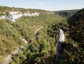
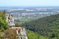
(9) Head left for a round trip of about 100 metres to admire the magnificent view over the valley. For your information, the Aiguillon de Chambœuf is at the far end opposite: use the road as a guide. Once you’ve retraced your steps, take the balcony path on the left and you’ll reach another junction, from where you can head to the Bec de Judry by taking the path on the left.
(10) Alternatively, continue along the Lavaux path, which is quite narrow amongst the trees.
(11) From this point, begin a steep, straight descent through the Bois Plein de la Belle Croix and emerge onto a good stony track, which is none other than the Curley track you have already encountered.
(12) Turn left onto this track, take a right-hand bend and head back to the car park (S/E).


 Visorando Member
 Difficult
 Easy
Easy