


walk2balance

 Visorando Member
 Premium user
Sign up:
Published route(s)
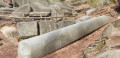
 Nibelungensteig (1): Zwingenberg - Reichenbach
 7.69 mi
 +2,241 ft
 -1,854 ft
 5h 30
5h 30
 Average
 Departure from Zwingenberg (Regierungsbezirk Darmstadt)
The Nibelungensteig is a certified Qualitätsweg "Wanderbares Deutschland" (Quality Trail "Hikeable Germany") that runs for 130 km in several stages, some of which are very strenuous, with a total of more than 4,000 metres of elevation gain from west to east across the Odenwald and thus through three federal states (Hesse, Bavaria, Baden-Württemberg). Our division differs from the official stages. We have chosen some shorter tours, added a few extra metres and stayed overnight in different places in some cases. When planning your tour, please note that accommodation, refreshment and catering facilities are not always available.
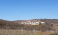
Leininger Castle Trail
 13.74 mi
+1,421 ft
-1,407 ft
7h 35
13.74 mi
+1,421 ft
-1,407 ft
7h 35
 Difficult
Departure from Bobenheim am Berg (Landkreis Bad Dürkheim)
Difficult
Departure from Bobenheim am Berg (Landkreis Bad Dürkheim)
The Leininger Burgenweg is a circular walking route in the northern Palatinate Forest. Just under 22 kilometres long, it links Neuleiningen, Altleiningen and Battenberg. Places to stop for refreshments include the castles at Altleiningen and Battenberg. Several rest areas along the route invite you to take a break at your leisure.
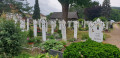
Nibelungensteig (2): Reichenbach - Lindenfels
 9.82 mi
+2,087 ft
-1,634 ft
6h 20
Average
Departure from Lautertal (Regierungsbezirk Darmstadt)
9.82 mi
+2,087 ft
-1,634 ft
6h 20
Average
Departure from Lautertal (Regierungsbezirk Darmstadt)
The Nibelungensteig is a certified Qualitätsweg "Wanderbares Deutschland" (Quality Trail "Hikeable Germany") that runs for 130 km in several stages, some of which are very strenuous, with a total of more than 4,000 metres of elevation gain from west to east across the Odenwald and thus through three federal states (Hesse, Bavaria, Baden-Württemberg). Our division differs from the official stages. We have chosen some shorter tours, added a few extra metres and stayed overnight in different places in some cases. When planning your tour, please note that accommodation, refreshment and catering facilities are not always available.
Through the Alster Valley
 12.55 mi
+69 ft
-131 ft
5h 50
12.55 mi
+69 ft
-131 ft
5h 50
 Easy
Departure from Hamburg
Easy
Departure from Hamburg
A walk through the Alster Valley from Duvenstedt to Winterhude. A route through nature that makes you forget you’re in the heart of the metropolis of Hamburg.
Nibelungensteig (3): Lindenfels – Grasellenbach
 8.23 mi
+1,713 ft
-1,637 ft
5h 15
Average
Departure from Lindenfels (Regierungsbezirk Darmstadt)
8.23 mi
+1,713 ft
-1,637 ft
5h 15
Average
Departure from Lindenfels (Regierungsbezirk Darmstadt)
The Nibelungensteig is a certified Qualitätsweg "Wanderbares Deutschland" (Quality Trail "Hiking in Germany") that runs for 130 km in several stages, some of which are very strenuous, with a total of more than 4,000 metres of elevation gain from west to east across the Odenwald and thus through three federal states (Hesse, Bavaria, Baden-Württemberg). Our division differs from the official stages. We have chosen some shorter tours, added a few extra metres and stayed overnight in different places in some cases. When planning your tour, please note that accommodation, refreshment and catering facilities are not always available.
Nibelungensteig (9): Amorbach - Miltenberg
 7.97 mi
+1,329 ft
-1,381 ft
4h 50
Average
Departure from Amorbach (Lower Franconia)
7.97 mi
+1,329 ft
-1,381 ft
4h 50
Average
Departure from Amorbach (Lower Franconia)
The Nibelungensteig is a certified Qualitätsweg "Wanderbares Deutschland" (Quality Trail "Hiking in Germany") that runs for 130 km in several stages, some of which are very strenuous, with a total of more than 4,000 metres of elevation gain from west to east across the Odenwald and thus through three federal states (Hesse, Bavaria, Baden-Württemberg). Our division differs from the official stages. We have chosen some shorter tours, added a few extra metres and stayed overnight in different places. When planning your tour, please note that accommodation, refreshment and catering facilities are not always available.
Nibelungensteig (10): Miltenberg – Freudenberg
 7.94 mi
+1,234 ft
-1,217 ft
4h 45
Average
Departure from Miltenberg (Lower Franconia)
7.94 mi
+1,234 ft
-1,217 ft
4h 45
Average
Departure from Miltenberg (Lower Franconia)
The Nibelungensteig is a certified Qualitätsweg "Wanderbares Deutschland" (Quality Trail "Hikeable Germany") that runs for 130 km in several stages, some of which are very strenuous, with a total of more than 4,000 metres of elevation gain from west to east across the Odenwald and thus through three federal states (Hesse, Bavaria, Baden-Württemberg). Our division differs from the official stages. We have chosen some shorter tours, added a few extra metres and stayed overnight in different places in some cases. When planning your tour, please note that accommodation, refreshment and catering facilities are not always available.
Across the ‘Wine Island’
 9.73 mi
+581 ft
-571 ft
5h 00
Easy
Departure from Volkach (Lower Franconia)
9.73 mi
+581 ft
-571 ft
5h 00
Easy
Departure from Volkach (Lower Franconia)
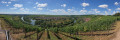
A circular walk through the vineyards along the Volkach bend of the Main, including a crossing over the Main and a traverse of the ‘Weininsel’ (wine island) near Nordheim.
From the Auenhütte via the Ochsenhofer Scharte to Baad
 6.80 mi
+2,241 ft
-2,369 ft
5h 05
Average
Departure from Gemeinde Mittelberg (Bezirk Bregenz)
6.80 mi
+2,241 ft
-2,369 ft
5h 05
Average
Departure from Gemeinde Mittelberg (Bezirk Bregenz)
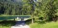
A lovely walk from the Ifenbahn valley station over to Baad, featuring a challenging climb over the Ochsenhofer Scharte. Unfortunately, it can get a bit crowded on fine days, so it is advisable to set off from the Auenhütte by 9 am at the latest.
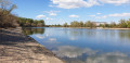
Industrial charm at the tip of the Neckar – Friesenheimer Insel/Mannheim
 10.00 mi
+177 ft
-171 ft
4h 45
Easy
Departure from Mannheim (Regierungsbezirk Karlsruhe)
10.00 mi
+177 ft
-171 ft
4h 45
Easy
Departure from Mannheim (Regierungsbezirk Karlsruhe)
A city walking tour that begins and ends in Mannheim’s Neckarstadt district. The route takes us along the Neckar, Rhine and Old Rhine, at times through beautiful, secluded woodland. The final section of the tour follows the signposted Industrial Heritage Trail – whilst the scenery here is by no means picturesque, it’s worth allowing extra time to read the descriptions of the industrial monuments at your leisure.
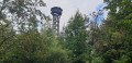
Via the Teltschik Tower and the Weißer Stein
 11.09 mi
+2,041 ft
-2,057 ft
6h 55
Average
Departure from Heidelberg (Regierungsbezirk Karlsruhe)
11.09 mi
+2,041 ft
-2,057 ft
6h 55
Average
Departure from Heidelberg (Regierungsbezirk Karlsruhe)
The idea behind this circular walk, which starts above Stift Neuburg, was to follow as many narrow, unpaved paths as possible and avoid the main hiking trails. This wasn’t always possible, and we do pass some popular hiking spots, but during the week and outside the holiday season, it’s also possible to be virtually alone on this route. All the paths are in place and clearly visible in the landscape, even if they are not marked on every map.
Historical tour of Bad Dürkheim
 14.81 mi
+2,362 ft
-2,346 ft
8h 50
Difficult
Departure from Bad Dürkheim (Landkreis Bad Dürkheim)
14.81 mi
+2,362 ft
-2,346 ft
8h 50
Difficult
Departure from Bad Dürkheim (Landkreis Bad Dürkheim)
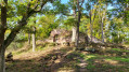
Bad Dürkheim – in the heart of the Palatinate on the German Wine Route. A circular walk in the footsteps of the Romans, the Leiningers and the Benedictines.
On and around the highest point in the Palatinate
 7.50 mi
+1,759 ft
-1,739 ft
5h 00
Average
Departure from Dannenfels (Donnersbergkreis)
7.50 mi
+1,759 ft
-1,739 ft
5h 00
Average
Departure from Dannenfels (Donnersbergkreis)
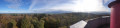
A leisurely circular walk on the Donnersberg, the highest point in the Palatinate. The walk starts and ends at Dannenfels.
Along the Hessian Bergstraße, starting in Jugenheim
 11.48 mi
+2,014 ft
-2,011 ft
7h 00
Average
Departure from Seeheim-Jugenheim (Regierungsbezirk Darmstadt)
11.48 mi
+2,014 ft
-2,011 ft
7h 00
Average
Departure from Seeheim-Jugenheim (Regierungsbezirk Darmstadt)
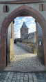
Circular walk along the Hessian Bergstraße, starting and finishing in Seeheim-Jugenheim, in the district of Jugenheim, via Heiligenberg Castle, the Tanneberg castle ruins and Frankenstein Castle.
Nibelungensteig (4): Grasellenbach – Güttersbach
 4.56 mi
+682 ft
-902 ft
2h 40
Easy
Departure from Grasellenbach (Regierungsbezirk Darmstadt)
4.56 mi
+682 ft
-902 ft
2h 40
Easy
Departure from Grasellenbach (Regierungsbezirk Darmstadt)
The Nibelungensteig is a certified Qualitätsweg "Wanderbares Deutschland" (Quality Trail "Hiking in Germany") that runs for 130 km in several stages, some of which are very strenuous, with a total of more than 4,000 metres of elevation gain from west to east across the Odenwald and thus through three federal states (Hesse, Bavaria, Baden-Württemberg). Our division differs from the official stages. We have chosen some shorter tours, added a few extra metres and stayed overnight in different places in some cases. When planning your tour, please note that accommodation, refreshment and catering facilities are not always available.
Nibelungensteig (5): Güttersbach – Bullau
 14.50 mi
+2,251 ft
-1,585 ft
8h 40
Difficult
Departure from Mossautal (Regierungsbezirk Darmstadt)
14.50 mi
+2,251 ft
-1,585 ft
8h 40
Difficult
Departure from Mossautal (Regierungsbezirk Darmstadt)
The Nibelungensteig is a certified Qualitätsweg "Wanderbares Deutschland" (Quality Trail "Hikeable Germany") that runs for 130 km in several stages, some of which are very strenuous, with a total of more than 4,000 metres of elevation gain from west to east across the Odenwald and thus through three federal states (Hesse, Bavaria, Baden-Württemberg). Our division differs from the official stages. We have chosen some shorter tours, added a few extra metres and stayed overnight in different places in some cases. When planning your tour, please note that accommodation, refreshment and catering facilities are not always available.
Nibelungensteig (6): Bullau – Hesselbach
 11.13 mi
+1,155 ft
-1,247 ft
6h 05
Average
Departure from Erbach (Regierungsbezirk Darmstadt)
11.13 mi
+1,155 ft
-1,247 ft
6h 05
Average
Departure from Erbach (Regierungsbezirk Darmstadt)
The Nibelungensteig is a certified Qualitätsweg "Wanderbares Deutschland" (Quality Trail "Hikeable Germany") that runs for 130 km in several stages, some of which are very strenuous, with a total of more than 4,000 metres of elevation gain from west to east across the Odenwald and thus through three federal states (Hesse, Bavaria, Baden-Württemberg). Our division differs from the official stages. We have chosen some shorter tours, added a few extra metres and stayed overnight in different places in some cases. When planning your tour, please note that accommodation, refreshment and catering facilities are not always available.
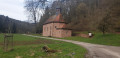
Nibelungensteig (7): Hesselbach - Kirchzell-Preunschen
 7.56 mi
+1,417 ft
-1,499 ft
4h 45
Average
Departure from Oberzent (Regierungsbezirk Darmstadt)
7.56 mi
+1,417 ft
-1,499 ft
4h 45
Average
Departure from Oberzent (Regierungsbezirk Darmstadt)
The Nibelungensteig is a certified Qualitätsweg "Wanderbares Deutschland" (Quality Trail "Hiking in Germany") that runs for 130 km in several stages, some of which are very strenuous, with a total of more than 4,000 metres of elevation gain from west to east across the Odenwald and thus through three federal states (Hesse, Bavaria, Baden-Württemberg). Our division differs from the official stages. We have chosen some shorter tours, added a few extra metres and stayed overnight in different places in some cases. When planning your tour, please note that accommodation, refreshment and catering facilities are not always available.
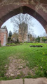
Nibelungensteig (8): Preunschen – Amorbach
 8.08 mi
+823 ft
-1,837 ft
4h 25
Average
Departure from Kirchzell (Lower Franconia)
8.08 mi
+823 ft
-1,837 ft
4h 25
Average
Departure from Kirchzell (Lower Franconia)
The Nibelungensteig is a certified Qualitätsweg "Wanderbares Deutschland" (Quality Trail "Hikeable Germany") that runs for 130 km in several stages, some of which are very strenuous, with a total of more than 4,000 metres of elevation gain from west to east across the Odenwald and thus through three federal states (Hesse, Bavaria, Baden-Württemberg). Our division differs from the official stages. We have chosen some shorter tours, added a few extra metres and stayed overnight in different places in some cases. When planning your tour, please note that accommodation, refreshment and catering facilities are not always available.
Via the Neunkircher Höhe along the Main-Stromberg walking trail
 8.38 mi
+1,020 ft
-1,699 ft
4h 45
Easy
Departure from Modautal (Regierungsbezirk Darmstadt)
8.38 mi
+1,020 ft
-1,699 ft
4h 45
Easy
Departure from Modautal (Regierungsbezirk Darmstadt)
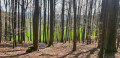
From Lützelbach in the Moda Valley, via the Neunkircher Höhe – at 605 metres, the highest point in the Hessian Odenwald – on to Lindenfels and finally to Fürth im Odenwald, this walk takes us along the relatively little-known Main-Stromberg Walking Trail, which runs from Frankfurt through the Odenwald to Maulbronn Monastery.
In 10 stages on the Nibelungensteig
87.49 mi
+14,931 ft
-14,793 ft
10 days
Difficult
Departure from Zwingenberg (Regierungsbezirk Darmstadt)
The Nibelungensteig is a certified Qualitätsweg "Wanderbares Deutschland" (Quality Trail "Hiking in Germany") that leads from west to east across the Odenwald and thus through three federal states (Hesse, Bavaria, Baden-Württemberg) over 130 km in several stages, some of which are very strenuous, with a total of more than 4,000 metres of elevation gain.
Our division differs from the official stages. We have chosen some shorter sections, added a few extra metres and stayed overnight in some different places. When planning your tour, please note that accommodation, refreshment and catering facilities are not always available.
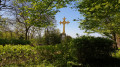
Castle Trail (1): DA-Eberstadt – Jugenheim
 9.11 mi
+1,781 ft
-1,739 ft
5h 45
Average
Departure from Darmstadt
9.11 mi
+1,781 ft
-1,739 ft
5h 45
Average
Departure from Darmstadt
"Nature experience combined with sporty hiking" ... this is how the Burgensteig trail is described in the official flyer of Tourismus Service Bergstraße e.V. The Burgensteig trail leads from Darmstadt-Eberstadt along the heights of the Odenwald to Heidelberg. Along the approximately 120 km, you will pass over 30 historical sights and cross two other well-known trails, the Nibelungensteig near Zwingenberg and the Neckarsteig in Heidelberg. We took the liberty of deviating from the "standard" route here and there.
We have put together the stages so that you can get to your starting point and back from your destination by public transport.
Castle trail (2): Jugenheim – Bensheim-Auerbach
 8.16 mi
+1,204 ft
-1,270 ft
4h 50
Average
Departure from Seeheim-Jugenheim (Regierungsbezirk Darmstadt)
8.16 mi
+1,204 ft
-1,270 ft
4h 50
Average
Departure from Seeheim-Jugenheim (Regierungsbezirk Darmstadt)
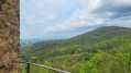
"A nature experience combined with sporty hiking" ... this is how the Burgensteig trail is described in the official flyer of the Bergstraße Tourist Association. The Burgensteig trail leads from Darmstadt-Eberstadt along the heights of the Odenwald to Heidelberg. Along the approximately 120 km route, you will pass over 30 historical sights and cross two other well-known trails, the Nibelungensteig near Zwingenberg and the Neckarsteig in Heidelberg. We took the liberty of deviating from the "standard" route here and there.
We have put together the stages so that you can get to your starting point and back from your destination by public transport.
From Jugenheim along paths that are partly unknown
 12.30 mi
+2,900 ft
-2,890 ft
8h 10
Average
Departure from Seeheim-Jugenheim (Regierungsbezirk Darmstadt)
12.30 mi
+2,900 ft
-2,890 ft
8h 10
Average
Departure from Seeheim-Jugenheim (Regierungsbezirk Darmstadt)
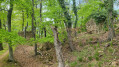
This circular walk takes you from Jugenheim via Heiligenberg Castle to the Felsenmeer in Reichenbach, then on towards Balkhausen, to the ruins of Jossa Castle and back to Jugenheim.
9 stages on the Burgensteig (Bergstraße)
 87.45 mi
+16,371 ft
-16,280 ft
9 days
Difficult
Departure from Darmstadt
87.45 mi
+16,371 ft
-16,280 ft
9 days
Difficult
Departure from Darmstadt
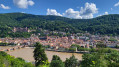
"A nature experience combined with athletic hiking" ... this is how the Burgensteig is described in the official flyer of the Tourismus Service Bergstraße e.V. The Burgensteig leads from Darmstadt-Eberstadt along the heights of the Odenwald to Heidelberg. Along the approximately 120 km, you will pass over 30 historical sights and cross two other well-known trails, the Nibelungensteig near Zwingenberg and the Neckarsteig in Heidelberg. We took the liberty of deviating from the "standard" route here and there.
We have put together the stages so that you can get to your starting point and back from your destination by public transport. This means that our version is about 20 km longer than the original.
Walk around the Saar Loop
 8.35 mi
+1,555 ft
-1,552 ft
5h 10
Average
Departure from Mettlach (Landkreis Merzig-Wadern)
8.35 mi
+1,555 ft
-1,552 ft
5h 10
Average
Departure from Mettlach (Landkreis Merzig-Wadern)
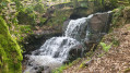
A walk around the Saar Loop near Mettlach, one of the Saarland’s most famous attractions. The route takes you from the “WELLES” ferry across the Mettlach lock up to the treetop walk and back in a loop to your starting point.
Burgensteig (3): Bensheim-Auerbach – Heppenheim
 11.44 mi
+1,955 ft
-1,936 ft
7h 00
Average
Departure from Bensheim (Regierungsbezirk Darmstadt)
11.44 mi
+1,955 ft
-1,936 ft
7h 00
Average
Departure from Bensheim (Regierungsbezirk Darmstadt)
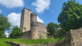
"Nature experience combined with sporty hiking"... this is how the Burgensteig trail is described in the official flyer of the Bergstraße Tourist Association. The Burgensteig trail leads from Darmstadt-Eberstadt along the heights of the Odenwald to Heidelberg. Along the approximately 120 km, you will pass over 30 historical sights and cross two other well-known trails, the Nibelungensteig near Zwingenberg and the Neckarsteig in Heidelberg. We took the liberty of deviating from the "standard" route here and there.
We have put together the stages so that you can get to your starting point and back from your destination by public transport.
The secluded path through the Hessian Odenwald to the River Neckar
 16.99 mi
+1,719 ft
-2,480 ft
9h 20
Average
Departure from Wald-Michelbach (Regierungsbezirk Darmstadt)
16.99 mi
+1,719 ft
-2,480 ft
9h 20
Average
Departure from Wald-Michelbach (Regierungsbezirk Darmstadt)
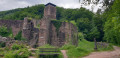
This walk takes us from Wald-Michelbach to Neckarsteinach without any cultural or historical highlights. We walk along or parallel to the Main-Stromberg Trail. Our aim was to avoid the ‘forest motorways’ and focus on walking on forest paths or at least on unpaved forest tracks.The route is ideal for switching off and simply walking – no sights, no places to stop for refreshments and absolutely nothing to distract you along the way. In return, there are hardly any changes in altitude, and at the end of the route, the castles around Neckarsteinach do offer a little highlight after all.
From Ober-Ramstadt to Brandau in the Modau Valley
 11.81 mi
+1,785 ft
-1,385 ft
7h 00
Average
Departure from Ober-Ramstadt (Regierungsbezirk Darmstadt)
11.81 mi
+1,785 ft
-1,385 ft
7h 00
Average
Departure from Ober-Ramstadt (Regierungsbezirk Darmstadt)
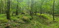
A section of the relatively little-known Main-Stromberg Trail runs from Ober-Ramstadt to Lützelbach. This route frequently deviates from the original trail and does not end until you reach Brandau in the Moda Valley. This allows you to bypass a number of wide forest tracks and create a lovely circular walk: either park your car in Brandau and take the bus to Ober-Ramstadt first thing in the morning (recommended, as bus services are limited), or park in Ober-Ramstadt and take the bus back to your car after the walk.
Castle Trail (4): Heppenheim – Hemsbach
 10.92 mi
+1,886 ft
-1,870 ft
6h 40
Average
Departure from Heppenheim (Regierungsbezirk Darmstadt)
10.92 mi
+1,886 ft
-1,870 ft
6h 40
Average
Departure from Heppenheim (Regierungsbezirk Darmstadt)
"Nature experience combined with athletic hiking" ... this is how the Burgensteig trail is described in the official flyer of the Tourismus Service Bergstraße e.V. The Burgensteig trail leads from Darmstadt-Eberstadt along the heights of the Odenwald to Heidelberg. Along the approximately 120 km, you will pass over 30 historical sights and cross two other well-known trails, the Nibelungensteig near Zwingenberg and the Neckarsteig in Heidelberg. We took the liberty of deviating from the "standard" route here and there.
We have put together the stages so that you can get to your starting point and back from your destination by public transport.
Bansin’s cliffs
 6.16 mi
+328 ft
-331 ft
3h 05
Easy
Departure from Heringsdorf (Vorpommern-Greifswald)
6.16 mi
+328 ft
-331 ft
3h 05
Easy
Departure from Heringsdorf (Vorpommern-Greifswald)
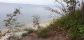
Circular walk starting and ending in Bansin. The route takes us along the nature trail through the woods to the cliffs. Here we can enjoy a magnificent view of the Baltic Sea and the Polish coast. We walk back high above the Baltic Sea and arrive directly at the pier. After a short detour to Schloonsee, the path takes us along the beach promenade and finally back to the starting point.
Baltic Sea beach and Achterwasser – a varied landscape near Koserow
 6.27 mi
+226 ft
-213 ft
3h 05
Easy
Departure from Loddin (Vorpommern-Greifswald)
6.27 mi
+226 ft
-213 ft
3h 05
Easy
Departure from Loddin (Vorpommern-Greifswald)
Sandy beach, views from Streckelsberg, Lüttenort, Schwanensee and Achterwasser – a walk on Usedom could hardly be more varied. We’ll also pass historic sites such as the listed salt huts, the site associated with the ‘Amber Witch’, and the viewpoint overlooking the sunken city of Vineta, the ‘Atlantis of the North’.
Castle Trail (5): Hemsbach – Weinheim
 7.46 mi
+1,289 ft
-1,243 ft
4h 35
Average
Departure from Hemsbach (Regierungsbezirk Karlsruhe)
7.46 mi
+1,289 ft
-1,243 ft
4h 35
Average
Departure from Hemsbach (Regierungsbezirk Karlsruhe)
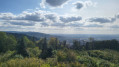
"Nature experience combined with sporty hiking" ... this is how the Burgensteig trail is described in the official flyer of Tourismus Service Bergstraße e.V. The Burgensteig trail leads from Darmstadt-Eberstadt along the heights of the Odenwald to Heidelberg. Along the approximately 120 km, you will pass over 30 historical sights and cross two other well-known trails, the Nibelungensteig near Zwingenberg and the Neckarsteig in Heidelberg. We took the liberty of deviating from the "standard" route here and there.
We have put together the stages so that you can get to your starting point and back from your destination by public transport.
Mill tour on Lake Schmollensee
 10.05 mi
+509 ft
-413 ft
5h 05
Average
Departure from Ückeritz (Vorpommern-Greifswald)
10.05 mi
+509 ft
-413 ft
5h 05
Average
Departure from Ückeritz (Vorpommern-Greifswald)
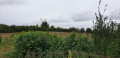
A wonderful walk around three-quarters of Lake Schmollensee – mostly through secluded woods on gentle, unpaved forest paths. Along the route are the historic highlights: the castle and post mill in Pudagla, and the church and Dutch windmill in Benz.
Gorge Trail Stage 1 – from Stühlingen to Blumberg
 11.41 mi
+2,080 ft
-1,263 ft
7h 05
Average
Departure from Stühlingen (Regierungsbezirk Freiburg)
11.41 mi
+2,080 ft
-1,263 ft
7h 05
Average
Departure from Stühlingen (Regierungsbezirk Freiburg)
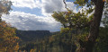
The Schluchtensteig trail leads in 6 stages over 119 km from Stühlingen to Wehr across the southern Black Forest.
The first stage takes us from Stühlingen to Blumberg along the Wutachflühen. High above the Wutach, we hike on narrow paths and exposed trails. We pass the Sauschwänzlebahn railway line several times and, with a bit of luck, we will see the museum train steam past.
The Buchberg with its long ascent challenges us in the last third of the tour before we descend to Blumberg.
Gorge Trail Stage 2 – from Blumberg to Schattenmühle
 12.86 mi
+2,087 ft
-2,185 ft
7h 45
Average
Departure from Blumberg (Regierungsbezirk Freiburg)
12.86 mi
+2,087 ft
-2,185 ft
7h 45
Average
Departure from Blumberg (Regierungsbezirk Freiburg)
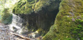
The Schluchtensteig trail runs for 119 km in 6 stages from Stühlingen to Wehr, right across the southern Black Forest.The second stage leads from Blumberg past the Schleifenbach waterfall to the River Wutach, through the magnificent Wutach Gorge, past the former spa town of Bad Ball and several waterfalls, and ends at Gasthof Schattenmühle.
Gorge Trail Variation Stage 3 – From the Lotenbachklamm gorge to Lenzkirch
 8.98 mi
+1,283 ft
-1,188 ft
5h 15
Average
Departure from Bonndorf im Schwarzwald (Regierungsbezirk Freiburg)
8.98 mi
+1,283 ft
-1,188 ft
5h 15
Average
Departure from Bonndorf im Schwarzwald (Regierungsbezirk Freiburg)
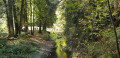
The Schluchtensteig trail runs for 119 km in 6 stages from Stühlingen to Wehr, right across the southern Black Forest. Our third stage starts at the upper entrance to the Lotenbach Gorge and ends in Lenzkirch, where there are plenty of places to stay and a bus service to the start of stage 4. Alternatively, you could stay overnight in Schluchsee and climb the Riesenbühl Tower – see the relevant tour.Anyone wishing to hike all the stages of the Schluchtensteig can stay overnight at the Schattenmühle between stages 2 and 3. From there, you can tackle the Lotenbach Gorge and hike uphill to the starting point of this walk.
Schluchtensteig supplement Stage 3 – Up to the Riesenbühlturm
 2.13 mi
+482 ft
-463 ft
1h 25
Easy
Departure from Schluchsee (Regierungsbezirk Freiburg)
2.13 mi
+482 ft
-463 ft
1h 25
Easy
Departure from Schluchsee (Regierungsbezirk Freiburg)
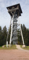
The Schluchtensteig trail leads in 6 stages over 119 km from Stühlingen to Wehr across the southern Black Forest. If you are staying in Schluchsee between stages 3 and 4, you should definitely climb the Riesenbühlturm tower and enjoy the magnificent view of Schluchsee and the Alps.
Schluchtensteig – 6 stages through the southern Black Forest
 87.77 mi
+13,340 ft
-16,319 ft
6 days
Difficult
Departure from Stühlingen (Regierungsbezirk Freiburg)
87.77 mi
+13,340 ft
-16,319 ft
6 days
Difficult
Departure from Stühlingen (Regierungsbezirk Freiburg)
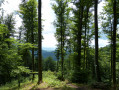
The Schluchtensteig trail runs in 6 stages over 119 km from Stühlingen to Wehr, right across the southern Black Forest.“Exposed paths along steep rocky gorges, some offering spectacular views down into the depths. The Wutachflühen, the Wutach Gorge, the Schleifenbach Falls, the Haslach Gorge, the Windberg Waterfall, the Hohwehras Gorge and the Wehras Gorge are destinations for all those who enjoy hiking through wild gorges, marvelling at thundering waterfalls, savouring the natural silence and wanting to switch off from everyday life for a week,” as stated on the Schluchtensteig website – and the trail certainly lives up to its promise.We’ve tweaked the third stage slightly, so you’ll avoid the hill between Lenzkirch and Fischbach. Instead, we’ll hike up to the Riesenbühlturm in Schluchsee, which offers a panoramic view in all directions.
Gorge Trail Stage 4 – from Fischbach to St. Blasien
 12.41 mi
+1,457 ft
-2,356 ft
7h 00
Average
Departure from Schluchsee (Regierungsbezirk Freiburg)
12.41 mi
+1,457 ft
-2,356 ft
7h 00
Average
Departure from Schluchsee (Regierungsbezirk Freiburg)
The Schluchtensteig trail leads in six stages over 119 km from Stühlingen to Wehr across the southern Black Forest.
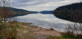
The fourth stage of the Schluchtensteig is almost completely free of gorges and therefore quite easy to walk. However, you should not underestimate the altitude difference, especially after Unterkrummenhof, where a long climb awaits hikers, and after St. Blasien, where the forest road descends for a long time and is quite steep in places.
The southern Black Forest with its isolated farms shows its charming side on this stage, offering frequent views of the Alps. At the end, you can enjoy the Windeck waterfalls above St. Blasien.
Thanks to good bus connections, this stage can also be hiked very well as a single stage.
Gorge Trail Stage 5 – from St. Blasien to Todtmoos
 11.52 mi
+1,952 ft
-1,831 ft
7h 00
Average
Departure from St. Blasien (Regierungsbezirk Freiburg)
11.52 mi
+1,952 ft
-1,831 ft
7h 00
Average
Departure from St. Blasien (Regierungsbezirk Freiburg)
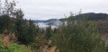
The Schluchtensteig trail runs for 119 km in 6 stages from Stühlingen to Wehr, right across the southern Black Forest.On the fifth stage, the route climbs 300 metres in altitude straight after the start to the Lehenbachkopf. And the route continues to climb steeply as it progresses.A new route now runs alongside the Klosterweiher pond and briefly follows the Bergbaurundweg circular trail. It then crosses the Horbacher Heide and the Ibacher Höhe, from where, on clear days, you can see as far as the Swiss Jura. The crowning glory of this stage is the stunning Hochwehraschlucht gorge.
Gorges Trail Stage 6 – from Todtmoos to Wehr (bad weather alternative)
 13.65 mi
+1,558 ft
-3,061 ft
7h 40
Average
Departure from Todtmoos (Regierungsbezirk Freiburg)
13.65 mi
+1,558 ft
-3,061 ft
7h 40
Average
Departure from Todtmoos (Regierungsbezirk Freiburg)
The Schluchtensteig trail leads in six stages over 119 km from Stühlingen to Wehr, right across the southern Black Forest.
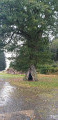
The last stage is the longest at almost 22 km. In case of continuous or heavy rain or other incidents, this is an easy alternative if you want to get to Wehr somehow and cannot walk through the Wehraschlucht gorge.
While the first half of the stage to Gersbach offers some variety, the hike to Wehr is exclusively downhill on a gravel forest path.
Gorge Trail Stage 6 – From Todtmoos to Wehr
14.81 mi
+2,441 ft
-3,973 ft
8h 55
Difficult
Departure from Todtmoos (Regierungsbezirk Freiburg)
The Schluchtensteig trail leads in six stages over 119 km from Stühlingen to Wehr, right across the southern Black Forest.
The last stage is the longest at almost 24 km and takes us through the wonderful Wehraschlucht gorge and later high above the Wehra river and then down to the Wehrastausee lake. Along the Wehra, we hike directly into the centre of Wehr.
Albsteig (E2) from Göhrwihl to Häusern
 15.71 mi
+3,320 ft
-2,746 ft
10h 05
Difficult
Departure from Görwihl (Regierungsbezirk Freiburg)
15.71 mi
+3,320 ft
-2,746 ft
10h 05
Difficult
Departure from Görwihl (Regierungsbezirk Freiburg)
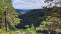
This variant of the Albsteig (Black Forest) takes you on a 112-kilometre journey through the Alb Valley along the river from Albbruck to the Feldberg, the roof of the southern Black Forest. Stage 2 takes you from Göhrwihl back down into the Alb Valley, then over the Dachsberg, to the Albstausee reservoir and up to Häusern.
In 5 stages from Albbruck to Feldberg and back
 69.61 mi
+11,762 ft
-11,696 ft
5 days
Difficult
Departure from Albbruck (Regierungsbezirk Freiburg)
69.61 mi
+11,762 ft
-11,696 ft
5 days
Difficult
Departure from Albbruck (Regierungsbezirk Freiburg)
This variant of the Albsteig (Black Forest) takes you through the Alb Valley along the river from Albbruck to the Feldberg, the roof of the southern Black Forest, covering around 111 kilometres. Along the route, the Albsteig crosses two other long-distance hiking trails, the Schluchtensteig near St. Blasien and the Westweg on the Feldberg. The multi-day tour described here takes you along the western route to the Feldberg and back down to Höchenschwand via the eastern route. From there, the Wolfssteig (23 km) takes you down to Waldshut-Tiengen and finally by train back to the starting point in Albbruck.
Albsteig (E3) from Häusern to Feldberg Pass
 15.04 mi
+3,176 ft
-1,909 ft
9h 40
Difficult
Departure from Häusern (Regierungsbezirk Freiburg)
15.04 mi
+3,176 ft
-1,909 ft
9h 40
Difficult
Departure from Häusern (Regierungsbezirk Freiburg)
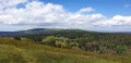
This variant of the Albsteig (Black Forest) trail takes you around 112 kilometres through the Alb valley along the river from Albbruck to the Feldberg, the roof of the southern Black Forest. The third stage of the Albsteig leads via St. Blasien and the Westweg trail to Bernau and the pass at the top of the Feldberg. The highlights of this stage, apart from the impressive landscape, are the Windberg waterfall, the view of the cathedral in St. Blasien and the Herzogenhorn, the highest point of the Albsteig. On a clear day, you can enjoy a magnificent panoramic view of the Black Forest and the Alps.
Albsteig (E4) from Feldberg Pass to Höchenschwand
15.69 mi
+1,837 ft
-2,579 ft
8h 50
Difficult
Departure from Feldberg (Regierungsbezirk Freiburg)
This variant of the Albsteig (Black Forest) trail takes you on a 112-kilometre journey through the Alb Valley along the river from Albbruck to the Feldberg, the roof of the southern Black Forest. The fourth stage leads from the pass at Feldberg via Menzenschwand and St. Blasien to Höchenschwand. In terms of altitude, it is a little less strenuous than the previous stages. The eastern route of the Albsteig takes you back down towards the Hochrheintal valley.
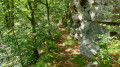
Albsteig (E5) from Höchenschwand to Waldshut
 14.65 mi
+1,352 ft
-3,507 ft
7h 55
Difficult
Departure from Höchenschwand (Regierungsbezirk Freiburg)
14.65 mi
+1,352 ft
-3,507 ft
7h 55
Difficult
Departure from Höchenschwand (Regierungsbezirk Freiburg)
This variant of the Albsteig (Black Forest) trail takes you on a 112-kilometre journey through the Alb Valley along the river from Albbruck to the Feldberg, the highest peak in the southern Black Forest. Stage 5 is not formally part of the Albsteig. The Wolfssteig is both the continuation and the missing link needed to turn the Albsteig Black Forest into a multi-day circular tour. The Wolfsteig continues down into the Upper Rhine Valley to Waldshut and from there by public transport to the starting point of the tour in Albbruck.
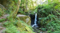
Albsteig (E1) from Albbruck to Göhrwihl
 8.53 mi
+2,077 ft
-955 ft
5h 45
Average
Departure from Albbruck (Regierungsbezirk Freiburg)
8.53 mi
+2,077 ft
-955 ft
5h 45
Average
Departure from Albbruck (Regierungsbezirk Freiburg)
This version of the Albsteig (Black Forest) takes you on a 112-kilometre journey through the Alb Valley along the river from Albbruck to the Feldberg, the highest peak in the southern Black Forest. The first stage takes you upstream from Albbruck through and along the picturesque Alb Valley and, towards the end, through the Höllbach Valley up to Göhrwihl.
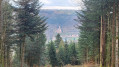
In 7 stages through the Neckar Valley from Heidelberg to Bad Wimpfen
 22.62 mi
+3,684 ft
-3,589 ft
7 days
Difficult
Departure from Hirschhorn (Regierungsbezirk Karlsruhe)
22.62 mi
+3,684 ft
-3,589 ft
7 days
Difficult
Departure from Hirschhorn (Regierungsbezirk Karlsruhe)
The Neckarsteig stretches over 128 kilometres from Heidelberg to Bad Wimpfen, winding its way along the majestic Neckar River through the picturesque region of Baden-Württemberg. This route promises an unforgettable journey through a variety of landscapes, from gentle vineyards to imposing rock formations.
Along the route, you can expect challenging climbs as well as relaxed sections along the river. You can look forward to varied landscapes ranging from wooded slopes in the Neckar Valley to charming half-timbered towns and historic castles.
We have designed the sections so that you can reach every start and end point of a stage by public transport.