Country:
 City:
City:


Getting there by public transport ...
(S) Your walk begins in front of the station in Eberbach at a signpost with 10 (!) direction indicators. You’ll head towards the ruins of Eberbach Castle, i.e. over the railway bridge and, on the other side, across the supermarket car park to ‘Güterbahnhofstraße’.
Cross this street, turn right and then immediately turn off onto “Schafwiesenweg”.
Shortly after the New Apostolic Church, turn right onto “Friedrichsdorfer Landstraße” and, at the next opportunity, left onto “Hohenstaufenstraße”.
After a while, turn right onto “Burgweg” (small sign for “zur Burg Eberbach”). This path takes you steadily uphill.
(1) Cross “Neue Diehlbacher Straße” and, on the other side, follow the narrow, winding forest path up to the ruins of Eberbach Castle.
Once at the top, you’ll find an information board detailing the history of the castle and its three sections. To the left of the information board, the path continues along a gravelly forest track. At the fork, keep left.
(2) Stay on the main path; you’ll come to a junction and continue straight on the other side. After a while, you’ll reach the Emichsburg Ruins junction. Here, take the fourth path from the left (effectively straight ahead) towards Waldkatzenbach and Unterdiehlbach.
(3) At the next junction , keep left and , after a short while , you’ll reach a crossroads with a stone signpost pointing straight on towards Waldkatzenbach.
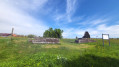
(4) As you emerge from the woods, walk across the open area and you’ll pass a bench. If the weather’s fine, you can take a short break here and enjoy the view.
Carry on to the VfR Waldkatzenbach sports ground, walk past it on the left and, once in the village, turn left onto ‘Katzenbuckel Straße’.
(5) Follow this road uphill and turn right when you reach Villa Katzenbuckel. You’ll be heading towards a car park.
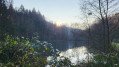
(6) The first fork leads you down to Katzenbuckel Lake, from where you’ll need to head back to your main path. The second fork takes you along the top of the lake and offers you lovely views of the lake time and again.
(7) You’ll come to three large stones lying across your path. Continue to the right here (even though going straight ahead might be much more tempting, it’s a dead end).
(8) You’ll reach a wider road again; turn left and you’ll find yourself unexpectedly at the Katzenbuckelschanze ski jump, home to the Katzenbuckel Eberbach Ski Club.
Carry on along the road for a short while, then turn left onto a narrow path up the hill to a wider path. You can already see the observation tower, but you’ll need to turn right once more and then immediately left to continue uphill.
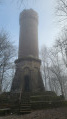
(9) You have now reached the highest point in the Odenwald, the Katzenbuckel. Here you can take a break and climb the observation tower for a fantastic panoramic view (on a clear day).
To the right of the information board, go down a few steps and continue downhill. After a while, you’ll reach the edge of the forest and turn right.
(10) Shortly after a fork in the path (keep left), you’ll reach the South Viewpoint. At the next fork, keep left and stay along the edge of the forest for the time being.
(11) The path takes you in a right-hand bend to the Freya Hut. After that, continue straight on for a short while and, at the next junction, turn left onto a narrow path leading downhill.
You’ll come to a wider forest track again and turn right towards Unterhöllgrund. Carry on straight ahead at the next junction and keep right at the following fork.
At the next junction, walk straight ahead onto the narrow path and downhill to the K3925. Cross this with due care and continue downhill on the other side.
You cross the Eisigklinge stream, walk uphill again below the Waldkatzenbach sewage treatment works until you reach a junction. Here, continue straight on for a short distance and then turn right onto a narrow path.
(12) Cross a wider path, then take a sharp left to follow the path; after a long climb, you’ll reach another wider path with a bench. Diagonally opposite, the path continues uphill.
(13) After a few steps, you’ll come to a wider path again. Follow this to the left, then turn sharply right straight away, and then left.
(14) You pass the Eichenwaldhütte and, a little later, continue straight on to a car park. Here, turn left and, at the next fork, turn right. You are now walking parallel to the Scheuerklinge stream.
(15) At the second right, you’ll come to a tarmac road (‘Höllgrundstraße’); continue to the left here and turn right above the country inn ‘Zur Mühle ’.
The route now continues straight on for quite a long way.
You’ll cross the Höllbach stream, then turn right and walk upstream along the Höllbach towards the village of Mülben. You’ll cross the Höllbach once more and, shortly afterwards, take a sharp left.
Once you reach the top, keep left (“Birkenstraße”, “Odenwaldstraße”) and, just before the village fountain, turn right onto “Jägerstraße” towards Neckargerach. This takes you out of the village again.
After a while, you’ll first cross the L524 and then the “Weisbacher Landstraße” before heading back into the woods.
(16) Once back at the edge of the forest, turn right, walk down the slope and, at the bottom, turn left towards Weisbach. At the bench on the right-hand side, continue to the right.
Follow the path to the K3929. Follow this to the left until you reach the turn-off to the right leading to a car park. Cross the K3929 with due care and continue to the right on the other side.
(17) The circular path winds down to the Weisbach, which you follow downhill. At the junctions along the route, keep right three times and then carry on straight ahead until you reach the Drei-Dolen Bridge. Here, cross the Seebach and walk along its right bank on the other side.
(18) The path leads steadily downhill, past the Läufertsmühle to the rest area by the Waldsee. Here, turn left, past the barbecue hut, and head uphill again along the hairpin bends.
At the wider path after the hairpin bends, turn right and walk straight on towards Neckargerach.
You’ll reach the first houses in Neckargerach, walk down ‘Gertbergstraße’ and turn right into ‘Neue Schulstraße’.
(E) Passing the ‘Neckargerach Bahnhof’ bus stop, cross the L527 (‘Reichenbucher Straße’), walk past a playground and you’ll reach your destination, the railway station in Neckargerach.
 Visorando Member
 Association / Club / Walk leader
 Moderate
  Tourism professional