Country:
 City:
City:


The tour starts at the ZOB in Wald-Michelbach.
We cross the road and turn left, past the Aral petrol station towards the church tower, down Ludwigstraße. We take the second right just by the church (street: In der Gass) and find ourselves in the centre of the little town. Here there is a butcher’s, a bakery and also the option to have breakfast right there on the spot. At the greengrocer’s, we turn left towards the car park.
(1) We pass the Einhaus. At the end of the car park, we turn right and walk along the stream, following the Draisinenrundweg. We cross the road – with the DHL branch to our right – and continue along the Ulfenbach, following the footpath.
At Zimmermeister Unger’s, we reach Michelstraße, turn right and follow the main road to the left ( Wetzkeil). We pass under the disused railway line (now used for handcar rides) and follow the signs for Birkenhof.
At a T-junction, we head uphill to the right ( Spechtbach), continuing to follow the signs for Birkenhof. To our left is the school complex with a bus stop; we carry on straight ahead. At a fork in the path, we follow the signs for the forest swimming pool and campsite (no longer towards Birkenhof). To our right is the campsite; at the sign for ‘Parkplatz Waldschwimmbad’, we keep to the left. Here we come across the red square trail marker for the Main-Stromberg-Weg, which we now follow. Before reaching the Waldschwimmbad, we head left uphill along a tarmac path into the woods.
(2) We reach a shelter. Just before the hill, we turn left onto a narrow path. We then follow a wide, gravelled forest track down to the left. At the next junction, we leave the red square trail marker and take the second turn-off on the left, a narrow path marked SI1. At the only turn-off to the right and downwards, we follow this; at the next opportunity, we keep to the right again and reach another junction. Here we come across the red square again, but we do not follow it.
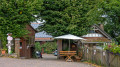
(3) There is another mountain hut here. We cross the clearing and take the second path on the right, following SI2 or heading towards Eiterbach, as we can see written on a tree a few metres further on. At the next fork, we follow the unpaved path up to the left – the SI1 cycle path – until we finally reach a forest track, which we follow to the left.
(4) We arrive at the Adlerstein. Here we rejoin the Main-Stromberg Trail and follow the red square down to the right. At the next fork, we leave the trail marker behind once more and keep to the right, following trail marker 4.
(5) At the signpost ‘Am Kautzekopf’, we head left and uphill and rejoin the red square; we follow this initially to the right along the forest track until a path cuts across diagonally. We follow this path to the left and uphill; at the next fork, we keep to the right.
(6) A junction that is difficult to spot, shortly after the woodland becomes denser again: the path comes in at a 90-degree angle to our route from the top left and leads down to the right at a right angle. We follow this path to the right. As soon as we reach the forest track, we follow it to the right until we reach the junction.
(7) At the Schlumberg signpost, we come across the red square again, which we follow for a few metres to the left towards Schönau/Heiligkreuzsteinach. After a clearing, we turn left downhill, following the ‘3’. At the next junction, take the second path on the right and continue to follow the ‘3’ or the Mittlerer Eichköpfleweg. As soon as you reach the road, follow it to the right and uphill, still following the yellow ‘3’.
(8) At the junction, we turn left towards the car park at Eichköpfel, past the information board for the Neckartal-Odenwald Nature Park, and continue along the path on the left, which tends to lead uphill. We now follow the markings for the Main-Stromberg-Weg again. At the next fork, we keep to the left and follow the beautiful narrow path uphill.
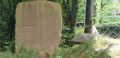
(9) We pass a boundary stone, cross a path and continue for a long time along the lovely path marked with the red square through the secluded Odenwald until we finally reach an open area again.
(10) We cross the Wolfsgrube junction diagonally and, to the left of the main path, we spot the red square again, which we follow. After a few metres, following the markings to the right, we head back into the forest. At the fork, we keep to the left.
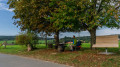
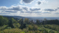
(11) At the start of the wind farm, we come to the first bench we’ve seen in hours. We cross the open area and continue to follow the red square through the wind farm. Before the third turbine, at the Greiner Eck junction, we leave the trail marker behind and turn right onto an unpaved forest track, continuing straight ahead.
(12) At the next junction, we carry on straight ahead, past a bench, and continue along the now tarmac-surfaced path out of the wood and across meadows.
(13) We pass a house (number 32), turn right here and immediately left again into the woods. We take the left-hand path of the two and, at the next T-junction, rejoin the Main-Stromberg-Weg, which we follow to the right. On the right-hand side is a forest nursery and petting zoo (formerly the Kreuzschlag youth campsite). At the next junction, we meet the Neckarsteig for the first time and follow it to the right.
(14) We pass a rest area, cross a track and, at the next fork, keep left on the Main-Stromberg-Weg, leaving the Neckarsteig. After about 1 km, we reach a junction, keep left and eventually arrive at a network of paths.
(15) Here we leave the Main-Stromberg-Weg for good and continue along the Neckarsteig, following the curved blue ‘N’ sign. The path continues straight on towards Dilsberg. We reach a road again, follow it to the left for a few metres and then immediately turn right onto a narrow path. We follow the Neckarsteig, which winds downwards in hairpin bends towards Neckarsteinach. We reach a path and the signpost leads us further downwards in a sharp right-hand bend.
(16) At the ‘Odenwaldblick’ seating area, we continue down the Neckarsteig with a view of the Hinterburg. At Kurt-Seibel Platz, we keep sharply to the left and reach the road (Philosophenweg), which we follow for a few metres to the left.
(17) Take care not to miss the descent. Between house numbers 2 and 2A, we go down a flight of steps and then carry on straight ahead, along narrow paths and steps, then winding our way through houses and alongside plots of land down the Meisenweg until we can make out the railway tracks.
We reach the road, Schönauer Straße, which we cross and then follow to the right; we immediately turn left onto a narrow path – ahead of us is the railway tunnel and the castle in the background. We cross the stream via a bridge and head straight towards the forest. At the next fork, we turn left, following the blue ‘N’ sign, and head uphill. At the next junction, we take the narrow path on the left and walk a few metres back along virtually the same route towards the Neckar. We reach a wider path, which we follow to the left.
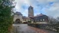
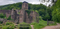
(18) We have reached the Hinterburg. We are now above the railway tunnel and can see the Neckar below us. Immediately after the castle, the path leads down to the right along a narrow track in small hairpin bends – no longer through the woods; in spring 2023, all the trees at this point had been felled.
(19) We cross the road at the pedestrian traffic lights and walk straight down a few steps, then turn left across the meadow past the playground; after this, we turn right towards the Neckar, where we reach a paved path which we follow to the left along the Neckar towards Neckarsteinach until we reach the small Neckar promenade. Here we take the steps up to Schiedweg, thereby leaving the Neckarsteig. At the end of the wall, turn left into Neckarstraße, past the ‘Zum Schwanen’ inn on the right, and immediately after the stream, follow Neckarstraße to the right. This becomes Bahnhofstraße, and we can now see the station building directly ahead of us on the left-hand side.
(E) Here, the S-Bahn to Heidelberg is waiting for us.
Z (for a one-way hike) S/E:: for a circular walk
 Visorando Member
 Easy
Easy 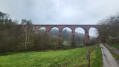
 Difficult