Country:

 City:


Travelling by train, e.g. from Freiburg – www.bahn.de
(S) Your walk starts at Hinterzarten railway station. Walk along ‘Bahnhofweg’ and then turn right towards ‘Freiburger Straße’. Cross ‘Freiburger Straße’ and turn right.
(1) On your left, you’ll pass the Kurhaus and the tourist information centre, then turn left immediately afterwards.
Passing two car parks, you cross the Zartenbach, walk across the meadow to the edge of the wood and turn left there (Säbelthomaweg, towards Mathisleweiher). The former village policeman Thomas Steiert (Säbelthoma) accompanies you for part of this walk. You’ll find a number of interesting and amusing information boards along the way. Carry on straight ahead, cross a cycle path and, at the next junction, turn right onto the nature trail. You’ll reach a wide path and turn left here.
(2) A little further on, you’ll already see a large playground on your right (Wolfsgrund playground)
At the fork near the playground, keep to the right and walk uphill. After a while, at a fork, keep left onto “Am Kesslerberg” and walk downhill between the houses. At the Hotel Sonnenberg, turn right again and walk uphill along the unpaved path (follow the “red diamond” sign for the Westweg).
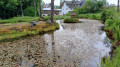
(3) At the next junction, keep left and pass a fish pond (private property). You’ll also find a sign for the Säbelthomaweg by the side of the path.
Continue along the “Red Diamond” route. Your path leads you onto a wider track, which you follow to the right. At the fork just beyond, keep left. At the next junction, turn left towards Mathisleweiher (signposted).
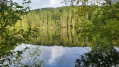
(4) The path now leads downhill and you’ll reach the idyllically situated Mathisleweiher. Just to the left are several benches, perfect for a short rest.
Continue walking clockwise round the pond, back up the hill, keep to the right on a narrow, steep path and rejoin the ‘Red Diamond’ markings of the Westweg. Follow these slightly to the left towards Häuslebauerhof, Feldberg. At the next fork, keep to the left. You’ll come to a wider path and follow the signposts further to the left.
(5) You’ll emerge from the woods and, shortly afterwards, come to a refreshment station on the right-hand side with an honesty box and a huge wooden bench. A great spot for a break. Continue along the wide path, through the Häuslebauerhof and turn left at the next junction. At the next fork, keep to the right.
(6) On the wide path, you’ll reach Rufenholzplatz with the Rufenhütte. Here, you leave the Westweg and continue along the left-hand of the two wide paths towards Reimartihof, Feldsee.
(7) After a while, a narrow path branches off to the right. Follow this uphill until you reach a wider path again. Follow this to the left as far as the Reimartihof.
(8) The self-service inn offers another opportunity to take a break. After your break, return to the wide path and turn left towards Feldsee.
(9) There, continue along the path by the lake, keeping to the left at the next junction and again to the left at the following fork. You’ll reach the forest track (Reimartihofweg) and follow it to the right, downhill, to the Waldhofbach water intake.
(10) You’ll find a detailed description of this part of the Schluchssee’s water supply system on the information board.
Shortly after the Waldhofbach water intake, leave the wide forest track and turn right. Walk uphill along the path to the B317 main road, cross it with due care, and on the other side turn left onto a narrow path (Walter-Wochner-Steig) which leads you downhill alongside the main road towards Bärental railway station.
Passing the Hotel Diana, you’ll come to the “Schrofenweg”; walk along it for a short distance and then continue on the Walter-Wochner-Steig on the other side. You’ll come to an underpass beneath the B317, through which you’ll cross to the other side of the road, and there you’ll turn right again straight away.
(11) You’ll reach another place to stop for refreshments, the Schnapshäusle.
(E) From the Schnapshäusle, the route continues downhill towards Bärental railway station, the destination of your hike.

 Visorando Member
 Difficult
 Association / Club / Walk leader
 Easy