Country:
 City:
City:


How to get there: By car via Dreisbach; turn off ‘Nohner Straße’ onto the road ‘Auf der Schleif’, which then becomes ‘Steinbach’.
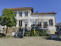
(S/E) We start at the “Steinbach” car park in front of the Fährhaus (former restaurant). From the car park, walk towards the Fährhaus.
(1) A short distance away, you’ll already be able to see the ferry landing stage on your right. If the ferry is moored on the other side, simply ring the large ship’s bell at the jetty. The crossing costs €2.50 per person (as of May 2023).
Once you’ve reached the other bank of the Saar, turn left and follow the wide path downstream.
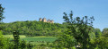
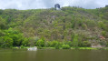
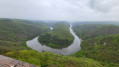
In the first few metres, you’ll have a good view up to your destination, the viewing platform of the treetop walk.
(2) Follow the wide path right up to the Mettlach lock. Here, turn left and cross the Saar via the road over the lock.
After the lock, turn left again. The path remains easy to walk on. You’ll cross two streams, the Wellesbach and the Weselbach, which flow into the Saar from the right.
(3) Shortly after crossing the Weselbach, turn sharply right onto a narrow forest path. The “Cloefpfad” leads you quite steeply upwards in hairpin bends.
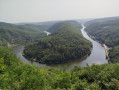
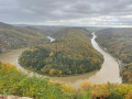
(4) After several hairpin bends, you’ll reach the “Coef” viewpoint at the top. Time to enjoy the view over the Saar Loop.
You continue your walk uphill around the stone building. The surface of the path changes; you’re now on a tarmac road. However, you soon leave this behind, turning right at a junction and walking along a wider path towards the ‘Futterkrippe’ and past the ‘Abenteuerwald Saarschleife’.
Follow the path to the Cloef Atrium. There you’ll find the Tourist Information Centre, and you’ll also have the chance to stop for a bite to eat and recover from the exertions of the climb.
Continue out of the Atrium and turn right towards the entrance to the treetop walk (current admission prices)
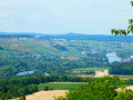
(5) Now it’s time for you to enjoy nature at eye level with the treetops and, from the 42-metre-high observation tower, let your gaze wander over the truly unique landscape and, on a clear day, into the distance.
Follow the treetop walkway to the exit, turn left and you’ll reach the tarmac path (Waldpromenade); cross this and, on the other side, follow a path down to the left.
You cross an open area and come to a T-junction; turn left here and then right again at the next fork. You now walk a short distance along the Saar-Hunsrück-Steig.
After a gentle left-hand bend, the path rejoins the Cloefpfad; here, turn sharply right.
(6) At the next fork, keep left, then cross a road and walk past an ostrich farm on your left.
You’ll now head back into the woods. You’ll come to a junction; keep left and continue following the Cloefpfad downhill.
At the next junction, carry on straight ahead down the path (Saarwanderweg). After a while, you’ll cross the Cloefpfad again and continue straight ahead down the narrow path. Please be aware that we got the impression this section is used by mountain bikers. Please be careful and give way if necessary.
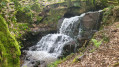
(7) To your right, the Kommetsteinerbach babbles along. You’ll pass a waterfall and continue down the Steinbach valley.
At the Saarschleifen Lodge, you’ll rejoin the road, turn right, cross the Steinbach and walk straight on past the ferry jetty to your starting and finishing point, the car park in front of the Fährhaus (formerly a restaurant) (S/E)

 Visorando Member
 Easy
Easy