Country:
 City:
City:


(S) The starting point of the walk is Ober-Ramstadt at the Alter Markt bus stop on Darmstädter Straße. At the ticket machine, follow the sign for Dr Mangold’s dental practice and walk through the shopping arcade. Then walk up Prälat-Diehl-Straße as it curves to the right; you’ll see the church ahead of you on the hill. At the next junction, before the wall, turn left uphill into Schulstraße; the church is on your right. Schulstraße bends to the left; there is a small parking bay on the right, and here you climb the steps. At the top of the steps, turn right into Friedhofstraße, where you’ll reach the red square marker for the Main-Stromberg Trail.
(1) Our route takes us along the cemetery wall, past the cemetery car park. We then cross Grabengasse and leave Ober-Ramstadt via Kleiner Galgenbergweg, heading slightly uphill. We follow the trail markings across meadows and fields; at the next junction, we turn left, generally heading uphill. At the next T-junction, we turn right downhill; at the next one, we turn right again. We reach an industrial estate and turn left into Mannesmannstraße, crossing Hahner Straße. This is a bit tricky as there is no pedestrian crossing. We continue straight ahead, up the gravelled track; at the row of trees, we turn left and reach a crossroads.
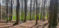
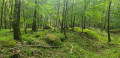
(2) At the airfield, we come across the red square again and continue towards the forest, or rather along the edge of the forest. After the barrier, we turn right, following the markings. At the next T-junction, we turn left onto an unpaved path where wild boars have left their tracks.
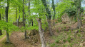
(3) We follow the beautiful path downwards to a stream. We cross this and reach a forest road, which we follow to the left along the edge of the woodland. Immediately after a left-hand bend, we leave our trail marker and follow the OR1 cycle path, which turns right uphill here. We follow the unpaved path until we reach a barely discernible fork.
(4) Look out for the yellow post (marker) here. The Waldenserweg is signposted here – a blue circle on a green wave – which we now follow. Initially straight downhill, before the path becomes steeper, we take the path to the left across the meadow – clearly visible but possibly leading through tall grass. At the edge of the wood, we see the blue circle on a green wave trail marker again, which we follow towards Wembach. After passing a factory building, we turn right; on Pragelatostraße, we turn left.
(5) We pass the Waldensian church on our right, as well as a bus stop. At the next junction, we rejoin the Main-Stromberg-Weg and continue straight on, following the red square ( Zum Hohen Stein). At the second opportunity, we turn right onto the street Im Höhlchen, along which we walk out of Wemberg. The path turns into a gravel forest track.
(6) We reach a garden gate and turn left in front of it; at the wooden bench, we take the path on the right along the edge of the woodland.
(7) At the next signpost, we leave the marked route again, turning right and then immediately left, so that we are walking along a meadow path at the edge of the woodland. At the T-junction, we take the wider path on the left, heading uphill for a few metres. At the next T-junction, we rejoin the Main-Stromberg-Weg and follow it to the right for a short while. Shortly after a bench, we turn left downhill, thereby leaving the red square markings behind. At the first opportunity, we turn right and walk downhill through the woods. At the edge of the woods, we rejoin the Main-Stromberg-Weg, which we follow to the left. The route continues along the edge of the woods.
(8) At a clump of trees, we turn right, cross the meadow, and at the edge of the wood turn left, always following the red square. As soon as we reach the tarmac road, the Mühlweg, we turn right and walk through the linear village of Rodau along Friedrich-Merz-Straße. We reach the main road, which we follow to the left for a few metres, cross it and turn right into Brückenstraße – a narrow footpath along the stream that leads directly into Eckstraße. On the outskirts of the village , we come to Jochertweg, which we follow to the left. In front of a property with a hedge, opposite a wooden shed and right at the fork where there is a wooden bench, the path leads us uphill to the right through the fields towards the woods. We walk along an unpaved track at the edge of the woods until we reach a car park.
(9) At the information board, we join the Alemannenweg and cross the road (Waldstraße). On the other side of the road, we immediately turn left into the woods, climb a few narrow steps, past a shaded bench. A short descent follows; at the first fork, we turn right and head uphill again, even before we have reached the bottom.
(10) At the Eselsbrunnen, we follow the path through the meadow, slightly uphill along the fence, then up the steps towards Lichtenberg, past the fire station.
(11) At the signpost, we turn right towards Lützelbach along the forest road; at a fork, we continue straight on into Lippmannweg, always following the red square. After the last house on the right-hand side, we reach a car park, which we cross diagonally before turning left onto a forest path towards Heuneburg, following the markings. The path climbs steadily; at a fork, it is advisable to leave the Main-Stromberg-Weg and continue to the right along the ‘Path of Stories’. After passing an old wall, we carry on straight ahead and then take a sharp left up the sunken path towards Heuneburg.
(12) We carry on straight ahead, now following the signposts again, and the path takes us down a lovely track, past a transmission mast, until we reach a fork.
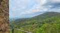
(13) We turn left before the garden fence; the path runs alongside the fence, and at the end of the property we follow the signpost to the right. The path leads through sparse woodland; as soon as we have a clear view, we can see the Neunkircher Höhe opposite, and if you look closely, you can make out the Kaiserturm. After the barrier, we turn left; the path to the right leads to the Hottenbacher Hof snack bar.
(14) Shortly after the Dieter Held Hut, we pass a signpost; the path continues downhill, now on the tarmac road, and at the next junction (with a bench on the left), we turn right and head uphill – the trail markings are unclear here. We are now walking along a gravel forest track at the edge of the woodland again. To our right are pastures and meadows; to our left, a sparse woodland or scattered trees.
(15) We reach a seating area, turn right initially and then continue straight on towards the Kaiserturm and Lützelbach. We follow the gravel forest track into the woods, following the red square markings. At the next fork, which is very confusing, we turn left and head uphill towards Lützelbach; the signpost is directly on our route. As soon as we leave the woodland, we can see Lützelbach ahead of us, and to the left the country road runs parallel to our path. We reach the village via the Lichtenberger Weg; at the entrance to the village there is a striking timber-framed house on the left-hand side. After the ‘Alte Schule’ bus stop, we turn left into Brunnengasse and walk straight towards a half-timbered house.
(16) We reach Brandauer Straße, cross it and leave the Main-Stromberg-Weg behind for good. We follow the road a short distance to the right; at the entrance to the (former) beer garden of the ‘Spitzewirt’, we turn left onto the cycle path. There is also a walkers’ car park here. We now walk along the Quellenrundweg towards Brandau, or rather the L4 walking trail. We cross the country road once more.
(17) At the junction at the edge of the forest, we continue straight on, walking directly towards the hut. At the next fork, we turn right downhill, now following the green-barred trail markers towards Jugenheim. We continue straight on downhill and reach the first houses on the Neunkircher Weg.
(18) In front of house no. 35, we turn left, following the signpost. The path takes us across the meadow, then immediately right again along the hedges and plots of land. We cross a stream, then keep left uphill and follow the green ‘M’.
(19) At the next signpost, we turn right towards Kuralpe. The path now takes us along the eastern edge of Brandau. Before we reach the tarmac road, we turn right, slightly uphill, along the edge of the village. The meadow is always to our right. At the end of the gravel track, we follow the narrow meadow path between the fences. As soon as we reach the road, we turn right – following the green bar – until we reach Odenwaldstraße. Here we turn left and reach the ‘Rathaus’ bus stop. We walk a few more metres towards Ober-Ramstadt, past the beer garden.
(E) We reach our car at the ‘Brandau-Mitte’ bus stop.
 Visorando Member
 Difficult
 Easy
Easy