Country:
 City:




The tour starts at the railway station in Fürth (Odenwald). You can reach this either by train from Weinheim or by bus from Weinheim or Heppenheim.
(S) We walk to the end of the railway track and turn right after the buffer stop, then take the footpath on the left leading uphill. The cobbled path winds its way uphill in an S-bend, running alongside the fence. At the end of the footpath, we cross the zebra crossing and turn left into Schulstraße. We take the first right (Humboldtstraße).
(1) Before house no. 23, we turn left into Am Langen Acker; as soon as we reach the T-junction, we turn right into Steinbacher Straße and are now on the Main-Stromberg-Weg, marked by a red square. We follow the signpost to the left into Kettelerstraße towards the Steinbachwiesen local recreation area.
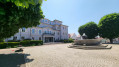
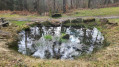
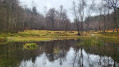
(2) Opposite house no. 27 is the entrance to a car park, a playground and the Steinbachwiesen local recreation area. We take the footpath through the park, passing the Wiesenteich pond on our left.
(3) We reach a balance trail. It’s worth taking a short detour to the stations; otherwise, stay on the path marked with the red square along the stream, which winds upwards in an S-bend. We reach a crossroads; on the right-hand side are a bridge and a small hydroelectric power station; we follow the markings straight ahead along the edge of the forest. We walk along a gravelly forest path on the flat; to our left the woodland rises, to our right the stream. At the end of the wide path, we turn right, cross the stream and reach the houses of Steinbach. We follow the markings along the Trommweg until we have left Steinbach behind us. We follow the tarmac path uphill towards the woodland.
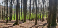
(4) We pass a forest nursery. At the end of the fence, we take the narrow path down to the right and, at the next fork, turn left onto the wide forest track heading uphill, always following the red square. A strenuous climb awaits us, the physical demands of which should not be underestimated. After a long, sweeping left-hand bend, the signpost at the next fork directs us left onto a narrow, beautiful unpaved forest path that climbs steadily but steeply up to the Tromm. At junctions, we always keep going straight uphill, reaching a gravelled forest track on which we continue straight uphill until we have almost reached the top of the hill.
(5) At the Brandschneiderskreuz, our route continues straight on, still climbing gently. As soon as we reach a tarmac road, we follow it to the right.
(6) We pass a small hamlet with a beer garden and a boules court – a lovely, idyllic spot to stop for a break right on the route, provided it’s open. We follow our signposts along Hammelbacher Straße.
(7) We arrive at the Naturfreundehaus Tromm and have reached the Tromm, the striking mountain range of the Hessian Odenwald; we continue straight on, initially along the edge of the forest and then into the woods.
(8) A short detour to the right towards Lindenstein is well worth it. We stick to the red square trail marker and spot an attractive, narrow forest path to our right. After a few metres, we can switch paths, leaving the Main-Stromberg-Weg and continuing along this path.
(9) We reach an information board about the border wall on the Tromm. Shortly afterwards, the view opens out onto the Rhine valley (due to clear-cutting). Several benches invite us to take a break and enjoy the magnificent view. We stay on the path; after a fork, it leads us slightly downhill and we follow trail marker 2. At the next fork, we keep to the right and continue to follow trail marker 2. Straight ahead, at a fork we are approaching, we take the left-hand branch marked with trail marker 2. The path takes us alongside a fenced-off wildlife reserve. At the next junction, we carry on straight ahead, even though the sign for the Trommturm points to the left. We reach a T-junction and turn right, following signpost 2. At the next fork, we leave signpost 2 and turn left onto cycle path WA1 until we reach a forest track, where we continue straight ahead following the signs for the Trommturm.
(10) After climbing the Trommturm, we turn right and follow the path downhill. Shortly afterwards, after about 100 metres, we turn left onto a narrow path into the woods and follow the red square again. At the next T-junction, we turn right; the path is now well and clearly marked.
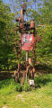
(11) We pass a sculpture paying homage to the Odenwald. From here, the Main-Stromberg Trail continues along the art trail. We follow the red square and, as soon as we leave the forest, we follow the signs for Wald-Michelbach, continuing straight ahead along the unpaved forest track. We walk along the forest track, descending gently all the time.
(12) We reach the Gaderner Hütte and continue downhill until we come to a fork in the path.
(13) We come to a solitary tree in a roundabout. There is no trail marker here; we carry on straight ahead, and the path now leads uphill again. At the end of a small copse, we reach the tarmac forest road, which we follow to the right. A covered rest area is visible ahead of us.
(14) At the Ritterstein signpost, we turn left, continuing to follow the red square, towards Kreidacher Höhe. We follow the tarmac path along the ridge, then head slightly downhill through the woods. We reach a car park with an information board about native songbirds and continue along the Main-Stromberg Trail. We come out onto Kreidacher Höhe road and can see a roundabout a little further down ahead of us. About 200 metres before the roundabout, we take the shortcut – a narrow path across the meadow to the left.
(15) At Kreidacher Höhe, we cross the road to the right of the bus stop and come across the red square again. We continue along the Kunstweg, heading uphill towards the woods. At the edge of the woods, by a bench, we turn left onto a narrow path leading into the woods. At Galgenhöhe, we leave the Main-Stromberg-Weg for good and take the unmarked path to the left, which we follow straight ahead. At a junction, we continue straight on; we reach a wider forest track, which we follow downhill. On our right, we pass a fenced-off property and continue straight on along the track until we reach Forsthausstraße
.
(16) We pass the Überwald Gymnasium; at the next junction, we turn left onto Wetzkeil
. Just before we cross the Überwaldbahn railway line, we turn left (back onto Forsthausstraße
) but immediately keep to the right. We follow the path through the houses, turn right again at the fork and reach Am Bahnhof
, which we follow as far as the Solardraisinenbahnhof ((17)).
(17) We walk along Am Bahnhof to the next junction, turn left into Schwalbengasse and then immediately right into Poststraße, past the drinks distributor. Before the traffic lights, by the DHL branch, right next to the Ulfenbach, we turn left onto the Draisinenrundweg. We pass the Einhaus and reach the pedestrian zone, turning right into In der Gass.
(E) We follow Ludwigstraße to the left and, after a few hundred metres, reach the Wald-Michelbach central bus station (ZOB).


 Visorando Member
 Easy
 Difficult