Country:
 City:
City:


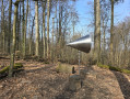
Start: You can reach the starting point by taking HEAG mobilo tram line 6 or 8 to the Malchen stop. Departure times can be found at https://heagmobilo.de/de/fahrplaene.
If you’re travelling by car, you can park directly opposite the tram stop at Malchen Cemetery.
(S/E) At the tram stop, we turn north; that is, to our right the path leads uphill towards the woods, whilst to our left is the wide Heidelberger Straße and the cemetery. We cross Frankensteiner Straße and continue straight on along Dieburger Straße, initially following the signposted Blütenweg (yellow ‘B’).
(1) At the edge of the woodland, we leave the Blütenweg and turn right at the car park (private) towards the youth centre. Here, we follow the yellow ‘1’ sign for a few metres up the gravel path, passing a wooden bench on the right-hand side, then leave the yellow ‘1’ and follow the narrow path uphill, which is quite steep. On the right-hand side is a fenced-in paddock and a beekeeper’s hive. We eventually cross the yellow ‘1’ hiking trail and continue uphill along a left-hand bend until we reach a barrier.
(2) We cross the track and continue up our path until we spot a tree with an orange arrow.
(3) We follow the direction of the arrow to the right and walk uphill through the gully. A mountain bike trail crosses our path; we continue to follow the orange arrow along an inconspicuous narrow path, which, however, becomes clearly visible after a few metres.
(4) Trail junction: Here we follow the orange trail to the right and uphill again. At the next confusing fork, we come across the signpost marked with two green horizontal bars. We follow this signpost to the left and uphill, also in the direction of the orange arrow, until we reach the next trail junction with a signpost pointing straight on towards Frankenstein Castle.
(5) We join the Burgensteig (signposted with a blue castle) and leave the orange arrow route. We take the only narrow path at this junction, which leads us straight on, following the sign showing two green bars and a blue castle, further uphill towards Frankenstein Castle. We reach a small sea of rocks just below the castle grounds.
(6) Here we turn right; the path takes us along the base of the castle through a herb garden.
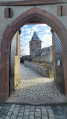
(7) Finally, we reach the entrance to the castle courtyard and the castle tavern. The rear exit of the castle may be open, in which case we rejoin our route. If not – as was the case for me – we walk along a tarmac road, reach the castle car park and walk along the back of the castle on a narrow path, past the rear entrance, back to the fork in the path at the small rock formation.
(6) Now we take the right-hand fork and follow the red-barred signpost (Odenwald–Vosges long-distance hiking trail), which immediately branches off to the right again. The path now leads us downhill and we come across various stations along the Frankenstein Forest Adventure Trail.
(8) We follow the Frankenstein Forest Adventure Trail down a few steps, keep to the right at the tree clock and head towards the table-and-bench combination, but not without first making a short detour to the canopy.
(9) We head back to the rest bench and follow the red bar or yellow ‘3’ trail markers straight ahead on the so-called ‘Himmelsleiter’ (Heaven’s Ladder), initially downhill. At the next fork, we leave both trail markers behind and continue straight on. To our right is a forest hut with an outdoor toilet. We ignore three turn-offs, pass the hilltop and the path now descends steeply.
(10) At the next fork, we leave the ‘Himmelsleiter’ and thus our signposts behind, and opt for the wider path to the right, which we follow until the next junction with a wide track. Here we take a sharp left-hand bend and follow the slightly wider path downwards. We reach another junction with a gravel forest track, which we follow to the right and downwards, following the yellow ‘3’ signpost.
(11) We pass steps on both the right and the left. Here, the ‘Himmelsleiter’ crosses our path; we continue walking moderately downhill on the yellow 3. At the next junction, we turn left (Oberer Brömsterweg); at the following junction, we turn right, always following the yellow 3 until we reach a fork with a tree stump in the middle.
(12) We keep slightly to the left, reach a wider path, turn left here too and spot our yellow 3 sign again; we ignore all side paths for the time being and reach a barrier near a road.
(13) We cross the road, walk briefly to the left and, at the car park, turn left onto the ‘Yellow 1’ footpath. After a gentle S-bend, we follow the narrow path to the left and leave the ‘Yellow 1’ route. At the next fork, we take the narrow path to the right uphill until we reach the unpaved forest track, which we follow to the left. We are back on the Blütenweg and the yellow 1 trail.
(1) We reach the crossroads below the youth centre once more; we now follow the yellow ‘B’ sign on the Blütenweg to the right and walk back along Dieburger Straße on the familiar route to the end point of the tour (S/E)



 Visorando Member
 Moderate
 Difficult