Country:
 City:
City:


The starting point for this walk is Kölpinsee railway station, which can be reached via the Usedomer Bäderbahn (UBB).
There are also car parks here for those travelling by car.
(S) We leave the station via the footpath alongside the railway tracks, cross them at Strandstraße and follow this road past the spa gardens and several rehabilitation clinics, passing a souvenir shop on the right.
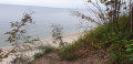
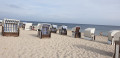
(1) We continue walking to the jetty at Kölpinsee. Back on Strandstraße, we walk on to the beach and head left along the sand by the water’s edge. We follow this path until we reach the second flight of steps.
(2) Here we leave the beach and climb the many steps. Once at the top, we take the first recognisable small path to the right, which we follow until we reach a fork in the path. Here we come across the Baltic Sea Coast Cycle Route – caution: heavy traffic – which we follow for a few metres.
(3) At the information board for the ‘Amber Witch’, the cycle path and footpath separate again, and we continue along a narrow path, ignoring all turnings until we reach Streckelsberg with its viewing platform.
(4) This is a good spot for a short breather. We carry on our way, following the footpath again until we rejoin the Baltic Sea Coast Cycle Route, which we follow to the right. There are a few houses on the left; we stay on the wide cycle/footpath.
(5) We reach a rest area. Shortly afterwards, we leave the cycle path again and take the narrow path that branches off to the right here.
(6) We pass some bars and carry on straight ahead along the path, again ignoring any turn-offs until we reach a junction. Here, we keep slightly to the right and walk the few metres downhill to sea level.
(7) We reach the Koserow salt hut and take a stroll round it, past smoked fish stalls and other stalls, before continuing on our way from the promenade.
(8) After a detour to the end of the Koserow pier, we continue along the beach by the water’s edge.
(9) At passage 6M, we leave the beach and take the narrow path through the dunes. We cross the main road (caution: no traffic lights, no zebra crossing and the road is busy), then the UBB railway line, and find ourselves right at the entrance to Otto Niemeyer-Holstein’s garden and studio.
(10) We walk round the building clockwise, cross the stream via a footbridge and continue our walk along the Achterwasser.
(11) We leave the Achterwasser, as the dyke path is officially closed, and follow the footpath to the left towards the Damerow forester’s lodge. At the next fork in the path, we take the narrow path to the right and carry on until we reach a wooden bench.
(12) Here we turn left and follow the unpaved forest track along the edge of the woodland until we reach a tarmac path. We follow this to the right along the railway tracks. With Koserow station in sight, we cross the railway line and walk the last few metres to the right to the platform.
(E) Here, we board the train back to Kölpinsee.
 Visorando Member
 Moderate