Country:
 City:
City:


The start and end point of this circular walk is Fischerweg, near the car parks of the Hotel Villen am Park in Bansin. There are also public car parks on Fischerweg, some of which are subject to a charge.
Public transport: take the UBB to Bansin Seebad, cross the Ahlbecker Chaussee here (opposite Lidl), then follow Seestraße and turn left into Fischerweg after about 150 metres.
(S/E) We start on Fischerweg – to the left of the road there is a narrow footpath, which we follow northwards (the hotel car park is to our right). Immediately after the last building on the right-hand side, opposite the sign for the Evangelical Church, we turn left onto a forest path. In the hollow, we reach a crossroads and follow the path to the right until we reach a signpost. Here, we follow the ‘Naturlehrpfad’ signs and continue straight ahead, following the green diagonal bar trail marker. We ignore all turn-offs until we reach another signpost. Here, we keep slightly to the right and briefly leave our marked route.
(1) Shortly afterwards, at the Wolfskuhle, we rejoin our trail markings and follow the nature trail, which turns right at the next T-junction, until we reach the next junction.
(2) We turn diagonally half-left, following the signpost for ‘Forsthaus Langenberg’, onto a narrow path that leads us slightly downhill through the beech forest. We cross an unpaved forest track (not shown on the map!), continue along the narrow path, past the information board on native mammals. A short while later, we cross the gravel forest road, where there is a sign for Mümmelkensee. Our path initially climbs a few metres and, shortly after the highest point, we pass a fenced-off drinking water protection area on our left. At the next junction, we turn left and follow the nature trail. The path descends somewhat more steeply.
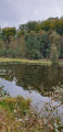
(3) We come to a covered rest area. Here in the hollow, we follow the nature trail signposting to the right. At the next junction, we pass a signpost; we continue straight on towards Ückeritz – this is the path to the lake. At another information board for the nature trail, we leave the nature trail, which turns left here. We continue straight on. To our left lies marshland, heralding Lake Mümmelken, which we reach a short while later.
(4) We continue walking along the lake and eventually rejoin the nature trail, which joins from the left. We now follow this path straight on, slightly uphill through a beech forest. At the next junction, with a litter bin in the centre, we carry on straight ahead, following the green diagonal bar. The path leads downhill and we cross the Baltic Sea Coast Cycle Route. Take care – there are a great many cyclists here. We then reach a rest area with a shelter.
(5) To the left of the shelter, we turn right into the woods, following the signs for the ‘Steilküste’ (cliff coast). The narrow path is already sandy and leads uphill. Just before reaching the top, we come to a fork and turn left, heading uphill to a viewpoint.
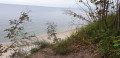
(6) This short detour offers magnificent views of the cliffs, but we walk back down the few metres and then continue straight on, with the cliffs to our left. The path leads slightly uphill and downhill over roots, steps and sand, and is somewhat challenging. We reach a bench with a great view.
(7) The path continues straight ahead, slightly off to the side, along the cliffs, past the Langen Berg, and we eventually reach the Langenberg forest lodge.
(8) This is the highest-altitude hotel in Bansin. The path first leads slightly to the right, then down to the left. At junctions, we always keep to the left, as close to the coast as possible. To our right, we soon spot a tarmac road – this is the East Coast Cycle Route again. Shortly afterwards, we reach a flight of steps leading down to the beach.
(9) Here we head down to the beach and walk along the promenade to the right towards the Bansin pier until we reach the Haus des Gastes.
(10) It’s well worth taking a short detour onto the Bansin Pier before we continue along the beach promenade.
(11) At the band shell, we turn right into Seestraße and, at the next junction, immediately left into Bergstraße, where we can see Schloonsee on our right. We follow the signs for ‘Schloonseeidyll’ for a short distance along the lakeshore.
(12) We return to Bergstraße via the access road to Café Schloonidyll and walk a few more metres along it. At the Sackkanal, we take the footpath to the left towards the Baltic Sea and rejoin the beach promenade, which we follow to the left as far as the band shell.
(11) We turn left onto Seestraße and walk to the second junction. Here, we turn right onto Waldstraße; before a patch of woodland, we turn left, then continue straight on after the woodland, and at number 42, we take the footpath into the woods. After about 100 metres, we come to Fischerweg, which we follow to the left back to our starting point.
(S/E) We have reached the car park behind the Hotel Villen im Park.

 Visorando Member
 Moderate