


cnu25

 Visorando Member
 Premium user
- Gender: woman
Sign up:
Published route(s)
 Circular route around Pédernec from Kernévez Jaudy via Guénézan and Rumodu
 8.98 mi
 +322 ft
 -344 ft
 4h 25
 Moderate
 Departure from Pédernec (Côtes-d'Armor)
This easy circular route, starting from the hamlet of Kernévez Jaudy in Pédernec, will take you through the surrounding countryside along various paths linking the different hamlets on either side of the four-lane road connecting Guingamp to Lannion. You’ll be able to admire the Chapel of Lorette and the church at Pédernec, as well as a few wayside crosses adorning the crossroads, whilst walking along the banks of small streams and the River Jaudy will offer you a refreshing break.
The Pergat Menhirs and the Koad Bré Wood
4.89 mi
+240 ft
-233 ft
2h 25
 Easy
Departure from Louargat (Côtes-d'Armor)
This short, easy walk takes you through the Louargat countryside to discover the two menhirs of Pergat, one of which is among the largest in Europe. You’ll follow the Ruisseau du Frout through its valley, which can be quite damp in places, before reaching the hamlet of Manaty. From there, you’ll head into the Koad Bré Forest at the foot of Ménez Bré before reaching Louargat via some lovely forest paths.
Circular route from Saint-Hernin to the Kerlosquer viaduct along the banks of the Trieux
6.34 mi
+505 ft
-486 ft
3h 20
Moderate
Departure from Ploumagoar (Côtes-d'Armor)
Just a stone’s throw from Guingamp, explore the south-western countryside of Ploumagoar, starting from Saint-Hernin. From wild valleys to country lanes, make your way to the right bank of the Trieux, where the river is still somewhat torrential, then visit the Kerlosquer Viaduct, which bears a passing resemblance to the ‘Bridge on the River Kwai’. Then enjoy the centre of Saint-Hernin with its beautifully restored heritage.You’ll have no trouble at all on this route, which combines all sorts of paths and offers you, by turns, lovely shelter beneath the canopy of trees and completely unobstructed views of the surrounding countryside.
Circular route around Locquirec via Île Blanche and Les Sables Blancs
10.08 mi
+581 ft
-607 ft
5h 10
Moderate
Departure from Locquirec (Finistère)
This easy hike will take you from one side of the Locquirec headland to the other, following the left bank of the Douron estuary, then through the countryside, vegetable fields and pretty valleys hiding small streams, until you reach the north-western coast of the headland. The GR® 34 offers beautiful views from the rocky points of Corbeau and Château. You will also walk along beautiful beaches, such as Sables Blancs, Porz Biliec and Fond de la Baie, where you can walk along the shore as you please, depending on the tide. You will also pass through part of Locquirec, where you can admire the church, the narrow streets, the small harbour and the seafront, which you will follow to the end.
Circular route around Trémuson via Les Mines
6.40 mi
+587 ft
-600 ft
3h 25
Moderate
Departure from Plérin (Côtes-d'Armor)
This circular route around the village of Trémuson will first take you along the outskirts of the village via major tarmac roads, then dirt tracks and forest paths will guide you alongside streams and the Gouët, eventually leading you higher up to the site of the old mines.
Circular route around Ploumagoar via Saint Hernin and the Bois de Kergré
5.77 mi
+262 ft
-249 ft
2h 55
Easy
Departure from Guingamp (Côtes-d'Armor)
This easy circular trail runs around Ploumagoar, winding through the countryside and valleys of small streams, the pretty Bois de Kergré with its contemporary statues and its well-maintained path, ideal for strolling and relaxing.
Between these two natural areas, a few more "urban" paths will take you to Sait-Hernin with its picnic area located next to the spring, the wash house and the recently renovated bread oven.
Circular route in Plestin-les-Grèves from Saint-Efflam to Sainte-Barbe and the Grand Rocher.
8.21 mi
+830 ft
-814 ft
4h 30
Moderate
Departure from Plestin-les-Grèves (Côtes-d'Armor)
This beautiful circular walk is divided into two parts.
The first part follows the customs officers' path and runs along the seafront, passing numerous viewpoints, headlands and beaches until it reaches the banks of the Douron estuary.
The second part winds through the countryside of valleys and hamlets, revealing pretty manor houses before reaching its climax at the seaside, at an altitude of 84 metres, at the top of the Grand Rocher, which offers an exceptional view of almost the entire bay of Lannion and the Plestinaise countryside.
Circular route around Plouisy from the shooting range to Kernabas Mill
6.09 mi
+282 ft
-282 ft
3h 05
Easy
Departure from Plouisy (Côtes-d'Armor)
This easy hike will allow you to discover the countryside around Plouisy, the village and the surrounding wild valleys. You can also enjoy the beauty of the Moulin de Kernabas (or Kernabat, depending on the map and signposts!) or the grounds of the Cours Sainte-Anne and Kernabas Castle or Saint-Antoine Chapel. At the starting point, you will find a picnic area with tables and sports equipment, perfect for ending a beautiful day in the great outdoors.
Circular route around Plougonver
6.37 mi
+358 ft
-358 ft
3h 15
Moderate
Departure from Plougonver (Côtes-d'Armor)
This easy, short walk takes you through the countryside around the village of Plougonver. You will follow pretty forest and farm tracks, passing through typical hamlets. You will discover magnificent landscapes, particularly after Kermaçonnet as you head towards Ménez Kerespers. In the village, you can also visit the Museum of Old Trades (free admission) next to the entrance to the famous Menou biscuit factory.
Circular walk in Plouézec from Boulgueff beach to Pointe de Minard
8.85 mi
+948 ft
-942 ft
4h 55
Moderate
Departure from Paimpol (Côtes-d'Armor)
This lovely circular walk offers beautiful views of Paimpol Cove and its rocks, then at Pointe de Minard, a stunning view of the Plouha cliffs. You can admire the beautifully restored Craca Mill, the pretty Port de Port Lazo where you can stroll along the beach and, further on, enjoy free access to the statue park. The famous Porz Donan steps will take you to Pointe de Minard. The return journey will take you from hamlet to hamlet along paths that are often agricultural and through very wild valleys.
Circular route in Tréglamus, from Kermadec to the Kermoda Cross
7.19 mi
+325 ft
-312 ft
3h 35
Moderate
Departure from Tréglamus (Côtes-d'Armor)
This is a lovely, easy little walk in the countryside around Tréglamus. You will pass from one hamlet to another, travelling along a wide variety of paths (sunken, white, forest, grassy and a little tarmac) and landscapes (forests, stream banks, fields, pastures, etc.).
Circular route to Maël-Pestivien via Le Loc'h and La Chaire des Druides
7.95 mi
+531 ft
-522 ft
4h 05
Moderate
Departure from Maël-Pestivien (Côtes-d'Armor)
This circular walk around Maël-Pestivien will take you to several megalithic sites such as the Roch Du Dolmen and the Chaire des Druides, as well as a few local heritage monuments such as the Saint-Isidore and Loc'h chapels. You will walk along various paths, including farm tracks, white roads, forest trails and tarmac roads.
Circular route around the Étang de Kerné Uhel via the Chaos de Toul Goulic
10.21 mi
+302 ft
-292 ft
4h 55
Moderate
Departure from Lanrivain (Côtes-d'Armor)
A lovely circular route around the Étang de Kerné Uhel along the left bank of the Blavet, then along the river through the Chaos de Toul Goulic. The return route, following a pretty stream, will take you back to the hydroelectric dam, then along the right bank, round the Goz-ar Hand peninsula before reaching the bridge and the car park. You’ll also have the pleasure of spotting a wide variety of birds and many remarkable trees.
⚠️15/09/2026: Route modified between points 6 and 8.
Circular route in Plouha, from Palus to Gwin Zégal
5.18 mi
+817 ft
-820 ft
3h 05
Easy
Departure from Plouha (Côtes-d'Armor)
A lovely hike starting from Palus Beach, which will take you along the customs officers' path to the Port of Gwin Zégal with its distinctive mooring posts, which are almost unique in the region. The passage through Pointe de Plouha and Le Pommier offers magnificent views of the coast and the highest coastal cliffs in Brittany. The return journey is along rural roads through various typical hamlets and beautiful forest paths.
Circular route from Saint-Michel-en-Grève to Locquémeau
7.80 mi
+574 ft
-564 ft
4h 05
Moderate
Departure from Trédrez-Locquémeau (Côtes-d'Armor)
This circular route starting from Toul ar Villin will take you to the Port of Locquémeau and Pointe de Séhar via rural paths in the bocage countryside around Trédrez-Locquémeau. Take the time to stroll around the harbour and walk around Pointe de Séhar. If the tide allows, venture onto the sharp rocks and climb up to the place known as "Le Château". The return journey is via the GR® 34 coastal path, passing through Beg an Evned, the cliffs of Trédrez and Beg ar Forn.
There are no particular difficulties on this excursion between land and sea, except for the hilly terrain of the coastline.
Circular Pédernec, from Kernévez Jaudy to Ménez Bré
8.50 mi
+719 ft
-712 ft
4h 30
Moderate
Departure from Pédernec (Côtes-d'Armor)
This circular walk in the Pedernecoise countryside will take you to the summit of Ménez Bré, the highest point in Trégor at an altitude of 302 metres. At the foot of the Saint-Hervé Chapel, you will have a 360° view of the Guingamp region and the Pink Granite Coast to the Monts d'Arrée. Apart from the fairly steep climb to the summit, you will encounter no difficulty on this hike. Choose a sunny day to enjoy the most magnificent view possible.
Circular between Kernévez Jaudy and Tréglamus
8.79 mi
+472 ft
-469 ft
4h 25
Moderate
Departure from Pédernec (Côtes-d'Armor)
A beautiful hike between Pédernec and Tréglamus on different types of paths. You will walk through the countryside, passing pretty hamlets and isolated farms, mainly on PR® or GR® trails. Between the views of the Ménez Bré summit and the wind farms, you will encounter no difficulty on the route, except for a few slightly damp sections, depending on the season, in the sunken paths.
Circular walk in Lemuy: the sources of the Roche and the Montorge stream
9.01 mi
+607 ft
-600 ft
4h 40
Moderate
Departure from Lemuy (Jura)
A lovely forest walk in the Joux State Forest, taking you through part of one of France’s most beautiful spruce forests. From the outskirts of Lemuy, you’ll reach the meadows of Villers-sous-Chalamont, then the source of the Roche at the foot of the viewpoint, followed by the source of the Ruisseau de Montorge and its picturesque setting with a waterfall emerging from an imposing cirque. Beautiful forest tracks and a lovely path will take you back to your car park.
To make the most of the rocky and rugged landscapes around both springs, it’s best to do this walk after a spell of rain so you can admire the waterfalls. In winter, when temperatures drop below freezing, ice will glisten all over the rocks and form magnificent stalactites along the cliff face, making this site even more spectacular.
Circular walk from Dournon to Sainte-Anne and the Pont du Diable
7.83 mi
+840 ft
-830 ft
4h 20
Moderate
Departure from Dournon (Jura)
This short, easy circular walk will take you from the hamlet of l’Entrepôt (Dournon) to Sainte-Anne and the famous Pont du Diable, which you can even admire from the bank of the Ruisseau de Château Renaud – the stream it spans – whilst following the small path leading to it. Before that, you’ll have passed through the quaint little village of Sainte-Anne with its street signs written in two languages: French and Arpitan, the local dialect. The return journey takes you through the lovely Chalème Forest with its beautiful forest lanes.
Circular Fontain to La Chapelle des Buis
 4.92 mi
+492 ft
-482 ft
2h 40
Easy
Departure from Fontain (Doubs)
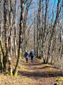
This easy circular route through woods and meadows will take you from the outskirts of Fontain to Notre Dame de la Libération, its crypt and its magnificent view of Besançon, the first plateau and the first peaks of the Jura. You will also discover the chapel of Notre Dame des Buis and a gentle return via the wild Mercureaux valley.
Circular Landresse loop to the Bougeottes cave
9.37 mi
+676 ft
-656 ft
4h 55
Moderate
Departure from Landresse (Doubs)
This lovely walk will take you around the village of Landresse and its surroundings, visiting the places dear to Louis Pergaud and described in his famous novel *La guerre des boutons*. From the Saute quarry, via the Gros Tilleul and Lebrac’s house, you’ll head towards the Grotte des Bougeottes (and its engraved stone) and the cross at the viewpoint.
From there, you’ll head back down through the Tuchevey woods, the Grand Teurey and the hut from the novel, rebuilt by the village children.
The return journey via the Grande Sommière back to your car will bring this walk—steeped in nostalgia for those who have read the novel—to a close.
Don’t say, like P’tit Gibus, “If I’d known, I wouldn’t have come” – you know the drill, so off you go!
A hiking app or GPS is recommended.
The Gratteris circular route via the Saint-Maximin Chapel, Les Roches and Mamirolle
6.79 mi
+738 ft
-745 ft
3h 45
Moderate
Departure from Le Gratteris (Doubs)
A walk with no particular difficulties, passing through beautiful forests where forestry work has, in places, left the paths a little rough. You’ll pass through the lovely site of the Saint-Maximin Chapel, then the Roches viewpoint will offer you a view over much of the plateau. You’ll then walk along a lovely forest track that will take you to the outskirts of Mamirolle. The return journey takes you through meadows and along the edges of the woods. Perhaps you’ll be lucky enough to spot some chamois in the pastures behind Le Gratteris or near the rocks? You can also visit the arboretum before enjoying the chapel grounds and their wooden tables, which are perfect for a rest.
The GPX track may prove useful.
Circular Thise through the Coutelot and Ban woods
7.61 mi
+597 ft
-594 ft
4h 00
Moderate
Departure from Thise (Doubs)
On the outskirts of Besançon, this entirely woodland hike will take you from the outskirts of Thise to the summit of the Côte de Marchaux via the aptly named Sentier des Dolines, then along various roads and tracks to reach the highest point of the route. The return journey along the ridge line and then along some lovely paths presents no difficulty.
Circular Larnod route via Fort de Pugey, Arguel Castle and Valmy
5.65 mi
+932 ft
-909 ft
3h 25
Moderate
Departure from Larnod (Doubs)
This short but intense hike will take you to a series of historical sites, including the military fort at Pugey, the ruins of Arguel Feudal Castle and the Valmy Monument, a memorial to the members of the Guy Mocquet resistance group who were shot at the citadel, as well as natural sites such as Malpertuis Cave, the Arguel Castle viewpoint, the viewpoint towards the Chère cave, the surprising Roche Trouée in the Martelin woods and finally the Valmy Monument viewpoint, which overlooks Besançon and the entire valley, from the Vosges to Burgundy.
Montgesoye circular walk via the Thuyère viewpoint and the Vau Waterfall
10.96 mi
+1,188 ft
-1,191 ft
6h 05
Moderate
Departure from Montgesoye (Doubs)
This lovely walk will take you through orchards and woods on the hillsides above the charming village of Montgesoye. From the Thuyère viewpoint, a superb panorama of the Loue Valley opens up before you, then, along the hillside, you’ll reach the seasonal waterfall of La Petite Pisse and the wild valley of the stream before arriving at a footbridge, which offers you the chance to walk along the banks of the Ruisseau de Vau to its beautiful waterfall for a refreshing round trip.
Circular route from La Sagne to Mont Racine, Tête de Ran and Vue des Alpes
11.39 mi
+2,051 ft
-2,031 ft
7h 00
 Difficult
Departure from La Sagne (Canton of Neuchâtel)
A superb walk in the hills above Neuchâtel, starting from La Sagne, a peatland area. You’ll first follow a path lined with dozens of statues carved directly into the trees by a local sculptor. The multitude of small paths leading from one statue to the next will make you forget the incline. You will then reach the day’s highest point at Mont Racine, with its view over the whole of the Swiss plain and, in the distance, the Alps.Depending on the season, you may spot a herd of yaks near the Grandes Pradières. The path will then take you to the summit of the Tête de Ran, and on to La Vue Des Alpes. The return journey follows excellent paths or crosses the mountain pastures, ending in a beautiful wooded valley bordering a lovely little stream.
Circular Athose to La Roche de Hautepierre
 7.90 mi
+1,201 ft
-1,201 ft
4h 40
Moderate
Departure from Athose (Doubs)
This relatively easy walk (apart from the climb up to the Roche de Hautepierre) will take you through the new commune of Les Premiers Sapins, between the villages of Athose and Hautepierre-le-Châtelet. Through woods and meadows, you’ll reach and pass through Hautepierre before climbing to the summit of the famous Roche de Hautepierre, which rises to an altitude of 881 metres. A breathtaking 360° panorama will allow you to take in the Loue valley, the Doubs plateaus and the first peaks of the Jura mountain range.You’ll return to the starting point by following the Ruisseau d’Athose gorge upwards through beautiful high forests, which provide welcome shade should the sun become a little too hot.
Les Rousses via the Creux du Croue, Le Noirmont and Mont Sâla
12.06 mi
+2,713 ft
-2,703 ft
7h 55
Difficult
Departure from Les Rousses (Jura)
A beautiful hike across the Swiss peaks bordering the frontier, offering spectacular views of Lake Geneva, the Lake Geneva basin and Mont Blanc, weather permitting. A steep climb takes you to the magnificent site of the Creux du Croue; continuing the ascent, you reach the summit of the Noirmont des Francais, and further on, the Noirmont.
A long descent through the ski slopes will take you to the other side of the mountain, where you’ll begin a long climb through the mountain pastures. After passing several farms, a short detour to Mont Sâla will reward you with a wonderful panorama.
After a brief stop at the curious Creux de la Neige, the return journey halfway up the slope, passing various farms, will offer you views of Lac des Rousses and the village of Bois d'Amont.
Tour of Lake Joux from Le Pont
14.08 mi
+545 ft
-531 ft
6h 55
Difficult
Departure from L'Abbaye (Vaud)
A beautiful but long walk around Lac de Joux with no difficulty apart from a short climb to go round a small cliff plunging into the lake. You walk along exceptionally well-maintained paths, with the verges mown. You cross the protected wetlands on raised boardwalks. Benches placed at regular intervals along the path, and magnificent log-built picnic tables surrounded by barbecues, invite you to take a break and admire the view. After a short climb and a walk through a small housing estate, the scenery changes as you cross summer pastures and spruce forests, where you may encounter various groups of chamois, which are not shy provided you remain quiet and unobtrusive.
Circular Alliés route via the Côte du Cerf and Les Grands Cernets
11.53 mi
+1,716 ft
-1,736 ft
6h 50
Moderate
Departure from Les Alliés (Doubs)
A beautiful Franco-Swiss walk that will take you from the Ruisseau des Étraches valley to the Côte du Cerf, then through a succession of Swiss mountain pastures and beautiful coniferous forests, you’ll pass lovely summer farms, cross the hamlet of Les Cernets to reach the ridge and descend towards the Ruisseau des Entreportes valley before crossing the border again and traversing the Étraches valley to return to the village of Les Alliés.
Weather permitting, you’ll be treated to lovely panoramic views of the Swiss plain and, perhaps, the Alps in the distance.
The Dames des Entreportes circular route via Le Larmont and Les Cernets
12.51 mi
+2,083 ft
-2,087 ft
7h 35
Difficult
Departure from Pontarlier (Doubs)
A beautiful Franco-Swiss walk starting from the picturesque site of Les Dames des Entreportes. From Larmont mountain, you’ll enjoy sweeping views of the Jura range and the Alps if the weather is ideal. After crossing magnificent mountain pastures and crossing the border, you’ll pass through Swiss hamlets and farms before returning to French territory and continuing your walk through the wild Vallon des Etraches.
Circular Creux du Van route via Ferme du Grand Vy and Fontaine Froide
7.80 mi
+1,811 ft
-1,831 ft
5h 10
Moderate
Departure from Noiraigue (Canton of Neuchâtel)
This beautiful hike in the Swiss Jura mountains will take you along the renowned Sentier des Quatorze Contours to the magnificent Creux du Van cirque with its steep cliffs, home to a herd of around twenty ibexes, which you’re almost certain to spot provided you keep a safe distance from them.
Pass the summit of Mont Soliat before reaching the Grand Vy farm and restaurant and beginning your descent.
You’ll then walk along the foot of these magnificent cliffs to the aptly named Fontaine Froide, before reaching the Ferme Robert – a seasonal relaxation area – and returning to your car park, your eyes still filled with images of this spectacular landscape.
Circular walk above Fuans via La Queugne and the Virgin of La Vauselle
7.67 mi
+945 ft
-912 ft
4h 20
Moderate
Departure from Fournets-Luisans (Doubs)
This lovely walk, almost entirely through woodland, takes you through the forest between Fuans and Grandfontaine-Fournet along beautiful forest paths. You’ll walk past the Boussière goat farm to reach the site of the Vierge de la Vauselle; on the way back, you’ll cross the stunning Gipandol ravine, and through lovely clearings in the vegetation, you’ll be treated to beautiful views of Fuans and the Val de Consolation.
Circular La Dôle from Les Dappes via Le Vuarne and Couvaloup de St-Cergue
8.50 mi
+2,116 ft
-2,096 ft
5h 45
Moderate
Departure from Prémanon (Jura)
This beautiful hike will take you to the summit of La Dôle at an altitude of 1,677 metres, where you can enjoy breathtaking views. A steep path through the mountain pastures will lead you to this unmistakable peak with its dome housing the Geneva airport radar. On the descent, you will no doubt see herds of chamois frolicking in the scree below the summit ridge. The rest of the route takes you along dirt tracks, roads and grassy paths over much less rugged terrain, but often offering magnificent views.
Conliège circular route via the viewpoints and tunnels
 7.80 mi
+1,627 ft
-1,601 ft
5h 00
Moderate
Departure from Conliège (Jura)
This lovely, easy walk will take you to the Conliège hermitage and then, via forest paths, to various viewpoints overlooking Lons-le-Saunier and the Revigny valley. The return journey follows the greenway and passes through various viaducts and tunnels (including the famous 100-Step Tunnel, which you can choose to visit and walk through on the way there and back).
Circular walk around the Pic de l’Aigle, the viewpoints and Lac de Bonlieu
 11.35 mi
+1,654 ft
-1,637 ft
6h 40
Difficult
Departure from Le Frasnois (Jura)
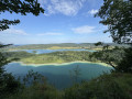
A superb walk offering magnificent views of the lake district, with numerous vantage points. Much less crowded, the stretch between the village of La Chaux-du-Dombief and Lac de Bonlieu offers the peace and tranquillity of the forest. The return route along the lakeshores is easier on the calves, but incredibly beautiful, especially at the end of the day during the golden hour. As you walk along the ridges skirting the shores, your eyes will be treated to a variety of colours and light, and a wide range of landscapes.
Circular walk around the Langouette Gorges via the Col du Gyps
6.52 mi
+689 ft
-663 ft
3h 35
Moderate
Departure from Les Planches-en-Montagne (Jura)
A lovely walk with no major difficulties, offering a chance to discover the Langouette Gorges and its magnificent waterfalls via a well-maintained and safe path. After passing through the village of Les Planches-en-Montagne, you’ll reach Chaux des Crotenay via forest paths and the route over the Col du Gyps.
Circular Loop of the Échelles de la Mort via Le Refrain and the three belvédères.
 8.67 mi
+1,857 ft
-1,857 ft
5h 35
Moderate
Departure from Charquemont (Doubs)
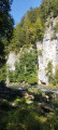
Superb hike in the Doubs Gorges offering magnificent panoramic views of the gorges and the surrounding Swiss Jura peaks. To get there, you will need to pass through the famous Échelles de la Mort, which are impressive but relatively easy to climb. Once you reach the ridge, you will go from the Cendrée viewpoint to the Vieilles Femelles viewpoint via the Crampoulotte viewpoint, before descending to the banks of the river via the magnificent Charbonnière du Haut site. The return journey is along a bucolic path with a pretty waterfall at the Ulysse bridge.
Circular walk around Lac à la Dame from Les Planches-en-Montagne
9.59 mi
+1,112 ft
-1,099 ft
5h 25
Moderate
Departure from Les Planches-en-Montagne (Jura)
Please note: the path is closed due to forestry work between waypoints (14) and (16) (September 2026).
A lovely walk starting from Les Planches-en-Montagne which, through a variety of landscapes, will take you to the shores of Lac à la Dame, then to the summit of Crêt Pelé, where you’ll enjoy a 360° panoramic view. You’ll cross some beautiful communal meadows to reach Fort du Plasne and, through a lovely forest, the outskirts of the village of Entre-Deux-Monts. Beautiful high forests, large peat bogs, dry grasslands and superb wooded meadows will delight those who appreciate stunning and diverse vegetation.
Circular route around Malbuisson via Fort Saint-Antoine and Montperreux
9.07 mi
+928 ft
-912 ft
5h 00
Moderate
Departure from Malbuisson (Doubs)
A lovely circular walk above Malbuisson that will take you to Fort Saint-Antoine (or Fort Lucotte), one of the sites where Comté cheese is matured. From there, through meadows and mountain pastures, and through the woods, you’ll reach the borders of Touillon and Loutelet with a superb view of the peaks of the Swiss Jura, the Mont d’Or and the resort of Métabief, and, weather permitting, Mont Blanc. After reaching Montperreux, you’ll walk along pleasant paths with views of Lake Saint-Point and the village of Chaudron.
Please note: some sections can be tricky to navigate; as a precaution, we recommend using the app or a hiking GPS.
Circular path in the Moidons Forest at Valempoulières
8.98 mi
+778 ft
-787 ft
4h 50
Moderate
Departure from Pont-d'Héry (Jura)
This easy walk, which takes place almost entirely in the forest, will take you through magnificent fir forests and beautiful deciduous woodlands. You’ll also enjoy lovely views of the iconic Mont Poupet, and, in the opposite direction, of Mont Rivel and the Haut Jura mountain range.
You’ll also pass through beautiful fields of sharp limestone pavement, typical of the region.
Circular route along the Poligny corniche and Chamole wind farm
 9.23 mi
+886 ft
-883 ft
5h 00
Moderate
Departure from Buvilly (Jura)
A beautiful hike offering superb views of Poligny and the Jura plain, then crossing the Chamole wind farm and, after passing through beautiful forests, a little touch of history with a visit to the remains of the Gallo-Roman fanum (temple).
The route is mainly through forest, except for the crossing of the wind farm plain, which offers a beautiful view of Mont Rivel and, further away, the Haut Jura mountain range.
Circular Geraise route via the viewpoints and Grange de Vaux
8.39 mi
+1,132 ft
-1,119 ft
4h 50
Moderate
Departure from Geraise (Jura)
A lovely walk starting from Geraise that will take you through the Vaux valley, from the ridges on the way out and along the valley floor on the way back. The viewpoints along the route offer beautiful views of Nans-sous-Sainte-Anne and the head of the Lison valley.
Circular route through the Levier Forest via Hyoche and the ‘Épicéas du Roi de Rome’
 9.14 mi
+541 ft
-512 ft
4h 40
Moderate
Departure from Gevresin (Doubs)
An easy circular walk through the Levier State Forest. The route runs almost entirely through woodland on a variety of paths. After taking in the views of Hyoche, you can take a short break at the Brassecouche Spring, sitting at a picnic table by the old railway halt. At the end of the walk, after seeing the gigantic ‘Épicéas du Roi de Rome’ spruce trees, you’ll follow a botanical trail and, on your return to the car park, you can enjoy a relaxing break at one of the many tables and benches situated around the wildlife park at the Maison Forestière du Rondé.
Circular route around the Cascade de la Billaude via the Grande Cheminée
 9.29 mi
+1,670 ft
-1,670 ft
5h 45
Difficult
Departure from Le Vaudioux (Jura)
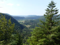
A beautiful walk around the famous Cascade de la Billaude, which you can admire on the way there or back. The route runs alongside the picturesque Étang des Pêchettes and takes you to a surprising and fairly challenging section, the Grande Cheminée. It also passes by viewing points, including those at Prés Grillet and Taiclet.Those who wish can climb up to the drystone shelter at the Ours (cave) and take advantage of a gap in the vegetation to catch a glimpse of Champagnole and its surroundings. You’ll enjoy the coolness of the banks of the Saine and, at the confluence with the Lemme, you’ll head back up towards the waterfall.
Circular Nans route via the Angillon springs and the little crosses
6.37 mi
+1,270 ft
-1,276 ft
4h 00
Difficult
Departure from Les Nans (Jura)
A lovely walk around the small village of Les Nans, taking you to the source of the Angillon and its superb waterfalls, the Grotte aux Ours, the Roche des Nans and its viewpoint. You can also enjoy the tranquillity of the Forêt de la Joux as you explore its very well-maintained paths. The route is entirely through woodland on forest paths and tracks.
The Lizine circular walk through woodland, sharp limestone pavement and viewing points
6.11 mi
+499 ft
-531 ft
3h 15
Easy
Departure from Lizine (Doubs)
An easy family walk, almost entirely through woodland, offering several views of the Lison and Loue valleys and the Gouille Noire canyon. The path also passes through some astonishing karst formations typical of the region: the sharp limestone pavement. A surprising spot where you might spot chamois or roe deer leaping from rock to rock.
The Forest of La Joux, from the Maison du Chevreuil to the Belvédère de la Roche
 8.99 mi
+981 ft
-955 ft
5h 00
Moderate
Departure from Supt (Jura)
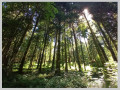
A hike entirely through the forest, alternating between forest roads and footpaths, traversing this vast forest massif. Several designated viewing points offer views of the Jura mountain range or, on the other side of the forest, the Poupet and the entire plateau. A superb site at the start with an arboretum and historical information about the area.
Circular route of Bourg de Sirod via the Rocher des Commères and the Côte Poire
8.70 mi
+1,818 ft
-1,824 ft
5h 35
Moderate
Departure from Bourg-de-Sirod (Jura)
A circular loop around Bourg de Sirod offering a rich variety of landscapes, forests, terrain and paths.
From the ruins of Chateauvillain to the Rochers des Commères, from dry grasslands to mossy thickets and bare scree slopes, from quiet forest tracks to the deafening, bubbling waterfalls of the Ain’s underground watercourses, and from cliff edges to dense forests – there’s something for everyone.
Circular loop around Dannemarie-sur-Crète
5.64 mi
+348 ft
-371 ft
2h 55
Easy
Departure from Dannemarie-sur-Crète (Doubs)
A lovely, easy walk around Dannemarie-sur-Crète. Beautiful views of the foothills of the Jura and the outskirts of Besançon. You’ll alternate between dirt tracks, forest paths and grassy trails.
The second part of the circular walk takes you through more rural landscapes, where you’ll discover an area created by schoolchildren (well worth a visit) and a disused wash house. You can therefore choose to do all or part of this walk, as you wish.