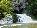
Circular route through the Levier Forest via Hyoche and the ‘Épicéas du Roi de Rome’

An easy circular walk through the Levier State Forest. The route runs almost entirely through woodland on a variety of paths. After taking in the views of Hyoche, you can take a short break at the Brassecouche Spring, sitting at a picnic table by the old railway halt. At the end of the walk, after seeing the gigantic ‘Épicéas du Roi de Rome’ spruce trees, you’ll follow a botanical trail and, on your return to the car park, you can enjoy a relaxing break at one of the many tables and benches situated around the wildlife park at the Maison Forestière du Rondé.

Details

47198371
Creation:
Last update:
Last review:
  • Walking
    Activity: Walking
  • ↔
    Distance: 9.14 mi
  • ◔
    Average duration: 4h 40 
  • ▲
    Difficulty: Moderate

  • ⚐
    Back to start: Yes
  • ↗
    Ascent: + 541 ft
  • ↘
    Descent: - 512 ft

  • ▲
    Highest point: 2,441 ft
  • ▼
    Lowest point: 2,215 ft

Photos

Description of the walk

The start point is in the car park of the Maison Forestière du Rondé.

(S/E) Head towards the D72 and cross with care. Take the Route des Sapins directly opposite you.

(1) At the junction, turn right onto the Route Forestière des Laves and continue until you reach the junction with the Route du Brûlé. Turn left and carry on to the next junction.

(2) You’ll arrive at the Paysage d’Hyoche viewpoint. If you walk up about fifty metres, you’ll find a picnic table on the edge of the forest. Opposite the Route du Brûlé, take a lovely tarmac road. Carry on until you reach the junction with the Route forestière de Prés l’Épée.

(3) Carry on straight ahead and take a right-hand bend to reach another junction.

(4) Turn right onto the Route des Sapins and follow it for a few dozen metres. Pass the wooden hut on your right, below the embankment, and reach the junction with the grassy track that runs past the wooden shelter.

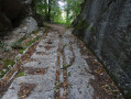
(5) Take the sharp right-hand bend to follow this path. Walk past the Hyoche railway halt, a relic of a bygone era. Shortly after the picnic table, head slightly downhill to the left and then left again after a few steps. If the vegetation isn’t too dense, you’ll be able to spot the Source de Brassecouche beneath the canopy.

(6) Retrace your steps to the junction with the Route forestière de Prés l’Épée, which you passed earlier.

(3) Turn right onto the Route forestière de Prés l’Épée. Continue along this very pleasant path and turn right at the junction with the Route forestière de la Louvetière. As you emerge from the forest, walk along the meadows until you reach the D72.

(7) Cross with great care, then continue to the right along the land consolidation track, which will branch off to the left. Walk past the pond and join a cross-road called the Voie du Moulin.

(8) Turn left onto it. Further into the forest, ignore the two side roads and carry on straight ahead until you reach the junction with the Route forestière du Rondé.

(9) Keep to the right, staying on the Voie du Moulin, and carry on until you reach the junction with the Route des Sapins. Follow this road, turning left, until you reach a larger crossroads.

(10) Look out for the grassy path on the left that leads into the forest between the Route des Sapins and the Route de Bellecombe: a sign reads “Épicéas du Roi de Rome”. Take this path, admire these gigantic trees and continue along the track.

(11) Take care and look out for a grassy track leading off to the right and uphill. Carry on, heading due west, through the vegetation until you reach a path running perpendicular to it.

(12) Turn left and walk a few dozen metres. Look out for a huge old stump covered in moss at the side of the path on the right and, at this point, turn right off the path between the fir trees. Walk for about forty metres until you reach a much better-marked path.

(13) Continue to the right, join the botanical discovery trail and follow it in the same direction. Carry on until you reach the Masson Forest Road and turn right for about fifty metres.

(14) Join the discovery trail on your left. Carry on along the most visible and best-marked track, which may not necessarily correspond to the map. You’ll reach a major junction with the Masson Forest Road.

(15) Turn right and carry on straight ahead to reach the car park (S/E).

Waypoints

  1. S/E : mi 0 - alt. 2,221 ft - Car park at the Rondé Forest House
  2. 1 : mi 0.26 - alt. 2,277 ft - Laves Forest Road
  3. 2 : mi 1.94 - alt. 2,300 ft - The Hyoche landscape
  4. 3 : mi 2.35 - alt. 2,310 ft - Crossroads for the return journey to the spring
  5. 4 : mi 2.47 - alt. 2,333 ft - Route des Sapins
  6. 5 : mi 2.72 - alt. 2,280 ft - Path to the railway halt and spring
  7. 6 : mi 2.87 - alt. 2,283 ft - Brassecouche Spring
  8. 7 : mi 4.92 - alt. 2,352 ft - Crossing the D72
  9. 8 : mi 5.51 - alt. 2,402 ft - Turn left onto Voie du Moulin
  10. 9 : mi 6.15 - alt. 2,382 ft - Three-way junction, turn right
  11. 10 : mi 6.94 - alt. 2,264 ft - Crossroads, sign for the King of Rome’s Spruce Trees
  12. 11 : mi 7.29 - alt. 2,251 ft - Turn right onto a path overgrown with grass
  13. 12 : mi 7.52 - alt. 2,336 ft - Turn left onto the track
  14. 13 : mi 7.59 - alt. 2,349 ft - Junction, turn right
  15. 14 : mi 8.2 - alt. 2,323 ft - Route Masson, nature trail on the left
  16. 15 : mi 8.7 - alt. 2,333 ft - Masson Forest Road, on the right
  17. S/E : mi 9.14 - alt. 2,224 ft - Car park at the Rondé Forest House

Notes

Between (11) and (14), follow the route map. Finding your way is quite tricky due to forestry work and vegetation.

Worth a visit

Rondé Wildlife Park.
Hyoche landscape.
Railway stop and Brassecouche Spring.
The King of Rome’s spruce trees.

Reviews and comments

3.8 / 5
Based on 4 reviews

Reliability of the description
4 / 5
Ease of following the route
4 / 5
Route interest
3.3 / 5
cnu25
cnu25

hello @pon39... Thank you for your feedback on this hike. See you soon on other trails... Have a nice day

Machine-translated

pon39
pon39

Overall rating : 4 / 5

Date of your route : Oct 14, 2025
Reliability of the description : ★★★★☆ Good
Ease of following the route : ★★★★☆ Good
Route interest : ★★★★☆ Good
Very busy route : No

Freshness in the forest, a bit of tarmac but small roads with very little traffic. In 2011, we spotted the path thanks to my colleague's Visorando app, but we avoided it because the vegetation was so thick that it was impenetrable! We reached the next crossroads and turned left, heading straight for the starting point.

Machine-translated

cnu25
cnu25

Hello @jackybois, you don’t need to go to the Levier Forest to enjoy some lovely views… but you’ll find it’s a refreshing place and a great way to get back into the swing of things after winter… Have a lovely day

Machine-translated

jackybois
jackybois

Overall rating : 3.7 / 5

Date of your route : Apr 20, 2025
Reliability of the description : ★★★★☆ Good
Ease of following the route : ★★★★★ Very good
Route interest : ★★☆☆☆ Disappointing
Very busy route : No

A easy but monotonous route. You hardly ever leave the pine forest. No spectacular views.

Machine-translated

cnu25
cnu25

Hello @reitop, sorry, but the names are clearly marked on the IGN map... Have a nice day

Machine-translated

reitop
reitop

Overall rating : 2.7 / 5

Date of your route : Apr 07, 2025
Reliability of the description : ★★★☆☆ Average
Ease of following the route : ★★☆☆☆ Disappointing
Route interest : ★★★☆☆ Average
Very busy route : No

Hello, after Brassecouche, the Près l’Épée forest track no longer exists, nor does the Louvetière! The names of the forest tracks no longer match the walking route.

Machine-translated

cnu25
cnu25

Hello woper25... thanks for your comment... we’re all looking for a bit of a breather at the moment... see you soon on other hikes

Machine-translated

woper25
woper25
• Edited:

Overall rating : 4.7 / 5

Date of your route : Aug 12, 2024
Reliability of the description : ★★★★★ Very good
Ease of following the route : ★★★★★ Very good
Route interest : ★★★★☆ Good
Very busy route : No

Hello, a lovely walk with no elevation gain. Ideal for hot weather. No difficulty.
Information boards (Hyoche and others) mark out this forest walk.
The GPX file and the description do the job well
I can confirm that between points 11 and 12 it’s practically a jungle .
I went from point 11 to 15 and then found my way back to 12.
Attached is a 360° view from the discovery trail.
Kind regards, Pierre

Machine-translated

Other walks in the area

For more walks, use our search engine .

The GPS track and description are the property of this route's author. Please do not copy them without permission.