Circular path in the Moidons Forest at Valempoulières

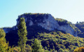
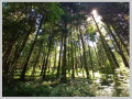
This easy walk, which takes place almost entirely in the forest, will take you through magnificent fir forests and beautiful deciduous woodlands. You’ll also enjoy lovely views of the iconic Mont Poupet, and, in the opposite direction, of Mont Rivel and the Haut Jura mountain range.
You’ll also pass through beautiful fields of sharp limestone pavement, typical of the region.

Details

48008197
Creation:
Last update:
Last review:
  • Walking
    Activity: Walking
  • ↔
    Distance: 8.98 mi
  • ◔
    Average duration: 4h 50 
  • ▲
    Difficulty: Moderate

  • ⚐
    Back to start: Yes
  • ↗
    Ascent: + 778 ft
  • ↘
    Descent: - 787 ft

  • ▲
    Highest point: 2,333 ft
  • ▼
    Lowest point: 1,995 ft

Description of the walk

Park at the Fontaine du Fou site, on the Longe Pâture forest track.

(S/E) Turn left onto this forest road, which climbs gently. Carry on until you reach a junction further on.

(1) Turn right onto this road, carry on, and at the next two junctions, go straight ahead. Then walk alongside the meadows until you reach the D23.

(2) Then take the path on the left, skirting the fields below the road. Carry on and look out for a lovely path on the right, just before a gap in the woodland.

(3) Turn right onto this lovely path, which winds through a beautiful fir forest on very pleasant ground. Further on, look out for line 25/26. Follow it to the left until the end, then turn right at the junction with a path and cross the D23 carefully. Carry on straight ahead and head back towards the fields.

(4) Take this unpaved track to the right and you’ll reach a large crossroads after the copse at a place called Champ de la Fin.

(5) Take thefirst road on the left towards a lodge. Cross the plain, enter the forest and reach a multi-way junction.

(6) Carry on straight ahead and cross the Route Forestière des Grands Plants. Continue along this track until you reach a Y-junction, marked by a timber storage area.

(7) Turn left onto the lovely avenue and rejoin the D23. Cross it carefully and head straight on towards the Chalet du Creux de l’Aigle, of which only a small section of wall remains.
Head up this path, passing some magnificent sharp limestone pavements. Watch out for the holes dotted around this area, even on the path itself. Further up, you’ll reach a wider track.

(8) Turn right onto it and you’ll soon reach a junction with a track.

(9) Turn right onto this track, head down through the sharp limestone pavement and you’ll come out onto the D23 again. Take care when crossing it, then head off to the left to reach the Sapin Président site; see the explanation in the ‘During the walk or nearby’ section.

(10) Carry on, then turn right onto the D23; walk along it carefully and you’ll soon come to a junction with a forest track just before the D467.

(11) Take this forest track on the left to reach the Fontaine du Fou car park (S/E).

Waypoints

  1. S/E : mi 0 - alt. 2,113 ft - Fontaine du Fou car park
  2. 1 : mi 1.23 - alt. 2,313 ft - Longe Pâture forest road junction
  3. 2 : mi 2.76 - alt. 2,195 ft - D23
  4. 3 : mi 3.21 - alt. 2,110 ft - Edge of the woodland
  5. 4 : mi 4.18 - alt. 2,110 ft - Fields
  6. 5 : mi 4.55 - alt. 2,090 ft - Champ de la Fin
  7. 6 : mi 5.49 - alt. 2,083 ft - Multi-way junction
  8. 7 : mi 6.24 - alt. 2,113 ft - Wood storage area
  9. 8 : mi 7.13 - alt. 2,290 ft - Forest track
  10. 9 : mi 7.52 - alt. 2,224 ft - Crossroads
  11. 10 : mi 8.14 - alt. 2,070 ft - Sapin Président site
  12. 11 : mi 8.64 - alt. 2,051 ft - D23 - D467
  13. S/E : mi 8.98 - alt. 2,113 ft - Fontaine du Fou car park

Notes

(S/E) There are picnic tables and a boules court at the Fontaine du Fou site.

Worth a visit

Between (7) and (8) The Chalet du Creux de l'Aigle is now nothing more than a ruin.
(10) The Sapin Président no longer exists, although it is shown on the IGN map.

Reviews and comments

4.1 / 5
Based on 3 reviews

Reliability of the description
4.7 / 5
Ease of following the route
3.7 / 5
Route interest
4 / 5
Philippe.dromard
Philippe.dromard

Overall rating : 4 / 5

Date of your route : Mar 03, 2025
Reliability of the description : ★★★★★ Very good
Ease of following the route : ★★★☆☆ Average
Route interest : ★★★★☆ Good
Very busy route : No

We had a bit of trouble finding the path after point 2 – we couldn’t find it. But the map helped us find an alternative route to get to point 4.

Machine-translated

MINOMICHEL
MINOMICHEL

It’s true that the vegetation is quite dense and the path isn’t very well-trodden!!! But with a bit of experience, you can manage it – and on a path like this, why not?

Machine-translated

cnu25
cnu25

Hello Minomichel... the lush vegetation is playing tricks on us this year... see you soon on the trails

Machine-translated

MINOMICHEL
MINOMICHEL

Overall rating : 4 / 5

Date of your route : Aug 30, 2024
Reliability of the description : ★★★★☆ Good
Ease of following the route : ★★★★☆ Good
Route interest : ★★★★☆ Good
Very busy route : No

A pleasant walk through the woods, not particularly interesting apart from the ‘Fontaine du Fou’ site at the start
However, I set off from point 2, which allowed me to have my lunch break at point S/E and finish the route at a leisurely pace; point 3, on the other hand, was difficult to find due to the dense vegetation

Machine-translated

cnu25
cnu25

Hello cuzcodom... thanks for your comment, it’s much appreciated... see you soon out and about

Machine-translated

cuzcodom
cuzcodom

Overall rating : 4.3 / 5

Date of your route : Aug 12, 2024
Reliability of the description : ★★★★★ Very good
Ease of following the route : ★★★★☆ Good
Route interest : ★★★★☆ Good
Very busy route : No

A very pleasant walk.
When it’s really hot, I’d definitely recommend the Moidons: almost entirely sheltered by a large forest, with a perfectly signposted route.
My warmest congratulations.

Machine-translated

Other walks in the area

For more walks, use our search engine .

The GPS track and description are the property of this route's author. Please do not copy them without permission.