Circular walk around the Pic de l’Aigle, the viewpoints and Lac de Bonlieu

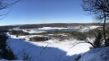
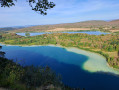
A superb walk offering magnificent views of the lake district, with numerous vantage points. Much less crowded, the stretch between the village of La Chaux-du-Dombief and Lac de Bonlieu offers the peace and tranquillity of the forest. The return route along the lakeshores is easier on the calves, but incredibly beautiful, especially at the end of the day during the golden hour. As you walk along the ridges skirting the shores, your eyes will be treated to a variety of colours and light, and a wide range of landscapes.

Details

51507196
Creation:
Last update:
Last review:
  • Walking
    Activity: Walking
  • ↔
    Distance: 11.35 mi
  • ◔
    Average duration: 6h 40 
  • ▲
    Difficulty: Difficult

  • ⚐
    Back to start: Yes
  • ↗
    Ascent: + 1,654 ft
  • ↘
    Descent: - 1,637 ft

  • ▲
    Highest point: 3,261 ft
  • ▼
    Lowest point: 2,536 ft

Photos

Description of the walk

The starting point is at the car park along the D75, at the far end of Lac du Petit Maclu.

(S/E) Look out for a path at the edge of the car park that leads into the vegetation, away from the shore. Follow this path until you reach a clearing and the junction with the GR®.

(1) Then take the clearly marked path on the right, which climbs steeply into the forest. Navigate the switchbacks along a treacherous path, with exposed roots and stones giving way beneath your feet. You’ll reach the summit of the Côte du Maclu.

(2) In this flatter section, turn right onto the most clearly marked path. Stay on the red-and-white-marked path and avoid the dangerous tracks along the cliff edge. Further on, you’ll reach a large junction.

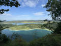
(3) This major junction leads from the car park to the viewpoint. Turn right, following the main path, and head for the viewpoint overlooking the four lakes. Enjoy the view, then set off again towards the south-west along the ridge path. Further on, the path returns to the cliff edge. You will then reach the viewpoint overlooking the three lakes (Narlay is no longer visible).

(4) Continue along the path, which quickly moves away from the sheer drop. You will then reach a major junction.

(5) Take the path furthest to your right, which winds in a hairpin bend. Continue along this path until you reach the highest point of the walk, the Pic de l’Aigle.

(6) At the summit, enjoy the view and head down to the viewpoint, situated slightly below. Take in the peaks of the Swiss Jura and the ridges of the Haut-Jura, the highest points of the massif.
Then look out for the steps, carved into the rock and fitted with a handrail, to make your way back down into the forest. When you reach the bottom of this descent, you’ll find signposts.

(7) At the foot of the steps, follow the signs for “La Chaux Du Dombief”. The path soon leads onto a dry grassy area and takes you to a car park. Cross it and head for the second parking area.

(8) Opposite the two statues at the car park entrance, cross the road and look out for the Cairns footpath. This will take you to the village without having to walk alongside the road. Cross the factory car park and turn right onto the street.

(9) You will then come out onto Rue des Saillards (D678), which you follow to the left. Walk through the village to reach the square.

(10) In the square, walk past the church and take the Grande Rue on your right. Walk through the village.

(11) At the next junction, where there is a Fork in the road ahead of you, take the Route de la Vallière on the right. Carry on past the “Chalet du Ski”, where the Route de la Vallière becomes the Maguenay forest track. Continue through the forest. You will then reach a Fork in the forest tracks.

(12) Turn right and carry on past the water tower. Carry on, ignoring any side paths.

(13) At the Balayre crossroads, by the hunting car park, take the road that branches off at a right angle to the right. Continue along this forest track and, further on, you’ll come to a signpost by a forestry track.

(14) At the signpost – which is not very visible – turn right and head up the forestry track. Carry on until you reach the cliff edge.

(15) Enjoy the view of Lake Bonlieu from the Maguenay viewpoint, then begin the descent to the left and join the junction with theGR® 559.

(16) Turn right down the slope and continue to the bottom. You will then arrive at the shore of Lake Bonlieu.

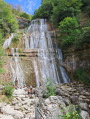
(17) Head straight ahead, passing the hamlet of L’Abbaye, then cross the Hérisson stream – a tributary of the lake – which flows gently towards the famous waterfalls of the same name.

(18) At the car park at the corner of the bridge, take the dirt track on your right, which winds its way through meadows and copses. Continue along this forest track until you come to a forestry track branching off to the right.

(19) At this junction, head steeply uphill to the right along this track. Continue along this path, with its uneven surface, which takes you up the Côte d’Aval. After a short descent, you’ll reach the D678.

(20) Take it very carefully on the left-hand side. You’ll very quickly reach a junction.

(21) Turn right onto Rue de la Cotière. Walk a few metres and take theGR® path which descends to the left. A little further on, you’ll rejoin the tarmac road.

(22) Cross Rue des Waterfalls via the parallel path, which is safer. Enter the hamlet of Ilay and reach the wash house at the hairpin bend in the road.

(23) Then turn right onto the path to the lake. Pass the last few houses and leave the path to turn right onto a lovely white track that runs alongside Lac d’Ilay. You’ll come to a small junction with a grassy path leading down to your left.

(24) Keep to the right on the main path and continue towards Lac du Grand Maclu.
Walk along the shores of both lakes until you reach the far end of Lac du Petit Maclu.
Where the lake ends, turn right and head back to your car park (S/E).


Waypoints

  1. S/E : mi 0 - alt. 2,552 ft - Car park at Lac du Petit Maclu
  2. 1 : mi 0.19 - alt. 2,536 ft - Junction of the PR and GR trails
  3. 2 : mi 0.36 - alt. 2,854 ft - Junction at the summit
  4. 3 : mi 1.07 - alt. 3,031 ft - Junction with the path from the car park
  5. 4 : mi 1.38 - alt. 3,048 ft - Viewpoint of the 3 lakes
  6. 5 : mi 1.69 - alt. 3,074 ft - Junction with a major forest track
  7. 6 : mi 2.33 - alt. 3,245 ft - Pic de l’Aigle
  8. 7 : mi 2.43 - alt. 3,087 ft - Crossroads at the foot of the stairs
  9. 8 : mi 2.77 - alt. 2,936 ft - 2nd car park
  10. 9 : mi 2.94 - alt. 2,917 ft - Junction with Rue des Saillards (D678)
  11. 10 : mi 3.1 - alt. 2,917 ft - Church Square
  12. 11 : mi 3.41 - alt. 2,917 ft - Y-junction
  13. 12 : mi 4.16 - alt. 3,051 ft - Crossroads of forest tracks
  14. 13 : mi 4.87 - alt. 3,163 ft - Balayre crossroads
  15. 14 : mi 5.32 - alt. 3,166 ft - Signpost for Le Maguenay
  16. 15 : mi 5.57 - alt. 3,212 ft - Maguenay viewpoint
  17. 16 : mi 5.69 - alt. 3,140 ft - Junction with the GR
  18. 17 : mi 6.34 - alt. 2,638 ft - Path along the lake
  19. 18 : mi 6.91 - alt. 2,605 ft - Car park at the bridge over the Hérisson
  20. 19 : mi 7.62 - alt. 2,615 ft - Junction of the GR trail and the main forest track
  21. 20 : mi 8.77 - alt. 2,749 ft - Arrival on the D678
  22. 21 : mi 8.94 - alt. 2,700 ft - Junction with Rue de la Cotière
  23. 22 : mi 9.1 - alt. 2,621 ft - Junction with Rue des Waterfalls
  24. 23 : mi 9.33 - alt. 2,549 ft - Lake path
  25. 24 : mi 9.67 - alt. 2,572 ft - Junction with a grassy path
  26. S/E : mi 11.35 - alt. 2,552 ft - Car park at Lac du Petit Maclu

Notes

Orientation table at the Pic de l’Aigle.
Several picnic tables at both car parks at (8), with dry toilets at thesecond car park.
Fast-food options in the village of La Chaux-du-Dombief.
Tables along Lac de Bonlieu towards (17)

Dangerous stretch between (20) and (21). Walk alongside the D678 with the utmost caution

For a more peaceful experience, avoid weekends and holiday periods for this walk.
Overcrowding with tourists and the resulting issues (disrespect, various nuisances) can be a nuisance.

This route passes through multiple protected areas, which may be subject to special regulations:

Worth a visit

There are numerous vantage points all along the ridge, in addition to the two designated viewing points.
Pic de l’Aigle: 2 viewpoints and an orientation board.
Maguenay viewing point.
A developed site along Lake Bonlieu.
The shores of the Grand and Petit Maclu lakes.

Always be cautious and plan ahead when you're outdoors. Visorando and the author of this route cannot be held responsible for any accidents occurring on this route.

The GR® and PR® markings are the intellectual property of the Fédération Française de Randonnée Pédestre.

Reviews and comments

4.9 / 5
Based on 3 reviews

Reliability of the description
4.7 / 5
Ease of following the route
5 / 5
Route interest
5 / 5
cnu25
cnu25

Hello @Drouillot … thank you very much for your feedback … and see you soon on other walking trails

Machine-translated

DROUILLOT
DROUILLOT

Overall rating : 4.7 / 5

Date of your route : Jul 09, 2026
Reliability of the description : ★★★★☆ Good
Ease of following the route : ★★★★★ Very good
Route interest : ★★★★★ Very good
Very busy route : No

Thank you, “cnu25”, for this largely shaded walk, which offers some truly beautiful panoramic views. Mont Blanc was visible today.
A GPS is required in addition to the route description.
No technical difficulties on dry ground, but you’ll need to be in good physical condition and wear suitable footwear.
It’s quite busy at the first three viewpoints and their surroundings, as well as around the lakes; there’s hardly anyone on the rest of the route.
A variety of paths: pleasant footpaths and trails, gravel tracks, dirt tracks with deep ruts, grassy paths: watch out for ticks.
There is a small error in the route description at (8): the cairn trail is actually located on the way out of La-Chaud-du-Dombief, on Route de la Vallière, on the right. As you leave the car park, take a path marked by a signpost on the left, which leads straight down to the factory car park.
We didn’t find any picnic tables by the shores of Lake Bonlieu, but there are benches.
We spotted a chamois!

Machine-translated

cnu25
cnu25

Hello @ktyy... thank you for your feedback on this description.... have a nice day

Machine-translated

ktyy
ktyy

Overall rating : 5 / 5

Date of your route : Jul 13, 2025
Reliability of the description : ★★★★★ Very good
Ease of following the route : ★★★★★ Very good
Route interest : ★★★★★ Very good
Very busy route : No

A brilliant hike! The view of the lakes is magnificent

Machine-translated

cnu25
cnu25

Hello, Hervé-Manu... thanks for that lovely comment. I always try to keep the ‘tarmac’ to a minimum on my walks whenever possible... Have a lovely day, and see you soon on more walks

Machine-translated

hervé-manu
hervé-manu

Overall rating : 5 / 5

Date of your route : Aug 07, 2024
Reliability of the description : ★★★★★ Very good
Ease of following the route : ★★★★★ Very good
Route interest : ★★★★★ Very good
Very busy route : No

Taken on Tuesday 6 August 2024. A superb hike with magnificent scenery; we were even lucky enough to see Mont Blanc from the Pic de l’Aigle. The route description is very precise, though it might be worth noting that you need to pass two paths on your right before reaching point 19. There are some lovely climbs, very little tarmac and plenty of shaded sections along the 18-kilometre route.

Machine-translated

Other walks in the area

For more walks, use our search engine .

The GPS track and description are the property of this route's author. Please do not copy them without permission.