The Dames des Entreportes circular route via Le Larmont and Les Cernets

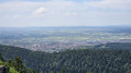
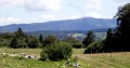
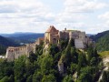
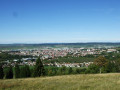
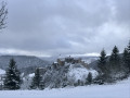
A beautiful Franco-Swiss walk starting from the picturesque site of Les Dames des Entreportes. From Larmont mountain, you’ll enjoy sweeping views of the Jura range and the Alps if the weather is ideal. After crossing magnificent mountain pastures and crossing the border, you’ll pass through Swiss hamlets and farms before returning to French territory and continuing your walk through the wild Vallon des Etraches.

Details

54442360
Creation:
Last update:
Last review:
  • Walking
    Activity: Walking
  • ↔
    Distance: 12.51 mi
  • ◔
    Average duration: 7h 35 
  • ▲
    Difficulty: Difficult

  • ⚐
    Back to start: Yes
  • ↗
    Ascent: + 2,083 ft
  • ↘
    Descent: - 2,087 ft

  • ▲
    Highest point: 4,091 ft
  • ▼
    Lowest point: 2,910 ft

Description of the walk

The start is at the car park at the Dames Des Entreportes site.

(S/E) Return to the road you arrived on and turn left, then immediately right, heading due south, onto the small tarmac road that climbs up into the valley. Shortly after the junction with the road leading off to the right towards the Ferme de la Motte, look out for a crossroads of paths by a bridge.

(1) Leave the road and turn left onto the path that runs alongside a pasture before entering the woods. Follow this path and continue uphill until you reach, further up, the tarmac road you left earlier.

(2) Turn left onto it, walk for about 200 m until you reach a junction with a forest track coming in from your right. Take this track and, further up, join the Grande Traversée du Jura (GTJ) route.

(3) Take this well-signposted path to the left. Further on, at a major junction of paths, follow the GTJ and climb up a hairpin bend to the right. Cross the ridge and enter the pasture.

(4) NB: in the meadow, the suggested route heads left and then descends towards the road, rejoining the path a little below the Grange des Miroirs farm. Unharvested crops and a herd of young cattle prompted us to take a detour to avoid causing any inconvenience to the farmers. You can follow the path leading straight down into the pasture and take the track that goes round the farm.
Once you’ve rejoined the grassy path, cross the meadows and hedgerows before entering the woodland. Further on, you’ll reach a tarmac road at a wooden picnic table.

(5) Turn left onto the road, walk alongside the meadow and enter the woods again. You will then find a path branching off to the right, just before a bend in the dirt track.

(6) Take this forest track, which descends gently to your right. After two changes of direction, it heads north-east, runs alongside the woodland and reaches a junction with another path.

(7) Leave the signposted path, head straight on, cross the small wood and reach the boundary wall.

(8) Cross the border and go to the right of the farm. Ignore the path on the left and head towards the hamlet of Les Petits-Cernets.

(9) At the junction in front of the restaurant, turn left (north), head for Les Grands Cernets and continue to the left. At a right-hand bend, look out for a grassy path on the left, at an elevation of 1155.

(10) Leave the road, enter the pasture and head straight up towards the water tower which you can see at the edge of the forest. Walk past it until you reach a crossroads of paths.

(11) Ignore the left-hand branch signposted for the summit of the Grand Taureau and head downhill, heading due west. Then cross a pasture and follow this path into the neighbouring woodland. Further on, theGR® 5 branches off due north.

(12) At this junction, leave the path heading straight on towards the border and turn right, heading north then north-east. Reach the edge of the woodland and continue until you reach a bridge in front of the Grosse Ronde farm.

(13) Turn left (south-west) onto the small path that runs alongside the stream. Further on, you’ll reach a boundary marker.

(14) Turn right at the hairpin bend to head back up the slope, staying in Switzerland. Further up, you’ll reach the forest track you left earlier.

(15) Turn left (west) and, at a small junction, turn right, staying on the signposted path; cross the border and head down this track, which widens and then crosses a pasture. Shortly after a copse with drinking troughs, look out for a path branching off to the left.

(16) Near the signposts, take this path heading west, then south-west; cross the small ridge and head completely to the left. You will then cross a strip of woodland separating the meadows and continue your descent towards a house.

(17) Go round the house and turn left onto the tarmac road. Carry on, passing a farm, until you reach the Grange des Ouillettes.

(18) Signs direct you to turn left onto the grass. Follow them and head uphill until you reach a tarmac road further up, which you take on your right. Carry on until you reach the junction with the road leading to the car park.

(19) Turn left, cross the Entreportes gorge to the crossroads and turn left to return to the car park (S/E).


Waypoints

  1. S/E : mi 0 - alt. 2,936 ft - Dames des Entreportes car park
  2. 1 : mi 0.77 - alt. 3,084 ft - Leave the tarmac road
  3. 2 : mi 1.46 - alt. 3,383 ft - Tarmac road
  4. 3 : mi 1.76 - alt. 3,573 ft - Junction with the GTJ
  5. 4 : mi 2.66 - alt. 4,052 ft - Entering the pastures
  6. 5 : mi 3.69 - alt. 3,734 ft - Forest track. Picnic table
  7. 6 : mi 4.1 - alt. 3,829 ft - Forest path
  8. 7 : mi 4.64 - alt. 3,704 ft - Junction of the GR and the footpath
  9. 8 : mi 5.11 - alt. 3,743 ft - Swiss border
  10. 9 : mi 5.72 - alt. 3,747 ft - Crossroads in Les Petits Cernets
  11. 10 : mi 6.31 - alt. 3,789 ft - Pasture at an altitude of 1155
  12. 11 : mi 6.7 - alt. 4,078 ft - Trail junction
  13. 12 : mi 7.4 - alt. 3,789 ft - GR 5 junction –
  14. 13 : mi 8.1 - alt. 3,448 ft - Ferme de la Grosse Ronde
  15. 14 : mi 8.74 - alt. 3,294 ft - Boundary marker
  16. 15 : mi 9.31 - alt. 3,504 ft - Forest track
  17. 16 : mi 10.03 - alt. 3,402 ft - Junction with a path through pastureland
  18. 17 : mi 10.89 - alt. 3,045 ft - Tarmac road in front of the house
  19. 18 : mi 11.81 - alt. 2,972 ft - Crossroads at La Grange des Ouillettes
  20. 19 : mi 12.29 - alt. 2,910 ft - Route from the car park
  21. S/E : mi 12.51 - alt. 2,936 ft - Dames des Entreportes car park

Notes

A walk with no particular difficulties, apart from its length and two slightly steeper sections.

Once you reach (13), you can head straight to (15), which is a little further on. The only reason to take a detour via (14) is to enjoy the coolness of the stream and the valley. After (14), the path can be very muddy following a spell of rain.

Always be cautious and plan ahead when you're outdoors. Visorando and the author of this route cannot be held responsible for any accidents occurring on this route.

The GR® and PR® markings are the intellectual property of the Fédération Française de Randonnée Pédestre.

Reviews and comments

4.4 / 5
Based on 3 reviews

Reliability of the description
4.3 / 5
Ease of following the route
4.7 / 5
Route interest
4.3 / 5
cnu25
cnu25

Hello @cprost, thank you for your comment... Have a nice day and see you soon on other trails.

Machine-translated

cprost99
cprost99

Overall rating : 4 / 5

Date of your route : Oct 20, 2025
Reliability of the description : ★★★★☆ Good
Ease of following the route : ★★★★☆ Good
Route interest : ★★★★☆ Good
Very busy route : Yes

It is well frequented, but not in its entirety.

Machine-translated

cnu25
cnu25

Hello @Drouillot, thank you for your feedback on this hike.... Have a nice day and see you soon on other trails.

Machine-translated

DROUILLOT
DROUILLOT

Overall rating : 4.7 / 5

Date of your route : Aug 06, 2025
Reliability of the description : ★★★★☆ Good
Ease of following the route : ★★★★★ Very good
Route interest : ★★★★★ Very good
Very busy route : No

In beautiful surroundings, this Franco-Swiss route offers lovely panoramic views, alternating between sunny and shaded sections.
No technical difficulties. Only to be avoided after heavy rain.
Good description, to be completed with the GPS track. Yellow/blue markings are present throughout the entire circuit. You only leave the circuit at (14) to take a muddy, bumpy path, as indicated.
Thank you, "cnu25", for this great suggestion.

Machine-translated

cnu25
cnu25

Hello jul70... thank you for your kind comment... the climb must have been a bit slippery after the bad weather we’ve had over the last few days... see you soon on other hiking trails

Machine-translated

Jul70
Jul70

Overall rating : 4.7 / 5

Date of your route : Sep 29, 2024
Reliability of the description : ★★★★★ Very good
Ease of following the route : ★★★★★ Very good
Route interest : ★★★★☆ Good
Very busy route : Yes

A lovely walk in the countryside; it wasn’t at all difficult and I found it very enjoyable.

Machine-translated

Other walks in the area

For more walks, use our search engine .

The GPS track and description are the property of this route's author. Please do not copy them without permission.