The Lizine circular walk through woodland, sharp limestone pavement and viewing points

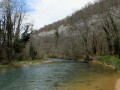
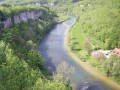
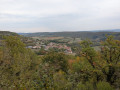
An easy family walk, almost entirely through woodland, offering several views of the Lison and Loue valleys and the Gouille Noire canyon. The path also passes through some astonishing karst formations typical of the region: the sharp limestone pavement. A surprising spot where you might spot chamois or roe deer leaping from rock to rock.

Details

46511893
Creation:
Last update:
Last review:
  • Walking
    Activity: Walking
  • ↔
    Distance: 6.11 mi
  • ◔
    Average duration: 3h 15 
  • ▲
    Difficulty: Easy

  • ⚐
    Back to start: Yes
  • ↗
    Ascent: + 499 ft
  • ↘
    Descent: - 531 ft

  • ▲
    Highest point: 1,608 ft
  • ▼
    Lowest point: 1,220 ft

Description of the walk

Park along the D105, in the car park at the Moulin Sapin viewpoint.

(S/E) Head towards the village of Lizine along the D135. Reach the village entrance and rejoin theGRP® trail between the Loue and Lison rivers in the Pays de Courbet.

(1) Turn right onto Rue de Simolière, then right again at the next Fork in the road. Follow the yellow and red markings, go through the gate – remembering to close it behind you – and reach the clearing.

(2) Continue along theGRP®, which turns sharply left and climbs through meadows at the edge of the forest. Take the stony path on your left and go through the gate. Then take the path on the right which climbs into the forest and carry on, ignoring the side tracks. At the bottom of the descent, you’ll come to a crossroads with several directions.

(3) Leave theGRP® and turn left to join the D105. Take care when crossing the road, then carry on; at the statue of the Virgin Mary, take the grassy path on the right. Continue along this wide gravel track. Then take a narrower path into a magnificent fir forest to reach a white track.

(4) Walk a few metres to the left, then enter the clearing on the right. Walk alongside the bushes and take the path that slopes gently downwards. Much further on, you’ll rejoin the D103.

(5) Follow it carefully, keeping to the right, to reach the Gouille Noire viewpoint.

(6) Walk back a few steps and turn right onto the forest path. Continue, making the most of the gaps in the vegetation which offer lovely views over the Loue valley. Walk across the sharp limestone pavement – a great spot for children – and follow the main path marked in red and white. Pass close to the Puits des Nods before reaching the Piquette viewpoint.

(7) Leave this viewpoint and turn left at the entrance to the fir forest. Shortly afterwards, you’ll reach the county road; turn left onto it to return to the car park at the Belvédère du Moulin Sapin (S/E).


Waypoints

  1. S/E : mi 0 - alt. 1,266 ft - Car park at the Moulin Sapin viewpoint. Near the - Lison (rivière)
  2. 1 : mi 0.64 - alt. 1,329 ft - GRP - Église Saint-Antoine (Lizine)
  3. 2 : mi 1.12 - alt. 1,362 ft - Flat stretch
  4. 3 : mi 1.84 - alt. 1,460 ft - Multi-way junction
  5. 4 : mi 3.09 - alt. 1,578 ft - Dirt track
  6. 5 : mi 4.2 - alt. 1,417 ft - D103
  7. 6 : mi 4.49 - alt. 1,414 ft - Belvédère de la Gouille Noire
  8. 7 : mi 5.88 - alt. 1,227 ft - La Piquette viewpoint. View of the - Loue (rivière)
  9. S/E : mi 6.11 - alt. 1,263 ft - Car park at the Moulin Sapin viewpoint

Worth a visit

(S/E) Moulin Sapin viewpoint. View over the Lison Valley and Mont Poupet.
Between (3) and (4) Enjoy the view of the village of Lizine and Châtillon-sur-Lison Castle in the background.
(6) Gouille Noire viewpoint. View over the Malans stream, a very wild and almost impassable site.
Between (6) and (7) sharp limestone pavement fields, viewpoints over the valley (unsecured).
(7) La Piquette viewpoint. View over a huge meander of the River Loue and the La Piquette farm, a paradise for trout anglers.

Reviews and comments

4.7 / 5
Based on 2 reviews

Reliability of the description
5 / 5
Ease of following the route
4 / 5
Route interest
5 / 5
User 20724760

Overall rating : 4.7 / 5

Date of your route : May 11, 2026
Reliability of the description : ★★★★★ Very good
Ease of following the route : ★★★★☆ Good
Route interest : ★★★★★ Very good
Very busy route : No

A lovely, easy walk. Sunny up to point 2, then mostly shaded after that. Some very pretty views. The walk through the ‘Snake Wood’ is remarkable, with its upright sharp limestone pavements and mosses, making you feel as though you’re in a fairy tale. In fact, in the absence of snakes, we almost thought we’d spotted some elves 😉
Thank you for this lovely suggestion.

Machine-translated

cnu25
cnu25

Hello @User 20724760, thank you for your feedback on this hike... it’s true that the woods are magnificent and that you really do feel as though you’re in another world. Thanks again, and see you soon on other hiking trails...

Machine-translated

User 20724760

Overall rating : 4.7 / 5

Date of your route : May 11, 2026
Reliability of the description : ★★★★★ Very good
Ease of following the route : ★★★★☆ Good
Route interest : ★★★★★ Very good
Very busy route : No

A lovely, easy walk. Sunny up to point 2, then mostly in the shade after that. Some very pretty views. The walk through the ‘Snake Wood’ is remarkable, with its upright sharp limestone pavements and mosses, making you feel as though you’re in a fairy tale. In fact, in the absence of snakes, we thought we’d spotted some elves 😉
Thank you for this lovely suggestion.

Machine-translated

jaienviedemarcher
jaienviedemarcher

I didn’t go on that walk.
However, on the ‘Le Grand Méandre et les Gorges de Chenecey’ route (Doubs), at point (2), the signpost has gone missing.
Please note this in the route description, as not all walkers have access to the app to help them find their way.
And a big thank you to Tonnoguh for all the walks he suggests.

Machine-translated

Other walks in the area

For more walks, use our search engine .

The GPS track and description are the property of this route's author. Please do not copy them without permission.