Country:

 City:
City:


The start is at the car park of La Sagne stadium.
(S/E) Take the road on your left which goes round the playing field and the football pitch, and head towards Marmoud. You’ll soon come to a path crossing the plain and climbing alongside the fence.
(1) Turn left and head up into the pasture, crossing the cattle track that leads back down towards the farm. Continue climbing towards the woods. Leave the edge path behind and head into the forest. The climb becomes steeper, and as you make your way along, you’ll discover dozens of sculptures created on site. All the paths leading to the sculptures will take you back to the main track, and you’ll then walk down the slope with ease.
You’ll emerge into the wooded meadows and head due south, keeping to your right. You’ll then reach a signpost at a crossroads.
(2) Carry on straight ahead through the meadows until you reach another junction.
(3) Continue your walk up the slope, heading straight ahead. Further up, you’ll reach the ridge and come to a larger crossroads of paths.
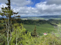
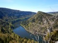
(4) Enjoy the view and head left along the ridge. Carry on and you’ll soon reach the summit of Mont Racine.
(5) Ignore the path leading down to the right and continue along the summit path. Carry on through meadows and copses of woodland until you reach a road crossing ahead of you.
(6) Cross it, go round the house and carry on across the meadow along the path that runs alongside the woodland. You’ll reach a junction of paths.
(7) Ignore the path branching off to the left and carry on along this path, through pastures and wooded meadows. Much further on, you’ll reach a road that curves in a semicircle.
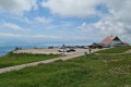
(8) Take the left-hand branch of the path towards the Tête de Ran via the summit. The right-hand branch also takes you there, without passing the viewpoint, and by staying on the tarmac road. Pass the summit and take the path that winds down towards the hamlet.
(9) At the car park, head left then immediately right onto the path that runs alongside the house, crosses the car park and leaves it at the left-hand corner to reach the hamlet a little further on. Continue along this path towards the Vue des Alpes. Further on, you’ll reach the car park of a restaurant.
(10) Then head left, skirting the buildings and following the main road, before turning left very quickly onto the Route de Tête de Ran.
(11) At the junction, cross carefully and take the small path on your right which descends into the meadows. Continue along the Chemin de la Petite Corbatière until you reach a Fork in the road.
(12) Leave the path and head off at a right angle towards the north-west. Further on, you’ll reach a junction with another lovely path.
(13) Turn left onto the path climbing between the pasture fences and reach a Fork in the road a little further up.
(14) At this fork in the road (elevation 1266), turn left and continue climbing gently through the meadows. When you see a farm, pass well behind it, cross the low wall and continue until you reach a junction of tracks.
(15) Turn right, heading south-west, along this more or less distinct track. You’ll come to a wider path; turn right here, heading due west. Ignore the path leading to the house and head towards the inn on the left.
(16) Stay on the main road and ignore the path leading uphill to the right. Head down into the valley, following the stream bed. You’ll reach a crossroads at elevation 1103.
(17) Stay on the path, continuing through this small gorge, still following the stream. Shortly afterwards, you’ll come to another junction.
(18) Continue along the bank, ignoring the path on the right. You’ll reach a large crossroads. Turn left and you’ll return to your car park (S/E).


 Visorando Member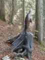
 Moderate