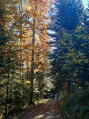
Circular walk above Fuans via La Queugne and the Virgin of La Vauselle

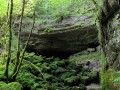
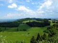
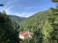
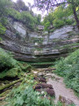
This lovely walk, almost entirely through woodland, takes you through the forest between Fuans and Grandfontaine-Fournet along beautiful forest paths. You’ll walk past the Boussière goat farm to reach the site of the Vierge de la Vauselle; on the way back, you’ll cross the stunning Gipandol ravine, and through lovely clearings in the vegetation, you’ll be treated to beautiful views of Fuans and the Val de Consolation.

Details

n°53100571
Creation:
Last update:
Last review:
  • Walking
    Activity: Walking
  • ↔
    Distance: 7.67 mi
  • ◔
    Average duration: 4h 20 
  • ▲
    Difficulty: Moderate

  • ⚐
    Back to start: Yes
  • ↗
    Ascent: + 945 ft
  • ↘
    Descent: - 912 ft

  • ▲
    Highest point: 3,110 ft
  • ▼
    Lowest point: 2,500 ft

Description of the walk

The start of this walk is in the car park near the ‘Sapin Président’ tree, at a place called La Queugne, above Grandfontaine-Fournet.

(S/E) Head towards this majestic tree and, shortly afterwards, you’ll come to a forest track which you’ll take on your left. You’ll then reach the D311.

(1) Follow the D311 for about a hundred metres on your right and you’ll soon spot a white track on the other side. Cross over carefully and take the track straight ahead until you reach a Fork in the road.

(2) Take the right-hand fork, which climbs gently through the woodland. Further on, you’ll reach a junction with another lovely forest track.

(3) Change paths and take the hairpin bend to the right, heading south-west. Climb up to reach the outskirts of a sawmill and the entrance to the village of Les Fournets.

(4) As you approach the building and the first piles of wood, veer sharply to the left to head north-east. Continue along this pleasant track, which narrows to become a forest path. Carry on until you reach a clearing and a junction with a lovely dirt track. This lovely clearing is equipped with a magnificent barbecue and picnic tables: the ideal spot for a break in complete tranquillity.

(5) Then turn right and head down the slope. After two right-angle bends, head straight north, then north-east to reach a junction with anotherPR® trail.

(6) Turn 90° to the right to reach the departmental road, which you follow along the inner path running alongside the woodland. You’ll come to a major junction with the D242.

(7) Cross it very carefully and head along the tarmac path that runs alongside a nightclub car park, towards the hamlets of Boussière and Les Côtards.
At the next fork, turn left towards Boussière. Walk past the farm building and the goat farm before joining the path that runs alongside the woodland and pastures.

(8) You will then enter the woods; head down to the right to cross the small stream and follow its course roughly until you reach a tarmac road.

(9) At the junction on your right, you are only about fifty metres from the site of the Vierge de la Vauselle. Take a moment to enjoy the view, then retrace your steps and continue due west until you reach a fork in the path.

(10) Then follow thePR® on your left, carry on and you’ll soon reach the D 242. Cross it – taking care, as always – and take the white track opposite. You’ll very quickly come to a junction of paths.

(11) Take the small path on your right and, a little further down, turn left to rejoin the PR®. Continue along this track, cross the Ravin de Gipandol, ignoring the side paths, and reach a junction with another PR®.

(12) Turn right onto the descending path to reach, shortly afterwards, a tarmac road that descends steeply towards Fuans.

(13) At the start of the road and at the foot of the water tower, turn left towards the picnic table to head into the forest. Pass the pumping station and continue uphill to reach a forest track at a junction you passed on the way out.

(14) Follow it to the right until you reach a junction with another unpaved track you passed on the way out.

(2) Join the D 311 and cross it carefully. Walk downhill for 50 metres and return to the original junction.

(1) Then leave the departmental road and head off to the left. Leave the forest and reach a Fork in the road (which you’ve already passed on the way there).
Turn right here, heading slightly downhill towards La Queugne farm, and return to your car park near the property gate (S/E).

Waypoints

  1. S/E : mi 0 - alt. 2,618 ft - Sapin Président car park
  2. 1 : mi 0.39 - alt. 2,664 ft - D311
  3. 2 : mi 0.45 - alt. 2,700 ft - White fork in the road
  4. 3 : mi 0.92 - alt. 2,854 ft - Forest road junction
  5. 4 : mi 1.35 - alt. 2,972 ft - Crossroads at the village entrance
  6. 5 : mi 2.27 - alt. 3,054 ft - Area with barbecue and picnic tables
  7. 6 : mi 3.43 - alt. 2,802 ft - PR junction
  8. 7 : mi 3.69 - alt. 2,923 ft - Crossing the D242
  9. 8 : mi 4.51 - alt. 2,884 ft - Entrance to the woods
  10. 9 : mi 4.74 - alt. 2,772 ft - Junction of the PR trail and the forest track
  11. 10 : mi 4.97 - alt. 2,733 ft - Fork in the road
  12. 11 : mi 5.42 - alt. 2,753 ft - Crossroads at elevation 839
  13. 12 : mi 6.17 - alt. 2,579 ft - PR junction
  14. 13 : mi 6.36 - alt. 2,500 ft - T-junction
  15. 14 : mi 6.68 - alt. 2,700 ft - Arrival via a forest track
  16. S/E : mi 7.67 - alt. 2,621 ft - Sapin Président car park

Notes

Picnic tables and barbecue at (5)
Picnic table at (13)

Worth a visit

Always be cautious and plan ahead when you're outdoors. Visorando and the author of this route cannot be held responsible for any accidents occurring on this route.

The GR® and PR® markings are the intellectual property of the Fédération Française de Randonnée Pédestre.

Reviews and comments

3.2 / 5
Based on 3 reviews

Reliability of the description
3.7 / 5
Ease of following the route
3.3 / 5
Route interest
2.7 / 5
User 28713185

Overall rating : 3.7 / 5

Date of your route : Mar 23, 2026
Reliability of the description : ★★★★☆ Good
Ease of following the route : ★★★★☆ Good
Route interest : ★★★☆☆ Average
Very busy route : No

Quite easy

Machine-translated

xerocrete
xerocrete

Overall rating : 2 / 5

Date of your route : Jul 17, 2024
Reliability of the description : ★★☆☆☆ Disappointing
Ease of following the route : ★★☆☆☆ Disappointing
Route interest : ★★☆☆☆ Disappointing
Very busy route : No

An enticing overview, but the reality on the ground is quite different... Although we are seasoned walkers and long-standing users of Visorando, we found ourselves struggling with the inaccuracies in the route description (somewhat haphazard directions and distances) and the ‘new terminology’ used (route blanche, PR, etc.). The sections along tarmac roads – the D311 and 242 – are too long and, in some cases, very dangerous.
In short, a huge disappointment, including the places of interest!

Machine-translated

Marie VB
Marie VB

I’m definitely planning to go on this walk as soon as possible. Thanks for the suggestion and the route description!
MarieVB.

Machine-translated

cnu25
cnu25

Hello Paps, thank you for your comment… It’s true that nature is reclaiming its place this year with all this rain… Have a lovely day, and I look forward to seeing you again on a walking trail

Machine-translated

Paps
Paps

Overall rating : 4 / 5

Date of your route : Jul 14, 2024
Reliability of the description : ★★★★★ Very good
Ease of following the route : ★★★★☆ Good
Route interest : ★★★☆☆ Average
Very busy route : No

A pleasant walk through the woodland, especially when it’s hot. It’s a quiet route with no signposting, but it’s not particularly difficult. As it’s summer, the vegetation means you can no longer enjoy the scenery, which is a shame.

Machine-translated

Other walks in the area

For more walks, use our search engine .

The GPS track and description are the property of this route's author. Please do not copy them without permission.