Circular walk in Lemuy: the sources of the Roche and the Montorge stream

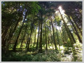
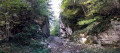
A lovely forest walk in the Joux State Forest, taking you through part of one of France’s most beautiful spruce forests. From the outskirts of Lemuy, you’ll reach the meadows of Villers-sous-Chalamont, then the source of the Roche at the foot of the viewpoint, followed by the source of the Ruisseau de Montorge and its picturesque setting with a waterfall emerging from an imposing cirque. Beautiful forest tracks and a lovely path will take you back to your car park.

To make the most of the rocky and rugged landscapes around both springs, it’s best to do this walk after a spell of rain so you can admire the waterfalls. In winter, when temperatures drop below freezing, ice will glisten all over the rocks and form magnificent stalactites along the cliff face, making this site even more spectacular.

Details

n°68770489
Creation:
Last update:
Last review:
  • Walking
    Activity: Walking
  • ↔
    Distance: 9.01 mi
  • ◔
    Average duration: 4h 40 
  • ▲
    Difficulty: Moderate

  • ⚐
    Back to start: Yes
  • ↗
    Ascent: + 607 ft
  • ↘
    Descent: - 600 ft

  • ▲
    Highest point: 2,487 ft
  • ▼
    Lowest point: 2,201 ft

Description of the walk

Throughout the route description, the abbreviation ‘RF’ is used to mean ‘Route Forestière’ (forest road).

To return to your car park, leave the D265 at the hamlet of Les Raffours on the outskirts of Lemuy. Head towards the forest along the RF des Cent Arpents. Continue to the three-way junction and its forest ranger’s house. Park here.

(S/E) Then head due north from the foot of the house along the RF des Grattes. Pass the junction with the RF de Tagençon and stay on your route, which will turn east and south-east to join a wide white track at elevation 673.

(1) On your right, you’ll see the hamlet of Montorge and its chapel. Head in the opposite direction, following the wide white track north-north-east. Ignore the track joining from the right and continue to a junction at elevation 705.

(2) Pass the letterboxes on your left and turn right to reach the meadows. Cross this vast meadow and, at the edge of the woodland, you’ll reach a crossroads at elevation 695.

(3) Turn right and walk uphill through the forest until you reach a crossroads at the edge of the meadows at elevation 745.

(4) Carry on straight ahead along the road, head down into the woods and reach the junction with the Loyauboz regional road.

(5) Walk about fifty metres to the left to reach the source of the Roche. Depending on the season, you may be able to admire the waterfall. Head back the way you came and, at the previous junction, carry on straight ahead along the tarmac road.
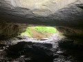
Further on, ignore the Vessoye local road (RF) which joins from your left. Carry on until you reach the picturesque site of the Montorge spring and its picnic table.You may be lucky enough to see the stream and, as you walk up along the banks, the waterfalls emerging from the rocky cirque.

(6) Set off again along the RF des Sources heading south-west and you’ll reach a junction at elevation 726 with the Chemin du Bagage.

(7) Turn right, staying on the RF, then ignore the road on your left. At the next junction, carry straight on, then ignore the road joining from the right. Shortly afterwards, you’ll reach a junction with the RF de la Fontaine du Tronc.

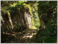
(8) Look out for the forest track heading off to the right into the woods below the road. Follow this lovely, moss-covered track, sheltered by the spruce trees, until you reach the junction by your car park (S/E).


Waypoints

  1. S/E : mi 0 - alt. 2,280 ft - Three-way junction
  2. 1 : mi 1.48 - alt. 2,211 ft - Junction towards Montorge, elevation 673
  3. 2 : mi 2.63 - alt. 2,313 ft - Crossroads at elevation 705
  4. 3 : mi 3.22 - alt. 2,287 ft - Crossroads at the edge of the woods, elevation 695
  5. 4 : mi 3.7 - alt. 2,444 ft - Crossroads at the entrance to the meadows, elevation 745
  6. 5 : mi 4.4 - alt. 2,336 ft - Junction with the Loyauboz forest road
  7. 6 : mi 6.59 - alt. 2,287 ft - Picnic table – Montorge Spring
  8. 7 : mi 7.47 - alt. 2,379 ft - Junction with the Chemin du Bagage
  9. 8 : mi 8.41 - alt. 2,320 ft - Junction with the RF de la Fontaine du Tronc
  10. S/E : mi 9.01 - alt. 2,283 ft - Three-way junction

Reviews and comments

5 / 5
Based on 1 review

Reliability of the description
5 / 5
Ease of following the route
5 / 5
Route interest
5 / 5
cnu25
cnu25

Hello @Isabelle39500 … thank you for that lovely comment; it’s much appreciated and it makes us want to carry on describing more walks … have a lovely day

Machine-translated

Isabelle39500
Isabelle39500

Overall rating : 5 / 5

Date of your route : Apr 27, 2025
Reliability of the description : ★★★★★ Very good
Ease of following the route : ★★★★★ Very good
Route interest : ★★★★★ Very good
Very busy route : No

A lovely walk through the Joux Forest along forest paths… it was very peaceful as we didn’t come across a soul… we explored the spring and the waterfalls, which were almost dry at this time of year, but it was still a wonderful connection with Mother Nature 🦋🙏

Machine-translated

Other walks in the area

For more walks, use our search engine .

The GPS track and description are the property of this route's author. Please do not copy them without permission.