The Gratteris circular route via the Saint-Maximin Chapel, Les Roches and Mamirolle

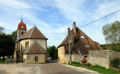
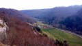
A walk with no particular difficulties, passing through beautiful forests where forestry work has, in places, left the paths a little rough. You’ll pass through the lovely site of the Saint-Maximin Chapel, then the Roches viewpoint will offer you a view over much of the plateau. You’ll then walk along a lovely forest track that will take you to the outskirts of Mamirolle. The return journey takes you through meadows and along the edges of the woods. Perhaps you’ll be lucky enough to spot some chamois in the pastures behind Le Gratteris or near the rocks? You can also visit the arboretum before enjoying the chapel grounds and their wooden tables, which are perfect for a rest.

The GPX track may prove useful.

Details

n°67242779
Creation:
Last update:
Last review:
  • Walking
    Activity: Walking
  • ↔
    Distance: 6.79 mi
  • ◔
    Average duration: 3h 45 
  • ▲
    Difficulty: Moderate

  • ⚐
    Back to start: Yes
  • ↗
    Ascent: + 738 ft
  • ↘
    Descent: - 745 ft

  • ▲
    Highest point: 2,054 ft
  • ▼
    Lowest point: 1,519 ft

Description of the walk

The starting point is on Rue de la Fougère, in a small square at the edge of a copse.

(S/E) Continue along this street, and at the junction with the RD 221, turn right. Then ignore Rue de la Fontaine and Rue des Prés du Pont. Walk past the town hall, leave Rue du Frêne behind and head towards the village exit. You will then come to a Fork in the road and a wayside cross.

(1) Turn left onto Chemin du Rocheret. Walk past the two sinkholes where the streams flowing down from the hill disappear. When you reach the end of the straight stretch, you’ll find a junction with two side paths.

 (2) Leave the white track and turn right onto the grassy path. Continue for about 150 m until you reach a T-junction. Turn left and carry on until you reach the clearly marked path marking the boundary of the municipality.

(3) Turn left and follow this path, which is often on a slope. You’ll reach a fork with a barely visible path.

(4) Turn right. The path soon becomes clearer. Walk past the signpost for the Rocher du Chamois (a return walk of about 50 m). Further on, you’ll reach the Bois Saint-Paul arboretum, then immediately come to a dirt track.

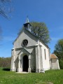
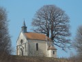
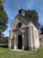
(5) Turn right, walk past the hut currently being renovated and arrive at a junction with a tarmac road at elevation 544. Turn left onto it and arrive at the Chapelle Saint-Maximin.

(6) After taking in the site and the view, continue along the narrow dirt track between two hedges, which leads to a pasture. Go through the gate and cross the meadow towards the road ahead, which you’ll reach once you’ve passed the fence.

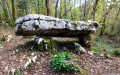
(7) Walk past the beautiful, renovated wash house, then turn left and immediately left again onto the white track heading towards the buildings in the craft centre. Continue through the woods, take a detour to see the dolmen, and you’ll reach a Fork in the road with a forest track.

(8) Take the path on the right, following the GR®145. After a long but very gentle climb, you’ll reach the sign for the Belvédère des Roches (elevation 587).

(9) Take a moment to turn left and admire the view. Return to the path and continue your walk. Further on, you’ll reach the RD112.

(10) Cross the road and continue straight ahead along the lovely GR®145 path. Stay on this path and ignore any other tracks you come across. The slope becomes steeper and you’ll soon reach a junction with a road at the corner of the water tower.

(11) Carry on downhill, turning left. A little further on, cross the RD112 carefully and continue until you reach a junction with a path on the left a little further down.

(12) Follow this path to the left, and cross the meadows, following this PR® sign to reach the RD221 at an elevation of 467.

(13) Follow it carefullytowards the village. Further on, you’ll reach the junction with Rue de la Fougère. Turn right onto it and head back to your car park (S/E).


Waypoints

  1. S/E : mi 0 - alt. 1,562 ft - Small square on Rue de la Fougère
  2. 1 : mi 0.34 - alt. 1,542 ft - Calvary at the fork in the road
  3. 2 : mi 0.81 - alt. 1,549 ft - Crossroads with two side paths
  4. 3 : mi 1.2 - alt. 1,686 ft - Junction with the municipal boundary
  5. 4 : mi 1.76 - alt. 1,781 ft - Junction of paths
  6. 5 : mi 2.01 - alt. 1,781 ft - Road
  7. 6 : mi 2.33 - alt. 1,791 ft - Chapelle St Maximin
  8. 7 : mi 2.54 - alt. 1,703 ft - RD 102 towards the wash house
  9. 8 : mi 2.86 - alt. 1,785 ft - Fork in the road with a forest path
  10. 9 : mi 3.46 - alt. 1,929 ft - Viewpoint sign at elevation 587
  11. 10 : mi 3.79 - alt. 1,841 ft - RD 112
  12. 11 : mi 5.21 - alt. 1,762 ft - Junction leading to the water tower
  13. 12 : mi 5.65 - alt. 1,575 ft - Junction with the PR
  14. 13 : mi 6.45 - alt. 1,526 ft - RD 221, elevation 467
  15. S/E : mi 6.79 - alt. 1,562 ft - Small square on Rue de la Fougère

Notes

Picnic tables near the Bois Saint-Paul arboretum and the Saint-Maximin Chapel.

Worth a visit

Chamois Rock, between (4) and (5).

Arboretum (5). 

Chapel, followed by the wash house (7) and dolmen.

Viewpoint (9). 

Always be cautious and plan ahead when you're outdoors. Visorando and the author of this route cannot be held responsible for any accidents occurring on this route.

The GR® and PR® markings are the intellectual property of the Fédération Française de Randonnée Pédestre.

Reviews and comments

3.3 / 5
Based on 3 reviews

Reliability of the description
3.3 / 5
Ease of following the route
3 / 5
Route interest
3.7 / 5
cnu25
cnu25

hello @oudot ; we found it but it was seriously dismantled . Have a nice day

Machine-translated

Oudot
Oudot

Overall rating : 4 / 5

Date of your route : Jun 02, 2025
Reliability of the description : ★★★★☆ Good
Ease of following the route : ★★★★☆ Good
Route interest : ★★★★☆ Good
Very busy route : Yes

The route is a pleasant one to follow, with no particular difficulties despite a few gentle inclines and some steep paths. But I’m always on the lookout for dolmens.

Machine-translated

PAYER François
PAYER François

Overall rating : 2.7 / 5

Date of your route : Apr 05, 2025
Reliability of the description : ★★☆☆☆ Disappointing
Ease of following the route : ★★☆☆☆ Disappointing
Route interest : ★★★★☆ Good
Very busy route : No

1) “Turn left onto the Chemin du Rocheret…” There’s no sign indicating this name.

2) … and you’ll come to a T-junction … We won’t dwell on the shape of the T … continuing along the grassy path, there is indeed a track that climbs … Where?

The “clearly marked path marking the municipal boundary” – how are you supposed to know that this is the municipal boundary?
“Turn left...” at this point, the GPX track suggests turning right…?

Machine-translated

jean-luc et odile
jean-luc et odile

Overall rating : 3.3 / 5

Date of your route : Feb 28, 2025
Reliability of the description : ★★★★☆ Good
Ease of following the route : ★★★☆☆ Average
Route interest : ★★★☆☆ Average
Very busy route : No

Paths badly damaged by forestry work – it was difficult to follow the route to the chapel, so we took the tarmac road

Machine-translated

Other walks in the area

For more walks, use our search engine .

The GPS track and description are the property of this route's author. Please do not copy them without permission.