Country:

 City:
City:


(S/E) The start is in the car park at Montgesoye Town Hall. Set off to the right onto Rue de la Ville Haute, then turn left at the first junction. Shortly afterwards, you’ll reach the junction with the Chemin des Vergers de Chauchard.
(1) Turn right onto this country lane. At the water tower, it turns sharply left. Continue along this track through meadows and fallow land until you reach a crossroads further on.
(2) Take the hairpin bend to the left and head downhill to join the Route de Durnes.
(3) Turn right and walk carefully alongside the road. After about 200 metres, look out for a dirt track branching off to your left. At the signpost, turn left onto this lovely path and stay on it for about 2 km.
(4) Cross the Ruisseau d’Amathay and follow it. Further on, take the hairpin bend to the left and, a little further on, look out for a grassy path on your right, in a tight left-hand bend.
(5) Take this path, which will soon rejoin thePR®. Further on, you’ll reach a junction where several paths meet.
(6) Follow thePR® trail, which turns right, then shortly afterwards right again, heading south. Continue along this path, which gradually widens before joining the D133 (elevation 432).
(7) At this bend in the departmental road, turn left and climb carefully to reach the entrance to the pastures, where the path branches off fromthe PR® (elevation 472).
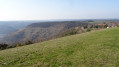
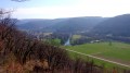
(8) Enter the meadow on your right to reach the Thuyère viewpoint further on. At the edge of the cliff, to the left of the information board, look out for a small wooden signpost pointing towards the village.
(9) Take this small path towards the village. As the slope becomes steeper, in a narrow passage, you’ll reach a junction with another path.
(10) At the junction of the two paths, head slightly to the left and climb quite steeply to reach a smallPR® junction. Turn right and stay on this path, avoiding any side tracks.
(11) At the waterfall, continue between the boulders along the edge of the stream bed – which is often dry – following thePR® path that runs alongside the stream. You’ll reach a footbridge.
(12) Do not cross the stream here. Turn left towards the Waterfall de Vau, following a path that is more or less well-marked, which runs along the stream bed at low water or along its banks (which may be steep in places if water levels are high). You will reach the foot of the Waterfall de Vau.
(13) After enjoying the cool surroundings, head back along the path in the opposite direction, though you needn’t stick exactly to your original route, as some obstacles are easier to negotiate in one direction than the other. Return to the footbridge.
(12) Cross it and follow the stream along its left bank. Leave the forest and, at the edge of the meadows, look out for a crossroads with a path (marker v375).
(14) Carry on straight ahead through the valley, ignoring the path leading uphill to the left.
Shortly afterwards, ignore thePR® as it branches off to the right to cross the stream. Not only is it almost invisible, but access to its end point in the village is now prohibited.
Carry on along your route to reach Rue de la Ville Haute.
(15) Take this street on your right and head up into the village. Pass the junction you took at the start and return to your car park (S/E).


 Visorando Member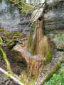

 Easy
Easy