Country:

 City:
City:


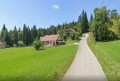
The route starts from the cemetery car park (there is another car park available in front of the village hall).
(S/E) Head south (do not cross the river) and follow the D127 for about 150 m.
(1) Just past the village hall, take a small road on the left. The tarmac soon gives way to a stony path, then a grassy one. Walk gently uphill to rejoin the D127.
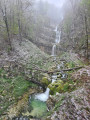
(2) Cross the road carefully and take the lovely path opposite, which immediately bends sharply to the right and enters the forest. Look out for a viewpoint over the Bief de la Ruine waterfall. Continue climbing along the path until you reach some meadows.
(3) At the junction, leave the white track and turn right onto a dirt forest path. Stay along the edge of the woodland, then enter the forest again. You’ll reach a junction with a cross-country path.
(4) Turn left and follow the Ruisseau de la Senge. Further on, cross the stream, either by wading across or using a rather makeshift footbridge… Continue southwards until you reach a junction.
(5) Turn left, towards the house by the lake. You’ll reach a small road; follow it to the left and cross the stream again. Walk through the hamlet of Les Fumey and reach a junction.
(6) Then turn right onto the D62. Walk carefully along this road until you reach some signposts.
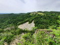
(7) Turn left onto the signposted path, heading towards Crêt Pelé (the IGN map background is not up to date here). Follow the numerous signposts to find your way through the copses. Reach the summit of Crêt Pelé (views of Foncine and Mont Noir and, in the opposite direction, Lac des Rouges Truites, Fort-du-Plasne, etc.
(8) Head west-south-west towards La Corne and Fort-du-Plasne. Descend through the pastures, following the markers, until you reach a tarmac road. Turn right and walk for about fifty metres.
(9) Take the stony track on the left. Pass through the various fences using the designated gates. Ignore a path branching off to the right; continue south-west through the countryside until you reach a farm track.
(10) First turn left then right to follow the signpostedPR®® route. Continue south-west until you reach a tarmac road.
(11) Turn right here, immediately leaving a dirt track on your left, and shortly afterwards take a path that descends alongside the road. Cross the road and continue along the path opposite. Pass a sawmill.
(12) At the junction (Lac de Fort-du-Plasne on the right), go straight on towards Les Vernes. Further on, turn right onto the track and follow it until you reach a dirt track.
(13) First turn right then left and leave the hamlet of Les Vernes on your right. Head off along the Vie du Four. Walk for a long way north-west. Pass a wayside cross, ignore a track coming in from the left and reach a junction with a tarmac road.
(14) Follow the road to the right and pass under a high-voltage power line.
(15) When the road bends to the right (signposted), leave it and take a path on the left, heading towards Entre-Deux-Monts. Walk down a gentle slope. Ignore a path coming from the left and continue east-north-east until the next junction.
(16) Turn slightly to the right. Walk for a while east-north-east, ignoring a path branching off to the left. Further on, cross the Ruisseau de la Senge and join the D16.
(17) First turn right then left to cross the D16 with care and follow the D127 towards Les Planches-en-Montagne.
(1) Continue straight ahead and you’ll soon reach the starting point (S/E).




 Visorando Member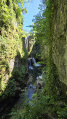
 Easy
Easy 
 Difficult
  Tourist office