Circular route around Malbuisson via Fort Saint-Antoine and Montperreux

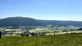
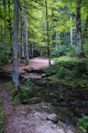
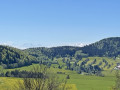
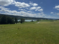
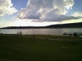
A lovely circular walk above Malbuisson that will take you to Fort Saint-Antoine (or Fort Lucotte), one of the sites where Comté cheese is matured. From there, through meadows and mountain pastures, and through the woods, you’ll reach the borders of Touillon and Loutelet with a superb view of the peaks of the Swiss Jura, the Mont d’Or and the resort of Métabief, and, weather permitting, Mont Blanc. After reaching Montperreux, you’ll walk along pleasant paths with views of Lake Saint-Point and the village of Chaudron.
Please note: some sections can be tricky to navigate; as a precaution, we recommend using the app or a hiking GPS.

Details

48216769
Creation:
Last update:
Last review:
  • Walking
    Activity: Walking
  • ↔
    Distance: 9.07 mi
  • ◔
    Average duration: 5h 00 
  • ▲
    Difficulty: Moderate

  • ⚐
    Back to start: Yes
  • ↗
    Ascent: + 928 ft
  • ↘
    Descent: - 912 ft

  • ▲
    Highest point: 3,589 ft
  • ▼
    Lowest point: 3,081 ft

Description of the walk

Parking available at the Parc Aventure car park, Rue de la Côte de Chaudron.

(S/E) Head back up towards the park’s entrance chalet. At the junction, ignore the path straight ahead and slightly to the right; instead, head south along the path climbing into the forest and running alongside the tree-top adventure course. Continue until you reach a road.

(1) Turn left, pass the old farm and enter the forest. Shortly afterwards, you’ll reach a crossroads.

(2) Turn right, cross communal fields and wooded meadows, and look out for signs in a clearing.

(3) Turn right onto a lovely path signposted as a mountain bike trail. Carry on and, as you approach the edge of the pastures, you’ll find a path branching off to your left.

(4) Take this forest track on your left, which heads back slightly before curving sharply to the right and joining a tarmac road.

(5) Turn left towards Fort Saint-Antoine. Follow the road, ignoring any side paths, until you reach the entrance at a cattle grid and some signposts.

(6) Continue to the car park. Enjoy the view and the orientation board showing the surrounding peaks. You can also make use of the various picnic tables, some sheltered and some not, near the car park.

(7) Head back to the Canadian gate.

(6) Look out for the signposts. Walk down the embankment and head to the right, following the tractor tracks across the pasture. Follow thePR® trail and its markings – which are often quite faint – heading north-east.

(8) Further on, at a high-voltage pylon, turn left and head towards the forest. When the path bends to the left, look for a small track on your right.

(9) Leave the marked path and head right, skirting the meadows and the boundary of the municipality. A good sense of direction is essential in this area, and it is advisable to open the app. After a 90° left-hand bend, you’ll reach a wide white track which forms part of the GTJ (Grande Traversée du Jura) route (GR®509).

(10) Turn right onto this track and continue until you come within sight of a huge quarry, with the village of Touillon-et-Loutelet at your feet. Head down to a hairpin bend to the right.

(11) Just before this, take the white track on your left, which climbs slightly to reach the edge of the forest. Enjoy the view of the Jura and the Alps one last time. Continue along this pleasant, well-shaded track. You’ll come to some signposts at a junction.

(12) At the sign for “La Fuvelle”, turn right, staying on the main path. You’ll come to a road; follow it. Carry on straight ahead, ignoring the various paths branching off to the right or left. Further on, you’ll reach a large forest lodge with picnic tables; walk past it and through a wooded area to reach the edge of the fields, with a farm in sight.

(13) Turn right, walk along the first meadow and continue along the path that crosses the second. The map does not accurately reflect the actual terrain. Find the gap between two large trees that leads you into the undergrowth. Return to the meadows and follow the tractor tracks across these grassy areas. Further on, you’ll reach a road.

(14) Turn left, cross the Fuvelle Nordic ski area and reach the village of Montperreux. Turn right, then left at the Fork in the road that appears immediately, and head downhill to reach a junction and a car park.

(15) Then turn left onto Rue de la Côte. Leave the village and continue southwards. A little further on, look out for a path on the right.

(16) Take this well-marked path, which descends quite steeply to the right. The slope levels out shortly afterwards and the path splits in two. Take the left-hand path, which remains at the same level. Carry on until you reach a tarmac road.

(17) Turn left here and you’ll reach a junction. Take the road on the right and carry on. Much further on, on the descent, look out for a junction with paths leading off to the right.

(18) Turn right towards the fir trees, then immediately left onto the path leading down between the trees. Carry on until you come out onto the forest track. Return to your car park (S/E).


Waypoints

  1. S/E : mi 0 - alt. 3,087 ft - S/E Adventure Park car park. Near the - Lac Saint Point
  2. 1 : mi 0.42 - alt. 3,346 ft - Junction – Dirt track
  3. 2 : mi 0.58 - alt. 3,389 ft - Junction – Turn right
  4. 3 : mi 0.88 - alt. 3,465 ft - Junction – Path following a mountain bike trail
  5. 4 : mi 1.3 - alt. 3,484 ft - Forest track to the left
  6. 5 : mi 1.78 - alt. 3,488 ft - Road to the left
  7. 6 : mi 2.2 - alt. 3,570 ft - Canadian Passage – Entrance to the estate - Caves du fort de Saint-Antoine
  8. 7 : mi 2.26 - alt. 3,576 ft - Car park, picnic area
  9. 8 : mi 2.68 - alt. 3,586 ft - High-voltage pylon, on the left
  10. 9 : mi 2.87 - alt. 3,537 ft - Junction of marked trail – Path on the right
  11. 10 : mi 3.43 - alt. 3,415 ft - Junction – GTJ on the right
  12. 11 : mi 4.52 - alt. 3,481 ft - GTJ bend – Dirt track on the left
  13. 12 : mi 5.19 - alt. 3,484 ft - La Fuvelle – Main path
  14. 13 : mi 6.09 - alt. 3,425 ft - In sight of a farm – Edge of the field
  15. 14 : mi 6.73 - alt. 3,383 ft - Junction – Tarmac road
  16. 15 : mi 7.09 - alt. 3,271 ft - Rue de la Côte
  17. 16 : mi 7.47 - alt. 3,356 ft - Path leading down to the right
  18. 17 : mi 8.29 - alt. 3,297 ft - Junction – Tarmac road
  19. 18 : mi 8.92 - alt. 3,199 ft - Path on the right leading down through the pine trees
  20. S/E : mi 9.07 - alt. 3,084 ft - Adventure Park car park

Notes

Shelter with table and chairs at point (5).
Open-air and covered picnic tables at the Fort Saint-Antoine site.
Between (6) and (10), the route is poorly signposted; a map is often required.
Between (13) and (14), the path on the ground differs from the map. Follow the route as marked.

Worth a visit

Always be cautious and plan ahead when you're outdoors. Visorando and the author of this route cannot be held responsible for any accidents occurring on this route.

The GR® and PR® markings are the intellectual property of the Fédération Française de Randonnée Pédestre.

Reviews and comments

4.1 / 5
Based on 4 reviews

Reliability of the description
3.8 / 5
Ease of following the route
3.5 / 5
Route interest
5 / 5
User 25988864

Overall rating : 3.7 / 5

Date of your route : Jun 09, 2026
Reliability of the description : ★★★☆☆ Average
Ease of following the route : ★★★☆☆ Average
Route interest : ★★★★★ Very good
Very busy route : No

I’d set off with nothing but a printed map, but without climbing over the barbed wire and my mate’s GPS, we’d never have finished the route... The surroundings are magnificent.

Machine-translated

Isabelle39500
Isabelle39500

Overall rating : 4.7 / 5

Date of your route : Oct 06, 2025
Reliability of the description : ★★★★★ Very good
Ease of following the route : ★★★★☆ Good
Route interest : ★★★★★ Very good
Very busy route : Yes

A wonderful discovery, but as already mentioned, there is no path between points 9 and 10. Fortunately, the GPS is excellent and we found our way through the meadows.

Machine-translated

cnu25
cnu25

Hello cuzcodon... thank you for your feedback... it’s true that we often take unmarked paths on the GR trails for our own enjoyment, and as a result, we end up blazing a trail a bit blindly... but for me it’s a pleasure because all the suggested walks have been tried and tested on the ground by our own two feet.

Machine-translated

cuzcodom
cuzcodom

Overall rating : 4.3 / 5

Date of your route : Aug 05, 2024
Reliability of the description : ★★★★☆ Good
Ease of following the route : ★★★★☆ Good
Route interest : ★★★★★ Very good
Very busy route : No

A brilliant walk.
We love the wild crossings amongst the cows.
Just one problem: even with the GPS and the app, it was impossible to follow the route between points 9 and 10. Should we cross the barbed wire or not?

Machine-translated

cnu25
cnu25

Hello MduViso... what a shortcut!!!

Machine-translated

MDuViso
MDuViso

Overall rating : 3.7 / 5

Date of your route : Jul 09, 2024
Reliability of the description : ★★★☆☆ Average
Ease of following the route : ★★★☆☆ Average
Route interest : ★★★★★ Very good
Very busy route : No

Hello,
We missed the turn-off at point 3… and ended up back at the fort via the return route!!!
After point 9, we had a real struggle at the right-angled junction.
We ended up going off-track to get to point 2!!! After that, no problems – great info.
Thanks for this suggestion – it was more interesting than the lake circuit after all.
MDu

Machine-translated

Other walks in the area

For more walks, use our search engine .

The GPS track and description are the property of this route's author. Please do not copy them without permission.