Refine your search for walks in Échalas
Échalas walks


 Between Echalas and Longes J 2
 Visorando Member
 13.49 mi
 +2,201 ft
 -2,221 ft
 8h 05
8h 05
 Difficult
 Departure from Échalas (Rhône)
A long walk through the countryside of the lower Pilat region, with little elevation gain but stream crossings (fords) which may be difficult depending on the season and water level.
In the Gier Valley
 3.64 mi
+692 ft
-679 ft
2h 15
3.64 mi
+692 ft
-679 ft
2h 15
 Easy
Departure from Saint-Romain-en-Gier (Rhône)
Easy
Departure from Saint-Romain-en-Gier (Rhône)
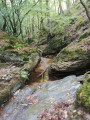
The walk is often through woodland between Saint-Romain-en-Gier and Échalas, north of Pilat (Gier valley).
Between Trèves and Échalas
 6.78 mi
+1,165 ft
-1,161 ft
4h 10
6.78 mi
+1,165 ft
-1,161 ft
4h 10
 Moderate
Departure from Dargoire (Loire)
Moderate
Departure from Dargoire (Loire)
Walk between the two villages of Bas-Pilat, crossing several streams and valleys that descend to the Gier.
Circular route from Trèves via the Croix de Crème, Croix du Trève and Croix de Longes
 18.08 mi
+3,612 ft
-3,602 ft
11h 30
Difficult
Departure from Trèves (Rhône) (Rhône)
18.08 mi
+3,612 ft
-3,602 ft
11h 30
Difficult
Departure from Trèves (Rhône) (Rhône)
This hike near Givors winds through the many wooded valleys and rural hills of the south-eastern Pilat region. It begins by passing through the Grand Malval valley and climbs up to the Croix de Crème, then the Croix du Trêve, to cross the Petit Malval valley. It climbs to the Croix de Longes after passing through the village of the same name, then crosses the successive valleys of the Ruty, the Mézerin, the Jannoray and the Mézerin once more to return to the village of Trèves.
Circular Dargoire in Chagnon
 19.07 mi
+2,792 ft
-2,782 ft
11h 10
Difficult
Departure from Dargoire (Loire)
19.07 mi
+2,792 ft
-2,782 ft
11h 10
Difficult
Departure from Dargoire (Loire)
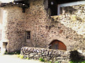
This hike, alternating between small roads and dirt tracks on the south-facing side of the Gier valley, largely avoids muddy patches and benefits from a south-facing aspect, making it more enjoyable in winter. From Dargoire, a charming little medieval village, the route heads west, crossing the Bezançon valley over the rustic stone bridge of La Roussilière and, after a detour to the waterfall, climbs up to the village of Saint-Joseph. It runs along the top of the Saint-Martin-la-Plaine zoological park, then passes in front of the small chapel of La Cula, before crossing the hamlet of Tarévieux. It descends to Chagnon, heads east to follow the Durèze and passes under its remarkable Roman bridge. It climbs back up to Genilac, crosses the Féloin valley, then descends to Les Peschures, from where it climbs to Grand leat. At La Renavelière, it climbs through woods in the Bezançon valley and, via La Roussilière, reaches Tartaras, then plunges down to Dargoire.
Around Saint-Andéol-le-Château
 5.29 mi
+151 ft
-144 ft
2h 35
Easy
Departure from Saint-Andéol-le-Château (Rhône)
5.29 mi
+151 ft
-144 ft
2h 35
Easy
Departure from Saint-Andéol-le-Château (Rhône)
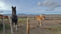
A walk in the countryside for those who don't like hills. Wide views of the ridges with meadows, moors and horses on the Mornantais plateau.
Loop starting from Croix Régis
 6.81 mi
+1,112 ft
-1,106 ft
4h 05
Moderate
Departure from Les Haies (Rhône)
6.81 mi
+1,112 ft
-1,106 ft
4h 05
Moderate
Departure from Les Haies (Rhône)
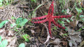
This is a hike through the woods in the Pilat massif, best done in dry weather and avoided in strong winds as most of the route is in the woods with few paved roads.
The Givors valleys and the Echalas plateau (long version)
11.51 mi
+1,775 ft
-1,755 ft
6h 50
Moderate
Departure from Givors (Rhône)
A walk between Givors and Echalas, mostly through woods and along wild valleys. Although close to the town, this walk remains very natural before reaching the plateau.
The Combes de Givors
7.46 mi
+978 ft
-978 ft
4h 15
Moderate
Departure from Givors (Rhône)
Hike in the valleys between Givors and Echalas, in unspoilt countryside just a stone's throw from a large town.
Around and in the Combe d'Allier
 12.74 mi
+1,129 ft
-1,152 ft
6h 50
Moderate
Departure from Saint-Andéol-le-Château (Rhône)
12.74 mi
+1,129 ft
-1,152 ft
6h 50
Moderate
Departure from Saint-Andéol-le-Château (Rhône)
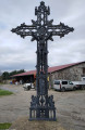
A long, bucolic walk on the plateau of Saint-Andéol-le-Château and Saint-Jean-de-Toulas, interspersed with valleys and streams. Long but easy with little elevation gain.
Les Six Croix
18.51 mi
+3,123 ft
-3,117 ft
11h 15
Moderate
Departure from Longes (Rhône)
Beautiful day hike in the Pilat Massif (Loire) and around the Couzon Dam.
Starting from Longes, there are many hikes of varying lengths from an altitude of 450m to 1400m (at Cret de la Perdrix) or 1235m (at Cret de l'Oeillon).
From Longe to Sainte-Croix-en-Jarez
 9.02 mi
+1,621 ft
-1,591 ft
5h 35
Moderate
Departure from Longes (Rhône)
9.02 mi
+1,621 ft
-1,591 ft
5h 35
Moderate
Departure from Longes (Rhône)
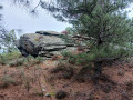
Starting from the village of Longes, this hike will take you to the Roches de Marlin site. You will then pass through the former Chartreuse de Sainte-Croix-en-Jarez. Along the way, you will enjoy beautiful views of the Lyon region, the Monts du Lyonnais, the Gier Valley and the Rhône Valley. In good weather, you can even see the Alps.
Mont Monnet from Longes
 12.18 mi
+2,421 ft
-2,444 ft
7h 45
Difficult
Departure from Longes (Rhône)
12.18 mi
+2,421 ft
-2,444 ft
7h 45
Difficult
Departure from Longes (Rhône)
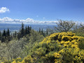
A very beautiful hike that allows you to discover some very interesting places, especially the beautiful village of Sainte-Croix-en-Jarez, with magnificent views along the entire route.
La Vaure
 8.12 mi
+732 ft
-741 ft
4h 20
Moderate
Departure from Chassagny (Rhône)
8.12 mi
+732 ft
-741 ft
4h 20
Moderate
Departure from Chassagny (Rhône)
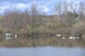
This is a pleasant walk around Chassagny and Montagny, passing the Château de Chassagny and the Château de La Vaure, as well as a pretty footbridge over the Mornantet.
Grand Tour of Mornant
14.54 mi
+1,713 ft
-1,693 ft
8h 10
Moderate
Departure from Mornant (Rhône)
A long walk with little elevation gain around Mornant, with the option to visit the old village.
From La Roussillière to Les Bozançons
 6.25 mi
+988 ft
-955 ft
3h 45
Moderate
Departure from Saint-Maurice-sur-Dargoire (Rhône)
6.25 mi
+988 ft
-955 ft
3h 45
Moderate
Departure from Saint-Maurice-sur-Dargoire (Rhône)
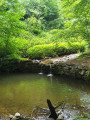
A wild walk, often along the Bozançon, with the option to visit special sites (Roman aqueduct).
Above the Bozançon
2.90 mi
+554 ft
-571 ft
1h 50
Easy
Departure from Saint-Maurice-sur-Dargoire (Rhône)
A short hike accessible to all with suitable footwear. Very pleasant in summer as it passes partly through woodland and partly in the open along the Bozançon.
Our canine friends will find shade on 75% of the route, less than 1000 m of road (with little traffic), and 2 river water refill points.
Le Crêt de la Magdeleine in Longes
 4.67 mi
+673 ft
-692 ft
2h 45
Easy
Departure from Longes (Rhône)
4.67 mi
+673 ft
-692 ft
2h 45
Easy
Departure from Longes (Rhône)
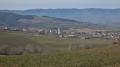
Walk in the hills above Longes with magnificent panoramic views of the Alps, the Pilat massif and the Monts du Lyonnais. Car park with a beautiful table and two magnificent wooden deckchairs from which to admire the Rhône valley and the Alps.
Around Le Colombier
 9.95 mi
+1,391 ft
-1,411 ft
5h 45
Moderate
Departure from Loire-sur-Rhône (Rhône)
9.95 mi
+1,391 ft
-1,411 ft
5h 45
Moderate
Departure from Loire-sur-Rhône (Rhône)
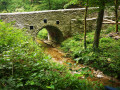
Walk in the forest with three charming streams and beautiful views of the valley. A complete change of scenery for the day.
Stream crossings near Loire-sur-Rhône
 6.95 mi
+1,306 ft
-1,306 ft
4h 20
Moderate
Departure from Loire-sur-Rhône (Rhône)
6.95 mi
+1,306 ft
-1,306 ft
4h 20
Moderate
Departure from Loire-sur-Rhône (Rhône)
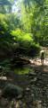
Shaded walk along the banks of streams in a Rhône ravine. A surprisingly peaceful natural area given its proximity to urban centres.
Girard – Le Grisard circular loop
 8.21 mi
+1,178 ft
-1,152 ft
4h 50
Moderate
Departure from Ampuis (Rhône)
8.21 mi
+1,178 ft
-1,152 ft
4h 50
Moderate
Departure from Ampuis (Rhône)
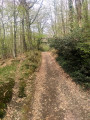
A hike with a varied route, mostly through woodland, with a short stretch of tarmac road, a few fords to cross and, in some places, a path running alongside a small stream, the water level of which varies depending on the season. Best undertaken in dry weather. Views over the Rhône Valley, the Vercors and the Alps.
Old wall circuit
5.79 mi
+804 ft
-787 ft
3h 20
Easy
Departure from Saint-Maurice-sur-Dargoire (Rhône)
A beautiful, easy walk on either side of the Bozançon River, where this section of the valley is a succession of ancient terraces structured by low stone walls. A taste of Provence... Old description, see reviews if you are not using the app.
Going up the Bozançons
 10.59 mi
+1,388 ft
-1,385 ft
6h 05
Moderate
Departure from Saint-Maurice-sur-Dargoire (Rhône)
10.59 mi
+1,388 ft
-1,385 ft
6h 05
Moderate
Departure from Saint-Maurice-sur-Dargoire (Rhône)
This varied circuit runs through the upper catchment area of the Grand and Petit Bozançon rivers, taking you along the banks of streams, up hillsides through orchards and, at times, offering unobstructed views of the Pilat mountain range.
Around the Bozançon
 8.55 mi
+1,220 ft
-1,194 ft
5h 00
Moderate
Departure from Saint-Maurice-sur-Dargoire (Rhône)
8.55 mi
+1,220 ft
-1,194 ft
5h 00
Moderate
Departure from Saint-Maurice-sur-Dargoire (Rhône)
Walk around the Bozançon valley (and even the Bozançon rivers) with remains of Roman aqueducts, water mills, old railway tracks and old gold mines.
At Les Piles, you can continue up the Bozançon to the viaduct and return to Jurieux via the old railway line (an extra 2 hours).
De Saint-Maurice-sur-Dargoire, boucle des ruisseaux Bezançon
 16.66 mi
+3,107 ft
-3,084 ft
10h 20
Difficult
Departure from Saint-Maurice-sur-Dargoire (Rhône)
16.66 mi
+3,107 ft
-3,084 ft
10h 20
Difficult
Departure from Saint-Maurice-sur-Dargoire (Rhône)
This circular hike in the Monts du Lyonnais between the Rhône and Loire rivers takes place in a little-visited and rather secret area around the Bezançon valleys and its tributaries, including the Grand Bezançon and Petit Bezançon, passing through a few isolated hamlets. It allows you to discover three arches, remnants of the Roman aqueduct of the Gier, and a high bridge pier of a railway line, intended to connect Rive-de-Gier to Mornant, whose construction was halted by the war of 1914. This route can be shortened to 23 km with an 800 m elevation gain by taking a shortcut (see practical information).
Between the Rhône and Loire rivers in Saint-Joseph
 4.44 mi
+653 ft
-679 ft
2h 35
Easy
Departure from Saint-Joseph (Loire)
4.44 mi
+653 ft
-679 ft
2h 35
Easy
Departure from Saint-Joseph (Loire)
Straddling the Loire and Rhône rivers, near Rive de Gier, Saint-Joseph and Saint-Maurice-sur-Dargoire, this is a very pleasant walk along the river.
Trek around Saint-Joseph - Le Mas
 3.81 mi
+377 ft
-400 ft
2h 05
Moderate
Departure from Saint-Joseph (Loire)
3.81 mi
+377 ft
-400 ft
2h 05
Moderate
Departure from Saint-Joseph (Loire)
This hike is primarily along clear paths with views over le Pilat and Sainte-Catherine. An easy trek with some slight up and downhill slopes. Be careful, as non-stone tracks can get muddy in the rainy season.
Between the Roman aqueduct of Gier and the unfinished railway line
9.14 mi
+1,601 ft
-1,601 ft
5h 35
Moderate
Departure from Saint-Maurice-sur-Dargoire (Rhône)
Take a walk through time, between the Roman aqueduct of the Gier and the unfinished railway line, interrupted by the First World War, which was supposed to link Mornant to Rive-de-Gier.
Around Mornant
 10.82 mi
+1,519 ft
-1,532 ft
6h 20
Moderate
Departure from Mornant (Rhône)
10.82 mi
+1,519 ft
-1,532 ft
6h 20
Moderate
Departure from Mornant (Rhône)
Walk in the Mornant countryside after visiting the medieval centre.
Heathland and meadows in Montagny
 4.38 mi
+75 ft
-75 ft
2h 05
Easy
Departure from Montagny (Rhône) (Rhône)
4.38 mi
+75 ft
-75 ft
2h 05
Easy
Departure from Montagny (Rhône) (Rhône)
This is an easy walk, best done in the cool of the evening in summer as it is a very sunny area.
Panoramic view of Mont Monnet from the Col de Grenouze
 2.50 mi
+512 ft
-512 ft
1h 35
Easy
Departure from La Chapelle-Villars (Loire)
2.50 mi
+512 ft
-512 ft
1h 35
Easy
Departure from La Chapelle-Villars (Loire)
Magnificent panoramic view of the Alps on a clear day. Partially shaded return route through the woods. Somewhat strenuous climb but no technical difficulty.
Pilat hike
 17.49 mi
+3,130 ft
-3,143 ft
10h 45
Moderate
Departure from La Chapelle-Villars (Loire)
17.49 mi
+3,130 ft
-3,143 ft
10h 45
Moderate
Departure from La Chapelle-Villars (Loire)
Hike in the heart of Pilat, with magnificent panoramic views alternating between the Rhône valley to start with, then the Gier valley and finally the Lyon region in the distance.
The Mont Monnet tour
 5.40 mi
+791 ft
-801 ft
3h 10
Moderate
Departure from La Chapelle-Villars (Loire)
5.40 mi
+791 ft
-801 ft
3h 10
Moderate
Departure from La Chapelle-Villars (Loire)
Walk around Mont Monnet on small roads and good paths with views of the Rhône valley.
A viewpoint overlooking the Chartreuse de Sainte-Croix-en-Jarez
12.54 mi
+2,188 ft
-2,185 ft
7h 40
Difficult
Departure from La Chapelle-Villars (Loire)
With easy and quick access from the A7 motorway coming from Lyon, La Chapelle-Villars is an ideal starting point for exploring the Pilat Massif. This route takes you to Sainte-Croix-en-Jarez and offers a beautiful view of the Chartreuse from the heights of Sainte-Croix.
Couzon dam
 5.35 mi
+548 ft
-558 ft
2h 55
Easy
Departure from Châteauneuf (Loire) (Loire)
5.35 mi
+548 ft
-558 ft
2h 55
Easy
Departure from Châteauneuf (Loire) (Loire)
This is a beautiful hike that allows you to see different landscapes: lake, forest, path and, finally, the river bed as you pass over a pretty aqueduct. This hike is a shorter variation in the opposite direction to the hike I found on this website, called 'Around the Couzon Dam'.
Around the Couzon Dam
12.85 mi
+2,175 ft
-2,172 ft
7h 50
Difficult
Departure from Châteauneuf (Loire) (Loire)
Walk in the Pilat, 6 km from Rive de Gier, around the beautiful Lake Barrage du Couzon.
Couzon Dam, Les Roches de Marlin, Sainte-Croix-en-Jarez
 9.71 mi
+1,453 ft
-1,430 ft
5h 45
Moderate
Departure from Châteauneuf (Loire) (Loire)
9.71 mi
+1,453 ft
-1,430 ft
5h 45
Moderate
Departure from Châteauneuf (Loire) (Loire)
Walk to the Roches de Marlin and return along the Lac du Couzon. On the way, you can visit the former Chartreuse de Sainte-Croix-en-Jarez.
From the Couzon Dam to Sainte-Croix-en-Jarez
 6.47 mi
+955 ft
-932 ft
3h 50
Moderate
Departure from Châteauneuf (Loire) (Loire)
6.47 mi
+955 ft
-932 ft
3h 50
Moderate
Departure from Châteauneuf (Loire) (Loire)
Discover Sainte-Croix-en-Jarez and its Chartreuse in the Pilat region, starting from the dam on the Couzon.
The Chartreuse de Sainte-Croix-en-Jarez
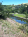 7.64 mi
+1,306 ft
-1,299 ft
4h 40
Moderate
Departure from Châteauneuf (Loire) (Loire)
7.64 mi
+1,306 ft
-1,299 ft
4h 40
Moderate
Departure from Châteauneuf (Loire) (Loire)
Hike in the Pilat Massif with views of the Rhône Valley.
Circular route around Sainte-Croix-en-Jarez starting from the Couzon dam.
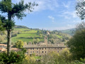 11.18 mi
+1,690 ft
-1,696 ft
6h 35
Moderate
Departure from Châteauneuf (Loire) (Loire)
11.18 mi
+1,690 ft
-1,696 ft
6h 35
Moderate
Departure from Châteauneuf (Loire) (Loire)
A very pleasant route starting from the Couzon dam, a little steep in places, alternating between nature and history. Once you reach Sainte-Croix-en-Jarez, it continues with a circular route passing by the Croix de Marlin. The paths are sometimes very stony, so this is not a family-friendly route.
Around Saint-Laurent d'Agny
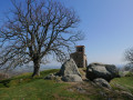 10.38 mi
+781 ft
-810 ft
5h 25
Moderate
Departure from Taluyers (Rhône)
10.38 mi
+781 ft
-810 ft
5h 25
Moderate
Departure from Taluyers (Rhône)
A day's hike along pleasant wooded paths around Saint-Laurent d'Agny with a break in front of the superb chapel dedicated to Saint Vincent, the patron saint of winegrowers.
La Vielle Chapelle via the Col de Grenouze and Col du Pavezin
 8.14 mi
+1,703 ft
-1,683 ft
5h 15
Moderate
Departure from Chuyer (Loire)
8.14 mi
+1,703 ft
-1,683 ft
5h 15
Moderate
Departure from Chuyer (Loire)
A hike in the hills above Chuyer, mostly through woodland, best undertaken in dry weather and to be avoided in strong winds. This hike passes through the Col de Grenouze and the Col du Pavezin, with the option, depending on the weather, to shorten it at the (4) to link directly to the (10).
Via Mont Ministre
 9.72 mi
+2,195 ft
-2,175 ft
6h 25
Moderate
Departure from Chuyer (Loire)
9.72 mi
+2,195 ft
-2,175 ft
6h 25
Moderate
Departure from Chuyer (Loire)
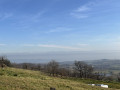
A very pleasant walk in the Pilat Massif.
Some beautiful panoramic views of the Rhône valley, Crêt de l'Oeillon and Trois Dents.
The Rhône floodplains between Grigny and Millery
 2.57 mi
+30 ft
-30 ft
1h 10
Easy
Departure from Grigny (Rhône) (Rhône)
2.57 mi
+30 ft
-30 ft
1h 10
Easy
Departure from Grigny (Rhône) (Rhône)
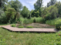
This walk connects Grigny to the hillsides of Millery via the banks of the Rhône. The route passes through wooded areas and unspoilt natural landscapes. You’ll discover the educational pond, the pumping station fed by the waters of the Rhône, the floodplains and several small natural beaches along the riverbank. Views of the Rhône valley accompany much of the walk.
Tupin, Condrieu, Semons: between the Rhône and the vineyards
 6.95 mi
+548 ft
-528 ft
3h 40
Easy
Departure from Tupin-et-Semons (Rhône)
6.95 mi
+548 ft
-528 ft
3h 40
Easy
Departure from Tupin-et-Semons (Rhône)
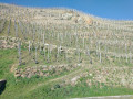
A hike with a very varied route.
Discover the Lônes with nature observatories in the protected area of Île du Beurre.
The banks of the Rhône (with the Port des Roches de Condrieu opposite) and a very pleasant arrival in Condrieu (restored residences).
Visit the old town of Condrieu, climb up to the village of Semons and enjoy the view over the market garden plain of Ampuis.
Descent into the vineyards of the Côtes Rôties to discover the intertwining terraces and low walls.
Lac de la Madone from Saint-Sorlin
 5.88 mi
+728 ft
-728 ft
3h 20
Moderate
Departure from Saint-Sorlin (Rhône)
5.88 mi
+728 ft
-728 ft
3h 20
Moderate
Departure from Saint-Sorlin (Rhône)
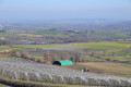
This circular route will delight you with its rural landscapes, horses and lake. In spring, the fruit trees are in bloom.
Discovering the village of Taluyers
 4.45 mi
+328 ft
-348 ft
2h 20
Easy
Departure from Taluyers (Rhône)
4.45 mi
+328 ft
-348 ft
2h 20
Easy
Departure from Taluyers (Rhône)
A stroll through the small village of Taluyers. Between paths through fields and vineyards and a detour to the Combe Gibert pond, come and discover one of the many villages of the COPAMO.
Short tour of the former Chartreuse de Sainte-Croix-en-Jarez
 2.62 mi
+377 ft
-400 ft
1h 30
Easy
Departure from Sainte-Croix-en-Jarez (Loire)
2.62 mi
+377 ft
-400 ft
1h 30
Easy
Departure from Sainte-Croix-en-Jarez (Loire)
A short walk to discover the former Chartreuse de Sainte-Croix-Jarez. No difficulty, just a chance to get some fresh air.
Pilat - From Sainte-Croix-en-Jarez to Longes
 10.27 mi
+1,654 ft
-1,657 ft
6h 10
Moderate
Departure from Sainte-Croix-en-Jarez (Loire)
10.27 mi
+1,654 ft
-1,657 ft
6h 10
Moderate
Departure from Sainte-Croix-en-Jarez (Loire)
This hike takes us to Les Roches de Marlin, which is somewhat overgrown with broom and other vegetation, and the beautiful flower-filled village of Longes. Don't forget to enjoy the beautiful views of the Gier valley and the crosses at almost every crossroads.
The Chartreux trail starting from Sainte-Croix-en-Jarez
 3.83 mi
+627 ft
-614 ft
2h 20
Easy
Departure from Sainte-Croix-en-Jarez (Loire)
3.83 mi
+627 ft
-614 ft
2h 20
Easy
Departure from Sainte-Croix-en-Jarez (Loire)
This is a short, easy circular. The walk starts at the former monastery of Sainte-Croix-en-Jarez and climbs up to Pavezin, mostly along small tarmac roads, before descending via a pleasant grassy path. Both the ascent and the descent offer superb panoramic views.
From cross to cross in the Monts du Pilat from Sainte-Croix-en-Jarez
 8.87 mi
+1,995 ft
-1,995 ft
5h 50
Moderate
Departure from Sainte-Croix-en-Jarez (Loire)
8.87 mi
+1,995 ft
-1,995 ft
5h 50
Moderate
Departure from Sainte-Croix-en-Jarez (Loire)
This route, which takes you sometimes across fields and sometimes through woodland, will lead you from cross to cross and from hamlet to hamlet in the heart of the Pilat Natural Park. You will occasionally be treated to beautiful views of the Rhône Valley, whilst at other times you may catch sight of lovely panoramas of the Monts du Lyonnais and the Giers Valley.
Sainte-Croix-en-Jarez circular route, Couzon reservoir, Le Chirat Rochat
16.31 mi
+3,179 ft
-3,199 ft
10h 15
Difficult
Departure from Sainte-Croix-en-Jarez (Loire)
This walk begins in one of the most culturally significant spots in the Pilat region, the pretty, tourist-friendly medieval village of Saint-Croix-en-Jarez and its 13th-century Chartreuse monastery. It follows the Couzon valley, then runs alongside the river and the left bank of its reservoir before taking the ridge path via the Croix du Cerisier, du Mazet and de Montvieux. The undulating, wooded route continues to the Chirat Rochat, the highest point of the walk, then descends to the hamlet of L’Eau-qui-bruit and returns to the start via the Crêt de Montivert.
The vineyards of Ampuis
 4.36 mi
+837 ft
-814 ft
2h 45
Moderate
Departure from Ampuis (Rhône)
4.36 mi
+837 ft
-814 ft
2h 45
Moderate
Departure from Ampuis (Rhône)
A short hike to discover the vineyards of Ampuis, with superb views of the terraced vineyards and the Rhône valley.
Vineyards and orchards between Millery and Grigny
 6.20 mi
+568 ft
-564 ft
3h 20
Easy
Departure from Millery (Rhône) (Rhône)
6.20 mi
+568 ft
-564 ft
3h 20
Easy
Departure from Millery (Rhône) (Rhône)
A beautiful country walk, mostly in the open. You will discover the local vineyards, walk alongside orchards and enjoy panoramic views of the Rhône valley and the countryside. You will also see horses and pass through part of the wine-growing village of Millery. The route is very well marked (yellow stripes).
From the vineyards of Côte-Rotie to Grand-Bois
8.19 mi
+1,302 ft
-1,286 ft
4h 55
Moderate
Departure from Ampuis (Rhône)
The famous Côte-Rôtie vineyards, laid out in terraces supported by low stone walls, will enchant you at the start and end of this hike. The rest of the hike takes place in a rural and wooded setting, along good paths and a few sections of quiet roads.
Sumptuous views of the Rhône Valley, the Pilat Massif and the entire Alpine range (weather permitting).
On the descent back, the Château d'Ampuis will stand before you.
Discover the beech forests in the municipality of Pavezin
 6.03 mi
+1,119 ft
-1,109 ft
3h 45
Moderate
Departure from Pavezin (Loire)
6.03 mi
+1,119 ft
-1,109 ft
3h 45
Moderate
Departure from Pavezin (Loire)
Most of this hike takes place in beech forests. It is perfect on sunny or windy days. It overlooks the village of Pavezin.
From Pavezin to the pass via the paved Roman road
 3.28 mi
+564 ft
-587 ft
2h 00
Easy
Departure from Pavezin (Loire)
3.28 mi
+564 ft
-587 ft
2h 00
Easy
Departure from Pavezin (Loire)
An easy climb to the Col de Pavezin via the pleasant paved Roman road, then through the forest. Return via a scenic path and then along the Couzon stream.
Circulars in the Pilat from the Col du Pavezin
 11.42 mi
+1,663 ft
-1,660 ft
6h 40
Difficult
Departure from Chuyer (Loire)
11.42 mi
+1,663 ft
-1,660 ft
6h 40
Difficult
Departure from Chuyer (Loire)
In the footsteps of Jean-Jacques Rousseau and Doctor Odouard, a circular eight between the Cols de Pavezin and Doizieu.
The first part leads to the Croix de Montvieux via the ruins of the Château de Bélize and the Crêts des Quatregrains, with a beautiful view of the Pîlât mountains. The second part goes to the Collet de Doizieux via pleasant forest tracks and views of Pélusin and the Rhône valley. The return route passes through the Neufond woods with two beautiful screes and the Baronnette trails.
From Col de Pavezin to Col de Grenouze via Mont Ministre
 5.36 mi
+886 ft
-879 ft
3h 15
Moderate
Departure from Chuyer (Loire)
5.36 mi
+886 ft
-879 ft
3h 15
Moderate
Departure from Chuyer (Loire)
The section between ::4:: and ::5:: is impassable due to forestry work (07/2026).A forest walk from one pass to the other via Mont Ministre, offering alternating views of the Pilat massif and the Rhône valley. Along the way, there are several notable sites: the Grotte des Fées and La Vieille Chapelle.There are places to eat at both passes, or you can stop for a picnic at the Col de Grenouze.Take care on the descent along the forest track towards the Vieille Chapelle: it is a narrow, fairly steep path which can be slippery in wet weather.
Paradise houses between Millery and Charly
 3.31 mi
+299 ft
-318 ft
1h 45
Easy
Departure from Millery (Rhône) (Rhône)
3.31 mi
+299 ft
-318 ft
1h 45
Easy
Departure from Millery (Rhône) (Rhône)
From the centre of Millery towards the Charly community gardens, the roads are tarmac-surfaced, but you’ll be able to admire the typical houses of Old Lyon, the gardens, the old porches and hidden courtyards, followed by the rural orchards, the nearby pond, other community gardens, the shaded uphill path of Chemin de la Taille Meule and the old streets. Finally, explore the historic centre around the church. If you’re up for a bit of a challenge, why not try to find the three doors?
The Way of the Cross in Pavezin
 9.99 mi
+2,024 ft
-2,034 ft
6h 20
Moderate
Departure from Pavezin (Loire)
9.99 mi
+2,024 ft
-2,034 ft
6h 20
Moderate
Departure from Pavezin (Loire)
More than fourteen crosses to discover on this hike around Pavezin.
In Ampuis, between the Rhône, vineyards and forests.
 11.14 mi
+1,677 ft
-1,670 ft
6h 35
Moderate
Departure from Ampuis (Rhône)
11.14 mi
+1,677 ft
-1,670 ft
6h 35
Moderate
Departure from Ampuis (Rhône)
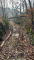
Discover the fantastic vineyards on the slopes of Ampuis. With beautiful forests in the hinterland, then a return to the Rhône river with magnificent views of the Pilat massif, the Alps and the Rhône valley.
Around the Communay mines
 4.53 mi
+66 ft
-69 ft
2h 10
Easy
Departure from Communay (Rhône)
4.53 mi
+66 ft
-69 ft
2h 10
Easy
Departure from Communay (Rhône)
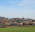
Did you know that there are traces of mining activity in Communay (south of Lyon)?
To discover them, follow this easy path. This hike can be done in two stages:
1) around the Sauveur, Baytan, Guérin and Dufélix pits;
2°) around the Espérance shaft headframe (rebuilt by associations linked to the mine) and a small slag heap, now wooded.
Nature and heritage in Ternay
 4.10 mi
+466 ft
-449 ft
2h 20
Easy
Departure from Ternay (Rhône) (Rhône)
4.10 mi
+466 ft
-449 ft
2h 20
Easy
Departure from Ternay (Rhône) (Rhône)
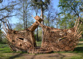
Discover Ternay, a Cluniac site located 15 km south of Lyon. You will discover the 23-hectare Grand Clos Park, the Cluniac priory and the Château de La Porte (16th century), only the exterior of which can be visited.
Circular route from La Chapelle-Villars, starting from Chuyer
5.15 mi
+620 ft
-597 ft
2h 55
Moderate
Departure from Chuyer (Loire)
A walk through open countryside overlooking the Rhône valley.
Short walk starting from Chuyer
 4.73 mi
+459 ft
-486 ft
2h 35
Easy
Departure from Chuyer (Loire)
4.73 mi
+459 ft
-486 ft
2h 35
Easy
Departure from Chuyer (Loire)
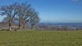
A pleasant, easy walk starting from Chuyer cemetery. Panoramic views of Mont Blanc and the Vercors. Lovely views of Mont Pilat. Very rural paths.
Over ridges and crosses in the Pilat Mountains
14.55 mi
+3,258 ft
-3,245 ft
9h 30
Difficult
Departure from Chuyer (Loire)
Discover some of the crests and passes, often marked with a cross, on this part of the eastern slope of the Pilat Massif. This large circular route passes through Crêt de Quatregrains, Crêt de Montivert, Croix de Monvieux, Croix du Mazet, Croix du Cerisier, Sainte-Croix-en-Jarez, and Crêt de Baronnette.Route change between (3) and (4). See the notices at the bottom of this page.
Around Chaussan
 5.02 mi
+801 ft
-827 ft
3h 00
Moderate
Departure from Chaussan (Rhône)
5.02 mi
+801 ft
-827 ft
3h 00
Moderate
Departure from Chaussan (Rhône)
Get some fresh air and exercise with this 100% rural hike, which offers beautiful panoramic views over much of the route. It allows you to appreciate the dynamism of local agricultural activity (fruit, vegetables, livestock, etc.) and admire a large tree house.
Circular around Chaussan
 3.24 mi
+633 ft
-630 ft
2h 00
Easy
Departure from Chaussan (Rhône)
3.24 mi
+633 ft
-630 ft
2h 00
Easy
Departure from Chaussan (Rhône)
A simple, often shaded circular trail, allowing you to discover the wine-growing landscape of the village of Chaussan and its woods. The trail can be muddy during rainy periods.
From Chaussan to Signal Saint-André
 6.02 mi
+1,460 ft
-1,460 ft
4h 00
Moderate
Departure from Chaussan (Rhône)
6.02 mi
+1,460 ft
-1,460 ft
4h 00
Moderate
Departure from Chaussan (Rhône)
This route starting from Chaussan will take you to the Signal Saint-André viewpoint, where you can enjoy breathtaking views of the Rhône valley and the Monts du Lyonnais, not to mention a superb view (in good weather) of the Alps.This is a fairly easy route, suitable for families, but can be muddy when it rains. Sturdy footwear is recommended, especially in the woods.
Tour of Mont Ministre and Mont Monnet
 10.10 mi
+1,785 ft
-1,808 ft
6h 10
Moderate
Departure from Chuyer (Loire)
10.10 mi
+1,785 ft
-1,808 ft
6h 10
Moderate
Departure from Chuyer (Loire)
The hike combines the Odouard and Jean-Jacques Rousseau trails, starting from Chuyer. The first part, to the south-east, on the Odouard trail, offers beautiful views of the Rhône valley. At the Col de Grenouze, the small loop takes you up to Mont Monnet: orientation table, beautiful view in good weather over the valley, the Vercors and the Alps (Mont Blanc). Forest paths then follow the Jean-Jacques Rousseau trail to the Col de Pavezin, and return via the Odouard trail.
The Bois Bouchat forest at the start of the Saint-Vincent Chapel
 6.12 mi
+656 ft
-666 ft
3h 25
Easy
Departure from Saint-Laurent-d'Agny (Rhône)
6.12 mi
+656 ft
-666 ft
3h 25
Easy
Departure from Saint-Laurent-d'Agny (Rhône)
A scenic route through the forest with no difficulty, 95% of which is on paths.
Circular Rontalon and Thurins from Saint-Laurent-d'Agny
 9.50 mi
+1,329 ft
-1,345 ft
5h 30
Moderate
Departure from Saint-Laurent-d'Agny (Rhône)
9.50 mi
+1,329 ft
-1,345 ft
5h 30
Moderate
Departure from Saint-Laurent-d'Agny (Rhône)
Starting from the Saint-Vincent Chapel in the commune of Saint-Laurent-d'Agny, this hike allows you to discover the landscapes of the Monts du Lyonnais foothills, market gardens, orchards, meadows and woods. On a clear day, it also offers beautiful views of the Jura and the Alps.
Couzon and Ban Dam from Farnay
 7.75 mi
+814 ft
-804 ft
4h 15
Moderate
Departure from Farnay (Loire)
7.75 mi
+814 ft
-804 ft
4h 15
Moderate
Departure from Farnay (Loire)
A circular loop offering views of the Pilat Regional Nature Park, the Monts du Lyonnais and the Couzon Dam. Alternates between paths and very quiet roads. Best enjoyed in mid-season to make the most of the sunshine.
Circular route starting from La Bullière
 3.68 mi
+397 ft
-384 ft
2h 00
Easy
Departure from Sainte-Catherine (Rhône) (Rhône)
3.68 mi
+397 ft
-384 ft
2h 00
Easy
Departure from Sainte-Catherine (Rhône) (Rhône)
A family-friendly, easy and informative walk, punctuated by beautiful panoramic views of the village of Riverie, the Alpine range, the Pilat and the Bozançon Valley.
Return via the nature trail and the medieval village walkway in Riverie.
Between Vérin and Condrieu
 1.53 mi
+243 ft
-243 ft
0h 55
Easy
Departure from Loire
1.53 mi
+243 ft
-243 ft
0h 55
Easy
Departure from Loire
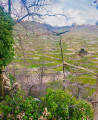
A short walk of just over an hour to pass through the vineyards and enjoy the view over the branch of the Rhône.
On the heights of Condrieu, starting from Vérin
 8.25 mi
+1,033 ft
-1,030 ft
4h 40
Moderate
Departure from Loire
8.25 mi
+1,033 ft
-1,030 ft
4h 40
Moderate
Departure from Loire
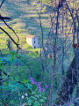
An easy walk in the countryside on the heights around Condrieu. This hike offers beautiful views of the Rhône valley and the Pilat mountains.
Cross trails in Farnay
 7.76 mi
+1,385 ft
-1,358 ft
4h 45
Moderate
Departure from Farnay (Loire)
7.76 mi
+1,385 ft
-1,358 ft
4h 45
Moderate
Departure from Farnay (Loire)
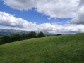
A pleasant circular walk starting from Farnay. Fully marked in white and yellow as Farnay 3 route. Two other walks start from behind the town hall and are signposted. This is the longest, but it is possible to shorten it by 3 km.
The Hauts des Roches de Condrieu
 7.37 mi
+869 ft
-860 ft
4h 10
Moderate
Departure from Les Roches-de-Condrieu (Isère)
7.37 mi
+869 ft
-860 ft
4h 10
Moderate
Departure from Les Roches-de-Condrieu (Isère)
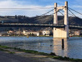
Starting from the river port at Les Roches-de-Condrieu, the path will take you from the lake up to the heights overlooking the Rhône valley. At certain points along the route, a bird’s-eye view of the river is sure to catch your eye. In Chonas-l’Amballan, you’ll pass by the foot of a Renaissance-style castle.
Stroll between Farnay and Vergelas
 2.87 mi
+443 ft
-459 ft
1h 40
Easy
Departure from Farnay (Loire)
2.87 mi
+443 ft
-459 ft
1h 40
Easy
Departure from Farnay (Loire)
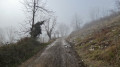
A short walk to do with children (but not with a pushchair!). The start is quite steep for little ones, but the rest is fairly easy.
Les Roches Saint-Prim Pré Margot
 5.08 mi
+778 ft
-751 ft
3h 00
Easy
Departure from Les Roches-de-Condrieu (Isère)
5.08 mi
+778 ft
-751 ft
3h 00
Easy
Departure from Les Roches-de-Condrieu (Isère)
Easy route: Saint-Clair-les-Roches, the village of Saint-Prim, Pré Margot, Les Roches de Condrieu.
Bélize Castle and Crêt de Baronnette Tower
 3.19 mi
+417 ft
-430 ft
1h 50
Easy
Departure from Pavezin (Loire)
3.19 mi
+417 ft
-430 ft
1h 50
Easy
Departure from Pavezin (Loire)
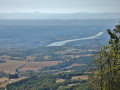
An easy route to discover the Crêt de Baronnette and the Celtic site of the Château de Bélize, in the Pilat Regional Nature Park. A half-day walk, perfect before or after lunch.
Between Saint-André-la-Côte and Rontalon
 10.89 mi
+2,133 ft
-2,123 ft
6h 50
Moderate
Departure from Saint-André-la-Côte (Rhône)
10.89 mi
+2,133 ft
-2,123 ft
6h 50
Moderate
Departure from Saint-André-la-Côte (Rhône)
This loop offers pleasant views of the plateau to the south-west of the Lyon conurbation. In good visibility, the Pre-Alps and Alps can be seen in the distance.
Saint-André-la-Côte circular, Signal de Saint-André and Roche de Matiole
 13.09 mi
+1,978 ft
-1,982 ft
7h 45
Difficult
Departure from Saint-André-la-Côte (Rhône)
13.09 mi
+1,978 ft
-1,982 ft
7h 45
Difficult
Departure from Saint-André-la-Côte (Rhône)
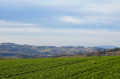
Starting from Saint-André-la-Côte, we head towards Saint-Martin-en-Haut via the Signal de Saint-André. Then we turn west towards Les Carelles and La Chapusière to reach La Roche de Matiole. We then descend towards Sainte-Catherine via Chavagnieux, Soleymieux and Chavassieux. After Montaland, we overlook the village of Sainte-Catherine to join theGR®7, which takes us back to Saint-André-la-Côte.
The Île de la Table Ronde and the Ferme du Loup
 2.76 mi
+16 ft
-16 ft
1h 15
Easy
Departure from Solaize (Rhône)
2.76 mi
+16 ft
-16 ft
1h 15
Easy
Departure from Solaize (Rhône)
Family walk leading to the Ferme du Loup via various observation points overlooking the surrounding nature: river, pond, meadow...