Circular route from La Chapelle-Villars, starting from Chuyer

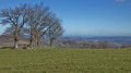
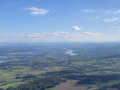
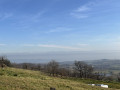
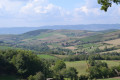
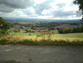
A walk through open countryside overlooking the Rhône valley.

Details

n°15614002
Creation:
Last update:
Last review:
  • Walking
    Activity: Walking
  • ↔
    Distance: 5.15 mi
  • ◔
    Average duration: 2h 55 
  • ▲
    Difficulty: Moderate

  • ⚐
    Back to start: Yes
  • ↗
    Ascent: + 620 ft
  • ↘
    Descent: - 597 ft

  • ▲
    Highest point: 1,791 ft
  • ▼
    Lowest point: 1,234 ft

Description of the walk

Parking is available in Chuyer in front of the cemetery.

(S/E) With your back to the cemetery, turn right towards the village, then take the first right onto Rue du Pilat.

(1) Turn right, then right again at the junction and follow the path uphill which joins the path to the Col de Pavezin.

(2) Turn right (east) onto the path which, further on, joins a road at a hairpin bend. Head left towards Bonne Bouche. At the hamlet, turn right, then left, and you’ll come out onto another road. Cross carefully and take the path opposite, which cuts across the bend. Continue to La Vieille Chapelle.

(3) Carry on to the right until you reach the Pras crossroads.

(4) Turn left, pass the Château de Villars on your left and continue to the crossroads by the church at La Chapelle-Villars.

(5) Turn back towards Le Pras.

(4) Carry on straight ahead, then keep to the right. After the last houses, keep left and head for the hamlet of La Pélarié.

(6) Go straight on, joining the Route de Pélussin a little further on for a few dozen metres. You’ll come to a four-way junction.

(7) Carry on straight ahead along the Chemin des Prés until you reach the D30.

(8) Turn right, then take the first path on the right. Cross the D19, continue straight ahead to reach Le Mollard. Make the first turn left then right to join a path leading to a road.

(9) Cross the road, take the track opposite which curves to the left and leads to Grange Blanche. Opposite the farm shed, turn right and return to the cemetery car park (S/E).

Waypoints

  1. S/E : mi 0 - alt. 1,460 ft - Cemetery car park
  2. 1 : mi 0.19 - alt. 1,526 ft - Crossroads, turn right
  3. 2 : mi 0.55 - alt. 1,647 ft - Chemin de Pavezin, on the right
  4. 3 : mi 1.55 - alt. 1,706 ft - Vieille Chapelle
  5. 4 : mi 1.97 - alt. 1,460 ft - Junction for both outbound and return routes
  6. 5 : mi 2.33 - alt. 1,401 ft - Chapelle Villars
  7. 6 : mi 3.32 - alt. 1,362 ft - La Pélarie
  8. 7 : mi 3.56 - alt. 1,319 ft - Crossroads, opposite
  9. 8 : mi 4.07 - alt. 1,234 ft - Le Mollard
  10. 9 : mi 4.66 - alt. 1,434 ft - Road, opposite
  11. S/E : mi 5.15 - alt. 1,463 ft - Cemetery car park

Worth a visit

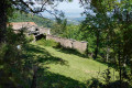
La Vieille-Chapelle with its fully renovated chapel.
Villars Castle before reaching La Chapelle-Villars.
The church at La Chapelle-Villars.
There are many farmhouses built in the traditional style.

Reviews and comments

4 / 5
Based on 2 reviews

Reliability of the description
4.5 / 5
Ease of following the route
4 / 5
Route interest
3.5 / 5
arnaud38370
arnaud38370

Overall rating : 3.3 / 5

Date of your route : Feb 13, 2022
Reliability of the description : ★★★★☆ Good
Ease of following the route : ★★★★☆ Good
Route interest : ★★☆☆☆ Disappointing
Very busy route : No

A boring walk!!! Much of the route is on roads... That’s a shame, given the many paths in Pilat Park

Machine-translated

ramatuelle83
ramatuelle83

Overall rating : 4.7 / 5

Date of your route : Oct 25, 2021
Reliability of the description : ★★★★★ Very good
Ease of following the route : ★★★★☆ Good
Route interest : ★★★★★ Very good
Very busy route : No

Thanks to the author

Machine-translated

Other walks in the area

For more walks, use our search engine .

The GPS track and description are the property of this route's author. Please do not copy them without permission.