Country:

 City:
City:


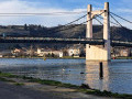
Drive as close as possible to the Condrieu bridge on the Isère side and park in a small car park below the bridge by the river (Parking de la Traille). The walk starts from this point.
(S/E) Leave the car park via the fairly steep staircase leading down to the Quai de la Paillasse. Once you’ve reached the quay, turn right and walk along the banks of the Rhône. You’ll pass close to the marina, the jetties providing access to the boats and the harbour master’s office.
(1) At the corner of the harbour basin, turn right towards the road (D4). Cross at the pedestrian crossing and continue straight ahead up a slight incline where a bollard restricts vehicle access. Go under a metal footbridge and continue round the bend to the left, this time crossing over the footbridge. Reach and take a zigzagging uphill ramp. Once you’ve passed this ramp, carry on straight ahead, keeping to the right.
(2) You’ll reach a junction where you should ignore the turn on the right and take the next turn on the left (Montée du Pré Margot). Continue straight on along this road for about 500 m, ignoring the roads branching off to the right.
(3) At the last houses on the left before a slight bend to the right, leave the tarmac road and take an uphill dirt track on the right. Follow this track, which winds its way uphill, until you reach another tarmac road.
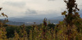
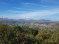
(4) Turn left onto this road and follow it for about 40 metres, then turn right at the first junction onto Chemin des Rotisses. Continue straight on to the end of the tarmac road and carry on along a dirt track: at this point, hikers are treated to a sweeping view of the Rhône Valley and the Alps in the distance. The track now descends and reaches a Fork in the road where you should take the left-hand bend. Carry on, ignoring a turn-off on the right, until you reach a tarmac road.
(5) Turn right at the electricity substation and, at the first junction about twenty metres further on, turn left onto Rue du Chanet. Turn left again at the next junction to follow the Chemin de Corneyzin. Stay on this track, ignoring the turn-offs to the left, until it ends and becomes a dirt track. Carry on straight ahead along this track until you rejoin the tarmac at Chemin des Allamandières.
(6) Take this road, continuing straight on. At the next junction, carry on straight ahead along the Chemin du Marais. Stay on this road, ignoring the turnings on the left, until you reach the centre of the village of Chonas-l’Amballan at the town hall. Turn left, then, a few metres further on, turn right.
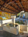
(7) Pass the wash house on the left and the entrance to Chonas-l’Amballan Castle on the right. Turn immediately left after passing the castle entrance (Chemin de la Cure). At the end of the slight bend to the left, follow the Allée des Tilleuls to the right to reach a park with picnic tables, from where you can see the castle more clearly. Then retrace your steps to rejoin the route. Walk past the chancel of the church and take the staircase leading uphill on the right. At the top of the stairs, turn right and join another path, which you should follow to the left. Carry on straight ahead and, at the next junction – about twenty metres further on – keep to the right, then continue straight ahead along the road (Chemin de l’Église). Ignore a path branching off to the right and carry on straight ahead until you reach a crossroads with a sign for Chemin de l’Église.
(8) Turn onto the dirt track on the left. Ignore a track branching off to the left, then, at the first junction you come to, take the road on the right. Continue straight on until you reach a junction where a track branches off to the left. Follow it straight on until you reach the crossroads by the small ponds.
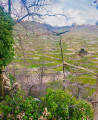
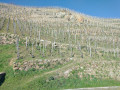
(9) Take the path on the left. After about a hundred metres, once you’ve passed a few rows of vines on the right, turn right at the top of the vineyard, following the rows of vines: please note that this section of the path does not appear on the IGN map. Walk downhill until you reach the bottom of the valley, then climb up the other side along a slope that is at times quite steep, until you come out onto another path.
(10) Follow this path to the left. Continue straight on along this path until you reach a road (Chemin de l’Abri).
(11) Take this road to the right and carry on straight ahead. Pass a junction where you must leave the road to the right to continue straight on, then reach a second junction. Leave the tarmac section by turning slightly left onto the Chemin de l’Escadron. Continue downhill along the winding track until you reach a railway line in Gerbey. Follow the railway line until you reach a tarmac section.
(12) Carry on straight ahead, still following the railway line, until you reach a junction. Turn right to go under the railway line, then left along a road leading to the D4.
(13) Cross the road carefully and head straight ahead towards the entrance to the car park at the Roches de Condrieu lake. After crossing this car park and passing through a gate, turn left to walk alongside the lake until you reach the water sports centre buildings.
(14) Walk past the entrance to the water sports centre, continue straight on along the lake, then pass between the lake and the harbour.
(1) Turn right and retrace the route you took at the start of the walk in the opposite direction to return to the car park (S/E).

 Visorando Member
 Easy
Easy 
 Difficult