Between Echalas and Longes J 2

A long walk through the countryside of the lower Pilat region, with little elevation gain but stream crossings (fords) which may be difficult depending on the season and water level.

Details

87196
Creation:
Last update:
Last review:
  • Walking
    Activity: Walking
  • ↔
    Distance: 13.49 mi
  • ◔
    Average duration: 8h 05 
  • ▲
    Difficulty: Difficult

  • ⚐
    Back to start: Yes
  • ↗
    Ascent: + 2,201 ft
  • ↘
    Descent: - 2,221 ft

  • ▲
    Highest point: 1,909 ft
  • ▼
    Lowest point: 840 ft

Description of the walk

Park to the south-west of Echalas, near the Blue Madonna (crossroads).

(S/E) Take the path to the west.

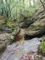
(1) At Le Gonty, take the second path on the left (south-west) which joins a stream; follow this to the right for 1 km before crossing it (ford).

(2) Follow the track opposite uphill, which joins the Basse Dhuire and then the Haute Dhuire further on.

(3) Turn right onto a small road, then take the first road on the left, which leads to the D502. Cross the road (take care) and take the path opposite.

(4) After 50m across a meadow, turn right and head into the woods. Pass a path on your left.

(5) About 100 metres further on, turn left onto a path that runs alongside and then through the woods until you reach a signposted path.

(6) Turn left and head down into the forest, cross the stream upstream, then head southwards and pass under the EDF power lines. Cross a track and continue straight ahead until you reach a road (D28) at La Grand Croix. Take the small road on the right leading to Dizimieux and continue to the cross.

(7) Turn left, cross the D28 (take care) and take the path heading due south, which crosses a stream in the woods before climbing up to La Balasserie. Continue south-west and go straight on to reach the Croix du Trève at the crossroads.

(8) Turn left onto the path heading east, then take the path on the right which leads to the Croix de la Garde. Turn left towards La Garde, cross the hamlet and walk a few metres to the right along the road.

(9) Then take a path on the left which leads to a small road (cross); turn right onto this to reach Longes. At the entrance to the village, turn left onto Rue du Château, which leads onto the D28. Follow the D28 to the left and carry on straight ahead.

(10) At the northern end of the village, turn right onto Chemin de la Charpière and, at the cross, follow a path down to the left.

(11) At the sewage treatment works, take the path on the right which crosses a road and continues opposite.

(12) At the junction by the stream, turn left to cross it, then immediately right. Continue straight on until you reach Chemin de la Bernadière, just before the main road (D502).

(13) Turn right until you reach the D140, then follow it to the left for 500 metres. Turn onto the first path on the right which passes through La Bonnetière, then, at the junction of the paths, turn left to rejoin the D502, which you follow to the right for 200 metres.

(14) At La Fournachère, take a path on the left which crosses a stream and continue on to Le Colombet. Follow the road to the right for about fifty metres.

(15) Turn left onto a path that descends north-east, crosses a stream and climbs back up to Jannoray.

(16) Walk through the hamlet and turn left onto a path that descends, crosses a stream and climbs back up onto the plateau to rejoin the crossroads where you started (S/E).

Waypoints

  1. S/E : mi 0 - alt. 1,276 ft - Crossroads near the Blue Madonna
  2. 1 : mi 0.23 - alt. 1,217 ft - Le Gonty
  3. 2 : mi 1.2 - alt. 912 ft - Path leading uphill on the left
  4. 3 : mi 1.77 - alt. 1,181 ft - La Haute Dhuire, on the right
  5. 4 : mi 2.26 - alt. 1,253 ft - Turn right
  6. 5 : mi 2.41 - alt. 1,227 ft - At the junction, turn left
  7. 6 : mi 2.98 - alt. 1,106 ft - Take the path on the left
  8. 7 : mi 4.35 - alt. 1,404 ft - Cross, turn left
  9. 8 : mi 6.43 - alt. 1,726 ft - Road junction, on the left
  10. 9 : mi 7.1 - alt. 1,880 ft - La Garde: take the path on the left
  11. 10 : mi 8.32 - alt. 1,476 ft - North exit from Longes, on the right
  12. 11 : mi 8.73 - alt. 1,214 ft - Wastewater treatment plant, on the right
  13. 12 : mi 9.18 - alt. 1,276 ft - Crossroads: turn left to cross the stream
  14. 13 : mi 9.48 - alt. 1,322 ft - Chemin de la Bernadière, on the right
  15. 14 : mi 11.02 - alt. 1,355 ft - La Fournachère: take the path on the left
  16. 15 : mi 11.85 - alt. 1,201 ft - Le Colombet: take the path on the left
  17. 16 : mi 12.54 - alt. 1,142 ft - Jannoray: take the path on the left
  18. S/E : mi 13.49 - alt. 1,276 ft - Crossroads near the Blue Madonna

Reviews and comments

4.1 / 5
Based on 3 reviews

Reliability of the description
4.3 / 5
Ease of following the route
3 / 5
Route interest
5 / 5
Stéphanie Le Touzé
Stéphanie Le Touzé

Overall rating : 3.7 / 5

Date of your route : Apr 06, 2026
Reliability of the description : ★★★☆☆ Average
Ease of following the route : ★★★☆☆ Average
Route interest : ★★★★★ Very good
Very busy route : No

Today’s hike, in glorious sunshine and mild temperatures, was magnificent and varied; it required a bit of physical effort, but not too much! In short, it ticks (almost) all the boxes. The only downside was the section between 7 and 8, which was decidedly impassable. It must be said that we did the walk in reverse, but that doesn’t change the story; coming from La Croix de Trèves, we reached La Balasserie very easily, but then… an imposing dog prevented us from crossing the farm (which is private property anyway). After asking a local resident for directions, we tried to take a track roughly following the small road leading to Dizimieux. But this track very quickly became impassable, completely overgrown with very young fir trees (or other conifers) forming an impassable barrier. So we had to resign ourselves to taking the road to Dizimieux until just before No. 7 to rejoin the route.
Otherwise, I’ll say again that it’s a wonderful discovery and a really lovely spot!!!

Machine-translated

gaulon
gaulon

Overall rating : 4 / 5

Date of your route : May 08, 2021
Reliability of the description : ★★★★★ Very good
Ease of following the route : ★★☆☆☆ Disappointing
Route interest : ★★★★★ Very good
Very busy route : No

Hike this morning: stunning scenery

Please note: between points 7 and 8, at the ‘La Balasserie’ stream, the path on the left is blocked and impassable (I went across the field above it...)
I met the farmers from ‘La Balasserie’ farm, who told me to head straight on at the coordinates: longitude: 4.46510 / latitude: 4550935, rather than turning left
This new path runs alongside the “La Balasseire” stream.
And when you reach the tarmac road, turn left to rejoin the original route

Machine-translated

jeanot52
jeanot52

Overall rating : 4.7 / 5

Date of your route : Nov 27, 2017
Reliability of the description : ★★★★★ Very good
Ease of following the route : ★★★★☆ Good
Route interest : ★★★★★ Very good

A great route… but a bit confusing along the banks of the stream, which you have to follow to the right for 1 km
as it’s hard to gauge the distance and the stream runs alongside the rocks
We went round in circles a bit before finding the path that climbs up towards the Basse and Haute Dhuire

The rest of the route is simply brilliant... Thank you

Machine-translated

Other walks in the area

For more walks, use our search engine .

The GPS track and description are the property of this route's author. Please do not copy them without permission.