Between Vérin and Condrieu

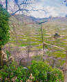
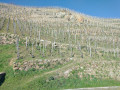
A short walk of just over an hour to pass through the vineyards and enjoy the view over the branch of the Rhône.

Details

32957798
Creation:
Last update:
Last review:
  • Walking
    Activity: Walking
  • ↔
    Distance: 1.53 mi
  • ◔
    Average duration: 0h 55 
  • ▲
    Difficulty: Easy

  • ⚐
    Back to start: Yes
  • ↗
    Ascent: + 243 ft
  • ↘
    Descent: - 243 ft

  • ▲
    Highest point: 719 ft
  • ▼
    Lowest point: 472 ft

Photos

Description of the walk

Park in the car park, which has a children’s playground and access to the ViaRhona.

(S/E) Cross the D86 with care and continue straight ahead. Pass under the railway line and head up through the village of Vérin. Keep well to the right to avoid cars; you are not yet on a path.

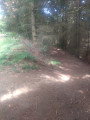
(1) Once you reach the left-hand bend, take the small path on the right which leads you through the vineyards and up the slope. Once you reach the edge of the wooded area, head down to the right into the valley and follow the stream until you reach the hospital complex below.

(2) Cross the small footbridge on the right to reach the county road after passing under the railway line again.

(3) Cross at the pedestrian crossing and continue straight ahead along Rue Beau Rivage. Head towards the banks of the Rhône and the ViaRhona. Turn right and follow the river until you reach the car park where you started (S/E).

Waypoints

  1. S/E : mi 0 - alt. 476 ft - Car park - Rhône (River)
  2. 1 : mi 0.32 - alt. 581 ft - Bend, path on the right
  3. 2 : mi 1.01 - alt. 492 ft - Footbridge
  4. 3 : mi 1.17 - alt. 479 ft - Departmental road, near the - Arbuel (ruisseau) - Affluent du Rhône
  5. S/E : mi 1.53 - alt. 476 ft - Open-air café

Notes

There’s a guinguette at the start where you can grab a quick bite to eat and/or have a drink.

Reviews and comments

4.3 / 5
Based on 3 reviews

Reliability of the description
4.7 / 5
Ease of following the route
4.3 / 5
Route interest
4 / 5
dougere
dougere

Overall rating : 4.3 / 5

Date of your route : Nov 27, 2024
Reliability of the description : ★★★★★ Very good
Ease of following the route : ★★★★☆ Good
Route interest : ★★★★☆ Good
Very busy route : No

A nice little walk we went on to make the most of a break in the clouds on that misty autumn afternoon.
We nearly went the wrong way on the way down by turning right too early. The app confirmed our mistake and we got back on the right track by turning left.

Machine-translated

soso8679
soso8679

Overall rating : 4.7 / 5

Date of your route : Jun 11, 2024
Reliability of the description : ★★★★★ Very good
Ease of following the route : ★★★★★ Very good
Route interest : ★★★★☆ Good
Very busy route : No

There’s a mistake in the summary of the walk in Indre-et-Loire!
Otherwise, the description and the downloaded map are brilliant. The walk took 45 minutes.

Machine-translated

Jodalton13
Jodalton13

Overall rating : 4 / 5

Date of your route : Dec 25, 2023
Reliability of the description : ★★★★☆ Good
Ease of following the route : ★★★★☆ Good
Route interest : ★★★★☆ Good
Very busy route : No

A lovely little walk through the vineyards – straightforward and easy

Machine-translated

Other walks in the area

For more walks, use our search engine .

The GPS track and description are the property of this route's author. Please do not copy them without permission.