Lac de la Madone from Saint-Sorlin

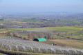
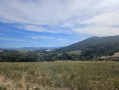
This circular route will delight you with its rural landscapes, horses and lake. In spring, the fruit trees are in bloom.

Details

30222377
Creation:
Last update:
Last review:
  • Walking
    Activity: Walking
  • ↔
    Distance: 5.88 mi
  • ◔
    Average duration: 3h 20 
  • ▲
    Difficulty: Moderate

  • ⚐
    Back to start: Yes
  • ↗
    Ascent: + 728 ft
  • ↘
    Descent: - 728 ft

  • ▲
    Highest point: 1,654 ft
  • ▼
    Lowest point: 1,276 ft

Photos

Description of the walk

Start and finish at the Route de Chaussan car park (follow the signs, car park located at the intersection of Route de Mornant and Route de Chaussan). There is a "Le Bourg" hiking signpost in this car park.

(S/E) Start the hike by following "Le Benegras". Turn left for a few metres (Route de Mornant), then immediately turn right onto Chemin du Benegras. Continue straight ahead on this same path for 200 m, ignoring Impasse des Loups on the left.

(1) Turn left onto the path (Monts du Lyonnais mountain bike sign) and descend for 200 metres.

(2) At the "Le Bénégras - 455 m" hiking sign, turn left towards the "Lac de la Madone" sign. Continue along this path for 400 m, then continue along the main path on the left. Continue straight ahead until you reach a crossroads with a "Grandes Terres - 408 m" hiking signpost.

(3) Turn right towards Lac de la Madone. You will then be on a long-distance hiking trail marked in yellow and red.
Continue straight ahead on this path until you reach the crossroads with the roads.

(4) Continue on theGR® trail along the road towards the south-east, then, at the fork, follow the sign for Site de la Madone (mountain bike trail) on the right for 300 m. At the crossroads, you will see a hiking sign for "Pré Bron - 412 m".

(5) Follow the "Site de la Madone" sign, turning right. After 150 m, turn left and continue straight ahead. Go through the site gate and walk along the car park topped with solar panels.

(6) Near the large information boards, a sign indicates the direction to follow: "La Madone par la digue" (La Madone via the dyke). Descend towards Lac de la Madone and cross the dyke. At the end of the dyke, continue to the right around the lake for 400 m.

(7) At the woods, a hiking sign points to "La Madone - 395 m". Follow the direction of Fond Mathieu, on the left. After 300 m, continue along the road. After 200 m, at the fork, take the road on the left. The road passes in front of La Grange, then climbs for 400 m to reach the signpost "Fond Mathieu - 442 m".

(8) Head towards La Fillonnière (road on the right, then immediately right again). The road quickly turns into a path. Follow this path for 250 m until you reach a road. Follow it to the right, and after 250 m, turn right onto thesecond lane: Rue du Puits. It quickly turns into a path. After 100 m, continue on the path slightly to the right. After 150 m, join the wider Combe Rollin path.

(9) Follow this path for 600 m, then take a smaller path on the left. Pass Combe Rollin and then Ruisseau de Corsenat, and continue uphill for another 300 m. A signpost indicates that you are at Les Appreaux (476 m above sea level).

(10) Turn right towards Saint-Sorlin and continue along this road for 700 m, then take the path that descends to the right. After 200 m, you cannot continue straight ahead. Turn left, walk 150 m, cross the road and you will reach the signpost from the outward journey: "Le Benegras - 455 m".

(2) Turn left to go back up the path you came on in the opposite direction.

(1) When you reach the road, turn right and follow the street until you reach Route de Mornant. Then turn left and immediately right to reach the car park (S/E).


Waypoints

  1. S/E : mi 0 - alt. 1,654 ft - Chaussan Road
  2. 1 : mi 0.21 - alt. 1,581 ft - Monts du Lyonnais mountain bike trail
  3. 2 : mi 0.34 - alt. 1,516 ft - Signpost "Le Bénégras - 455m"
  4. 3 : mi 0.97 - alt. 1,339 ft - "Grandes Terres - 408m" marker
  5. 4 : mi 1.41 - alt. 1,312 ft - Crossroads
  6. 5 : mi 1.72 - alt. 1,322 ft - "Pré Bron - 412m" marker
  7. 6 : mi 2.09 - alt. 1,319 ft - Information boards - Lac de la Madone
  8. 7 : mi 2.59 - alt. 1,280 ft - Marker "La Madone - 395m"
  9. 8 : mi 3.63 - alt. 1,450 ft - Marker "Fond Mathieu - 442m"
  10. 9 : mi 4.09 - alt. 1,611 ft - Combe Rollin trail
  11. 10 : mi 4.75 - alt. 1,562 ft - Marker "Appreaux 476m"
  12. S/E : mi 5.88 - alt. 1,654 ft - Chaussan Road

Notes

At Lac de la Madone, there are picnic tables and three dry toilets around the lake. There is a car park where you can decide to start your hike.

This route is well suited to dry weather and periods without heatwaves.
Avoid this hike in rainy weather or after heavy rain, as the path down to Combe Rollin and then Ruisseau de Corsenat can be very tricky.
Also take care in hot, sunny weather, as the route is mainly uncovered.

Worth a visit

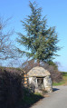
Between (S/E) and (1): Saint-Sorlin church, simple but worth a look inside.

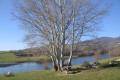
Between (6) and (8): Lac de la Madone is a reservoir used to irrigate the surrounding orchards and vegetable gardens. It is fed naturally by the Corsenat stream. In the event of a water shortage, it is replenished by pumping water from the Rhône. Fishing is permitted, but swimming is not. The lake has a children's playground, a fitness trail and an arboretum. It is unique in that it has a floating park of photovoltaic panels.

Always be cautious and plan ahead when you're outdoors. Visorando and the author of this route cannot be held responsible for any accidents occurring on this route.

The GR® and PR® markings are the intellectual property of the Fédération Française de Randonnée Pédestre.

Reviews and comments

4.4 / 5
Based on 9 reviews

Reliability of the description
4.5 / 5
Ease of following the route
4.4 / 5
Route interest
4.3 / 5
User 28619730

Overall rating : 5 / 5

Date of your route : May 11, 2026
Reliability of the description : ★★★★★ Very good
Ease of following the route : ★★★★★ Very good
Route interest : ★★★★★ Very good
Very busy route : No

A lovely walk along a very well-maintained path

Highly recommended

Danielle

Machine-translated

User 6718850

Overall rating : 3.7 / 5

Date of your route : Mar 11, 2026
Reliability of the description : ★★★★☆ Good
Ease of following the route : ★★★★☆ Good
Route interest : ★★★☆☆ Average
Very busy route : No

A pleasant route for those who enjoy horse riding (lots of horses along the route), but some of the paths were flooded (best avoided following the heavy rain the day before).

Kind regards

Machine-translated

momone
momone

Overall rating : 3.7 / 5

Date of your route : Feb 22, 2026
Reliability of the description : ★★★★☆ Good
Ease of following the route : ★★★★☆ Good
Route interest : ★★★☆☆ Average
Very busy route : No

Very muddy and bumpy path, lots of uphill climbing

Machine-translated

User 13063560

Overall rating : 3 / 5

Date of your route : Jul 28, 2025
Reliability of the description : ★★★☆☆ Average
Ease of following the route : ★★★☆☆ Average
Route interest : ★★★☆☆ Average
Very busy route : No

"Lac de la Madone" (Madonna Lake)... let's call it a small reservoir for EDF instead. At one point (at the lake's exit), it's not easy to find, and when we got to the small hamlet at the top, we got completely lost and ended up using Google Maps.

Machine-translated

CaroDuetti
CaroDuetti

Overall rating : 5 / 5

Date of your route : May 03, 2025
Reliability of the description : Not used / Not applicable
Ease of following the route : ★★★★★ Very good
Route interest : ★★★★★ Very good
Very busy route : No

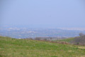
A very easy hike on a sunny Saturday. Beautiful arrival at Lac de la Madone, where you can relax and have a picnic, for example. Not many people (long weekend) on holiday, I don't know what it's like normally. Lots of open areas to enjoy the sun. Beautiful views of Lyon and the surrounding mountains.

Machine-translated

weilger
weilger

Overall rating : 4.7 / 5

Date of your route : Jun 15, 2024
Reliability of the description : ★★★★★ Very good
Ease of following the route : ★★★★☆ Good
Route interest : ★★★★★ Very good
Very busy route : No

Perfect for a couple of 78-year-old grandparents!

Machine-translated

Azur42
Azur42

Overall rating : 5 / 5

Date of your route : Sep 25, 2023
Reliability of the description : ★★★★★ Very good
Ease of following the route : ★★★★★ Very good
Route interest : ★★★★★ Very good
Very busy route : No

A very pleasant, well-described short hike in a hilly environment; despite the very sunny weather, there were few people around...

Machine-translated

schelker
schelker

Overall rating : 5 / 5

Date of your route : Feb 13, 2023
Reliability of the description : ★★★★★ Very good
Ease of following the route : ★★★★★ Very good
Route interest : ★★★★★ Very good
Very busy route : Yes

A beautiful route near Lyon, hiking through meadows where many horses graze. Lake Madone is very pleasant and a good place to stop for lunch. Between points 9 and 10 towards Combe Rollin, there is a muddy area about fifty metres long, crossed by a small stream. Otherwise, there are no particular difficulties.

Machine-translated

liliane.clarens
liliane.clarens
• Edited:

Overall rating : 5 / 5

Date of your route : Feb 08, 2023
Reliability of the description : ★★★★★ Very good
Ease of following the route : ★★★★★ Very good
Route interest : ★★★★★ Very good
Very busy route : No

A route that takes you through a multitude of orchards beginning to blossom, with panoramic views of the surrounding mountains dotted with villages.
Numerous horses, the dyke and Lake Madone, where we spotted cormorants and took a nice break.
At this time of year, the river crossing is a little muddy but pleasant, as is the journey through the hamlets with their typical stone houses and the village of Saint-Sorlin.
Thanks to the author for this walk, which must be splendid when the fruit trees are in bloom.

Machine-translated

Other walks in the area

For more walks, use our search engine .

The GPS track and description are the property of this route's author. Please do not copy them without permission.